Quick Info
Curated Experiences
Shopping and Food Market Tour from Fethiye
Saklikent Gorge, Tlos and Kayakoy Full-Day Tour
Private Fethiye History Tour: Kayakoy and Lycian Sites
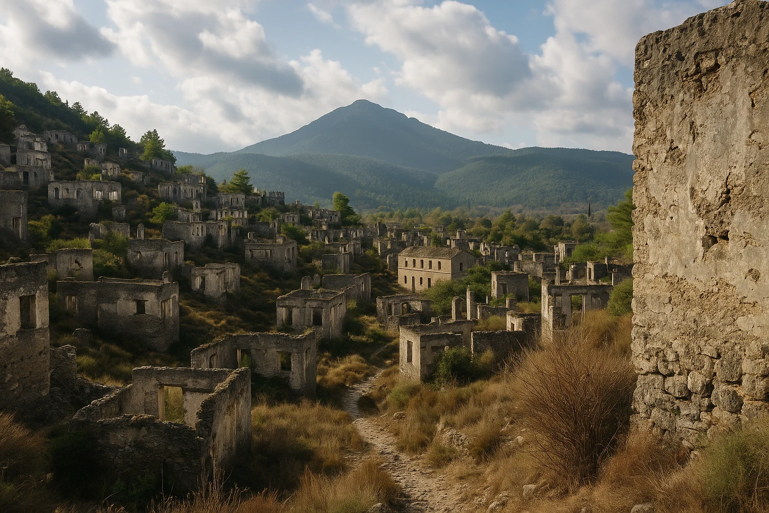
The first thing you notice in Kayakoy, Turkey is the silence between the houses. Stone walls rise in tight rows up the slope, windows open to the sky, and doors frame empty rooms where families once cooked, argued, prayed, and slept. Nothing is theatrically reconstructed. You are not looking at a polished archaeological park with ropes and explanatory lights; you are walking through a settlement where absence itself is the monument. For travelers used to grand temples and Roman theaters, Kayakoy can feel startlingly intimate, because the site is made of ordinary homes and ordinary streets frozen at the moment history turned.
Kayakoy (historically known as Levissi) sits in the hills above Fethiye, close enough for an easy half-day visit but emotionally dense enough to anchor your entire Lycian coast itinerary. This guide covers the village’s layered history, the key structures to look for, practical transport and admission details, seasonal strategy, and how to combine Kayakoy with nearby beaches and ruins in one rewarding day. If you want a site that connects archaeology to lived memory, this is one of the most affecting places in southwestern Turkey.
History: A Village Between Empires and Nations
Early settlement and Lycian landscape (c. 4th century BCE-4th century CE)
Long before the roofless houses of modern Kayakoy appeared, this valley belonged to the wider cultural world of Lycia, the maritime mountain region that shaped much of southwestern Anatolia. Communities here lived between inland ridges and coastal trade routes, with agriculture, small craft production, and seasonal movement linking upland and shore. During Hellenistic and then Roman rule, the nearby urban centers dominated politics, but smaller hillside settlements like this one supported those cities with labor, food, and transport routes. The landscape you walk today still reflects that older logic: terraces, cistern points, and paths designed for practical life rather than monumental display.
Byzantine continuity and local Christian life (5th-13th centuries CE)
As imperial authority shifted eastward, the region moved into the orbit of Byzantine Christianity, and village religious life became the core social framework. The earliest ecclesiastical presence around Kayakoy likely began as chapels and parish-scale worship spaces before expanding into larger churches in later centuries. Agriculture remained the economic base, but belief, festivals, and church calendars organized community time. Even when political control changed across Anatolia, local communities often preserved continuity through language, ritual, and kinship networks. That continuity matters for understanding Kayakoy: what appears abandoned now was once a stable, self-maintaining social world with deep roots.
Ottoman era Levissi and a thriving Greek village (14th century-early 20th century)
Under Ottoman rule, Levissi developed into a substantial Greek Orthodox settlement, particularly by the 18th and 19th centuries, when trade, schooling, and craftsmanship expanded. At its height, the village is often described as having hundreds of stone houses, multiple chapels, schools, workshops, fountains, and two large churches serving different quarters. Houses were built close together on the slope to preserve arable land below and to create sheltered lanes in summer heat. This was not an isolated hamlet but a connected community tied to nearby Makri (modern Fethiye), coastal commerce, and wider Aegean networks. Architecture reflected that prosperity: dressed stone façades, carved lintels, and layered domestic compounds that still define the site’s silhouette.
War, displacement, and the 1923 population exchange (1919-1923)
The early 20th century brought violent dislocation across the eastern Mediterranean. Regional conflict, political collapse, and rising nationalism destabilized mixed communities, and Levissi’s Christian population was progressively uprooted. The decisive break came with the 1923 population exchange between Greece and Turkey, a state-managed transfer that removed most Orthodox Christians from Anatolia and relocated Muslims from Greece into Turkey. In Levissi, many incoming families did not remain long; geography, livelihoods, and housing preferences pushed settlement elsewhere. The result was structural abandonment rather than gradual decline: homes left roofless, interiors stripped by weather, and a full village transformed into a memory landscape within a few years.
Preservation, archaeology, and modern interpretation (late 20th century-present)
In recent decades, Kayakoy has been recognized as both a heritage site and a difficult historical archive. Conservation has focused on stabilizing key structures, controlling unsafe collapse zones, and managing visitor access without over-restoration. Scholars, filmmakers, and oral historians have treated the village as evidence of forced migration, coexistence, and rupture in the late Ottoman world. Today, Kayakoy sits at the intersection of tourism and remembrance: you can enter with a simple ticket, but what you encounter is a place that asks ethical questions about identity, belonging, and what happens when political borders redraw everyday life.
The Key Monuments: What to See at Kayakoy
The hillside house grid
The most powerful feature of Kayakoy is not a single church or gate but the massed pattern of roofless stone houses stepping up the hill. As you walk the lanes, notice how similar the homes are in footprint and orientation: rectangular rooms, window openings facing light, and shared retaining walls that create a dense urban fabric. This repetition turns private architecture into collective testimony. You can read status differences in masonry quality and plot size, but the overall message is social interdependence. Many homes include niches, hearth remnants, and storage recesses that reveal how practical daily life was organized. For photography, late afternoon gives the best shadow lines across doorways and alley walls.
Upper Church (Taxiarchis)
Near the upper quarter stands the larger of the two principal churches, often associated with Taxiarchis in local references. Even in ruin, its scale is unmistakable: thick masonry walls, a broad nave volume, and surviving apse geometry that anchors the skyline. Look for traces of plaster and the rhythm of former window openings, which once controlled light across liturgical space. The church’s position higher on the slope also made it a visual marker for the whole settlement, linking sacred authority with topographic prominence. Standing here, you can see the social map of the village below. Visit early or late in the day; the interior stone tones photograph far better in angled light than at noon.
Lower Church (Panagia Pyrgiotissa)
Closer to the lower entrance, the second major church—commonly linked to Panagia Pyrgiotissa traditions—offers a different reading experience. It is easier to access, often less wind-exposed, and surrounded by lanes that show how worship spaces were embedded in neighborhood life rather than isolated from it. Architectural remains here include wall arcs, doorway frames, and partial enclosure lines that help you imagine procession routes and gathering points. Because it is near gentler terrain, this is the best stop for travelers who do not want the steeper climb. If you only have one hour at Kayakoy, prioritize this church plus the surrounding house blocks for the clearest impression of settlement structure.
Schools, chapels, and community infrastructure
Beyond the two large churches, Kayakoy’s smaller civic and devotional structures tell the fuller story of how the village functioned. You will find traces of school buildings, tiny chapels, water infrastructure, and communal paths linking quarters across contour lines. These fragments matter because they shift the narrative from “ghost town” spectacle to lived municipal life: education, worship, storage, water access, and neighborhood organization. Some sections are modest and easy to miss, so slow down and look for repeated stone thresholds and leveling terraces. The site rewards patient walking more than checklist tourism.
Viewpoints toward Oludeniz and Gemiler
As you climb toward the upper lanes and ridge edges, views open toward Oludeniz, surrounding pine-covered hills, and the route toward Gemiler Bay. This landscape context explains why the village existed here: defensible elevation, workable terraces, and proximity to coast without direct exposure to maritime attack. The visual contrast is striking—empty stone homes behind you, bright blue water in the distance—making this one of Turkey’s most evocative places to reflect on movement, migration, and continuity. Wind can be strong on the upper paths; keep a hand free and wear shoes with grip.
Getting There: Transportation and Access
Kayakoy is one of the easiest heritage stops on the Lycian coast, with straightforward access from Fethiye by road in under half an hour.
From central Fethiye
From downtown Fethiye, the route to Kayakoy climbs inland through winding but well-maintained local roads.
- Taxi: 350-500 TRY ($11-16 USD), about 20-25 minutes depending on traffic and pickup point.
- Dolmus (minibus): 35-60 TRY ($1-2 USD), usually 25-35 minutes; departures are more frequent in summer and weekends.
- Rental car or scooter: 20-25 minutes; parking is available near the lower entrance and village cafés.
From Oludeniz and Hisaronu
If you are based in the beach zone, Kayakoy is even closer and works well as a morning cultural detour before afternoon swimming.
- Taxi: 250-400 TRY ($8-13 USD), around 15-20 minutes.
- Local minibus connections: 30-50 TRY ($1-2 USD), with possible transfer depending on season.
- Rental car: 15-20 minutes; roads are scenic but narrow in places, so drive cautiously around bends.
Admission and hours
Kayakoy’s protected zone typically charges around 100 TRY (about $3 USD), though rates can shift each season. Opening hours are generally longer in summer and shorter in winter; a practical planning window is roughly morning to early evening in peak months and morning to late afternoon in low season. Card payment is usually accepted, but carry cash as backup. There is little shade on the upper slope, so your best visit window is early morning for cooler temperatures or late afternoon for softer light and fewer day-tour groups.
Practical Information
Bring water, sun protection, and shoes with traction. The paths are uneven, with loose stones and occasional steep segments. Lightweight long sleeves help in summer because exposure is constant once you leave the lower lanes.
You will find small cafés and artisan stops near the village edge, but services inside the archaeological zone are limited. Public toilets are usually near the entrance area, not in the upper sections. If you are combining Kayakoy with another stop, budget 2 to 3 hours on site plus transit.
Dress is casual and there is no strict code, but respectful behavior is expected around church ruins and memorial spaces. Avoid climbing unstable walls for photos. Accessibility is partial: the lower quarter can work for slower walkers, while upper routes involve sustained incline and rough footing.
When to Visit: Seasonal Considerations
Spring (March-May)
Spring is the ideal season for most travelers. Temperatures usually range from 16-26°C (61-79°F), wildflowers appear along the lanes, and visibility is often clear after winter rain. Crowds are moderate, especially on weekdays. Morning visits feel calm and comfortable, and you can combine Kayakoy with coastal stops without heat fatigue.
Summer (June-August)
Summer brings high heat, often 30-36°C (86-97°F), and stronger midday sun on exposed stone surfaces. Visitor numbers rise with beach tourism in Oludeniz and Fethiye. If you go in this season, start before 10:00 AM or arrive after 5:00 PM, wear a hat, and carry more water than you think you need.
Autumn (September-November)
Autumn is excellent, with temperatures around 20-31°C (68-88°F) in early fall and cooler conditions later. The light becomes warmer and lower, which improves photography in the house grid and churches. Crowds ease after peak summer holidays, and evenings are pleasant for combining Kayakoy with dinner in old-town Fethiye.
Winter (December-February)
Winter is quiet and atmospheric, with typical temperatures around 10-18°C (50-64°F). Rain is more likely, and wet stones can be slippery on steeper lanes. On clear days, though, the site feels almost private, and the subdued light suits Kayakoy’s reflective mood. Bring a light waterproof layer and shoes with grip.
Combining Kayakoy with Fethiye and the Coast
Kayakoy works best as a half-day anchor that you connect to the sea. The strongest sequence starts with an early arrival around 8:30 AM, when lower lanes are still cool and mostly empty. Spend the first hour tracing the house grid and lower church, then climb toward the upper quarter by 9:45 AM for wider views before the heat builds.
By 11:00 AM, descend to the village edge for tea or a late breakfast in one of the garden cafés. From there, continue by taxi or car to Oludeniz in about 20 minutes and take a swim or shoreline walk through midday. If you prefer history over beach time, pivot instead toward Gemiler Bay and short coastal viewpoints linked to Byzantine remains offshore.
A fuller cultural day can include Fethiye’s old town in the late afternoon. Arrive around 4:00 PM for the harbor promenade, then head to Paspatur lanes for dinner by 6:30 PM. This pairing gives you a satisfying arc: morning memory landscape, midday sea light, evening urban atmosphere. Total time for the combined experience runs 8 to 10 hours with relaxed pacing.
If your schedule is tighter, Kayakoy alone still rewards a focused 2-hour visit. Keep to the lower and middle lanes, prioritize one major church, and finish at a viewpoint before returning to Fethiye.
Why Kayakoy Matters
Kayakoy matters because it preserves a scale of history that monuments often hide. Empires are usually told through palaces, walls, and victory inscriptions, but this village tells history through kitchens, thresholds, stairways, and the repetition of homes that once held ordinary routines. You walk through political history at human height.
It also matters because the site refuses easy narratives. Kayakoy is beautiful, but its beauty comes from rupture. The stone geometry is photogenic, yet each empty house points to forced departure and unfinished belonging. In that tension, the village becomes more than a stop between beaches. It becomes a place where travelers can think honestly about movement, identity, and what survives after borders harden.
On the Lycian coast, where blue water and sunshine dominate the travel imagination, Kayakoy adds moral depth. It asks you to slow down, read landscapes carefully, and remember that archaeology is not only about the distant ancient world. Sometimes it is about lives close enough to feel immediate.
Quick Facts
| Attribute | Details |
|---|---|
| Location | Kayakoy (Levissi), near Fethiye, Muğla Province, Turkey |
| Ancient/Historic Name | Levissi (Greek Orthodox settlement) |
| UNESCO Status | Not inscribed; protected cultural heritage zone |
| Established | c. 4th century BCE settlement zone |
| Distance from nearest hub | ~8 km from Fethiye (20-25 min by car/taxi) |
| Entry Fee | ~100 TRY (about $3 USD) |
| Hours | Typically morning to early evening; shorter in winter |
| Best Time | Spring and autumn, early morning or late afternoon |
| Suggested Stay | 2-3 hours (half-day with café stop) |
| Terrain | Uneven stone lanes with moderate uphill walking |
Explore More Turkey
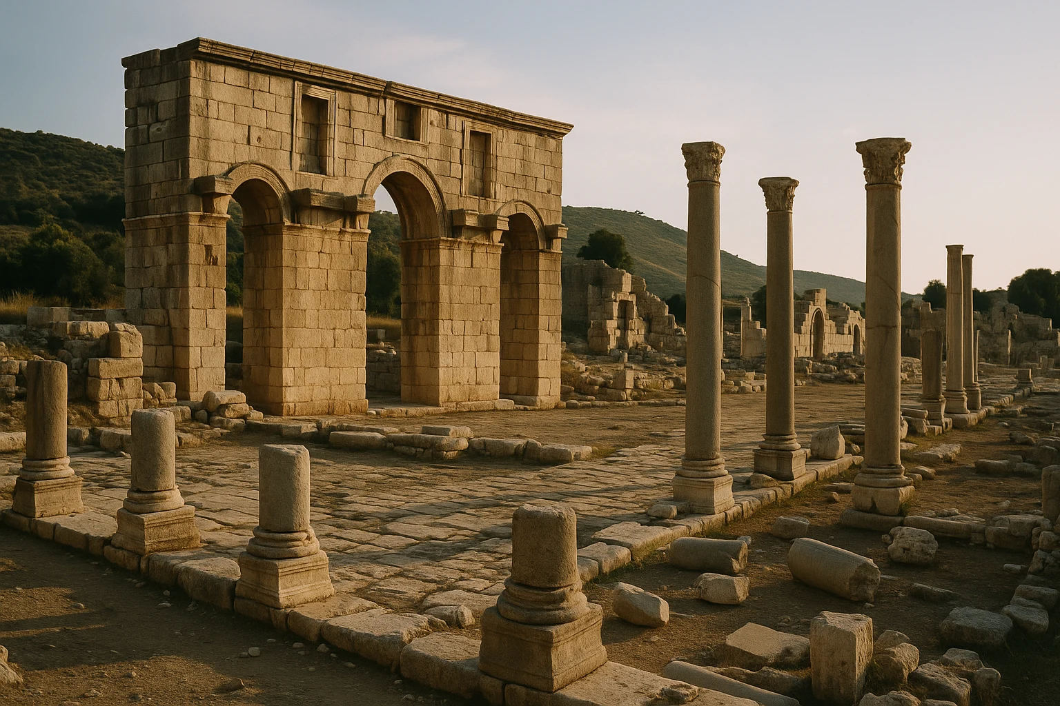
- Patara: A long Lycian-Roman cityscape with monumental streets, theater ruins, and one of the coast’s best beaches.
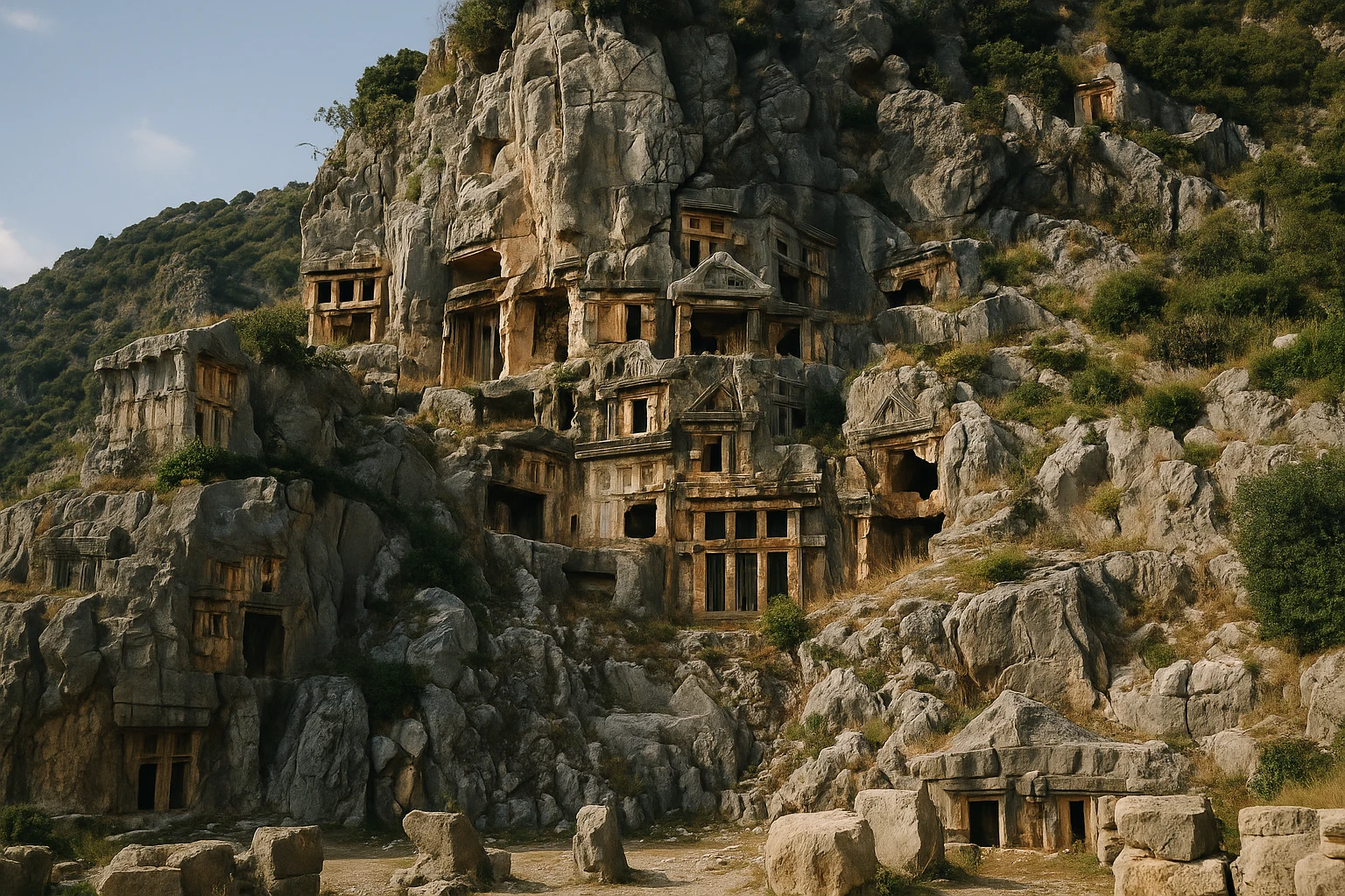
- Myra: Cliff-cut Lycian tombs and a major Roman theater near modern Demre.
- Aspendos: One of Anatolia’s best-preserved Roman theaters, paired with aqueduct remains and a historic acropolis setting.
Plan your wider route with our Turkey Ancient Sites Guide. For first-time planning strategy, read our beginner’s guide to archaeological travel.
Frequently Asked Questions
How much time should I plan for Kayakoy?
Most travelers spend 2 to 3 hours walking the village lanes, churches, and viewpoints. If you want a slower pace with photography stops and a café break in the lower quarter, plan closer to half a day. Add extra time if you continue to Gemiler Beach or Oludeniz afterward.
Is there an entrance fee for Kayakoy?
Yes, the protected archaeological zone charges an entry ticket of about 100 TRY (roughly $3 USD), though prices can change by season. Bring a bank card and a little cash in case card terminals are offline. Small side paths outside the core zone are free, but the main church and upper lanes are inside the paid area.
What is the best time of day to visit Kayakoy?
Early morning and late afternoon are best for cooler temperatures and softer light on the stone walls. Midday in summer can be very hot because the hillside has little shade. If you visit between June and September, aim to arrive before 10:00 AM or after 4:30 PM.
How do I get to Kayakoy from Fethiye?
The easiest route is by taxi, which takes about 20 minutes from central Fethiye and usually costs around 350-500 TRY ($11-16 USD). Dolmus minibuses also run between Fethiye and Kayakoy at low cost, typically 35-60 TRY ($1-2 USD), but schedules are less predictable outside peak season. Rental cars are convenient and parking is straightforward near the lower entrance.
Why is Kayakoy abandoned?
Kayakoy, historically known as Levissi, was largely depopulated after the 1923 population exchange between Greece and Turkey. The village's Greek Orthodox residents left for Greece, and incoming Muslim families generally settled elsewhere. The houses remained empty, creating today's haunting landscape of roofless stone homes.
Is Kayakoy suitable for children and older travelers?
It can be, but expect uneven stone paths and moderate uphill walking. Families with young children should stick to the lower lanes and bring water, hats, and good shoes. Older visitors who prefer flatter ground can still enjoy the lower churches and village edge without climbing to the top ridge.
Nearby Ancient Sites
Patara Turkey Guide 2026: Lycian Capital & Roman Granary
Lycian-Hellenistic-Roman-ByzantinePlan your Patara, Turkey visit: explore Lycian and Roman ruins, climb the theater, and pair the site...
Myra Turkey Guide 2026: Lycian Tombs & Roman Theatre
Lycian-Roman-ByzantinePlan your Myra, Turkey visit with rock-cut Lycian tombs, a Roman theatre, tickets, hours, and transp...
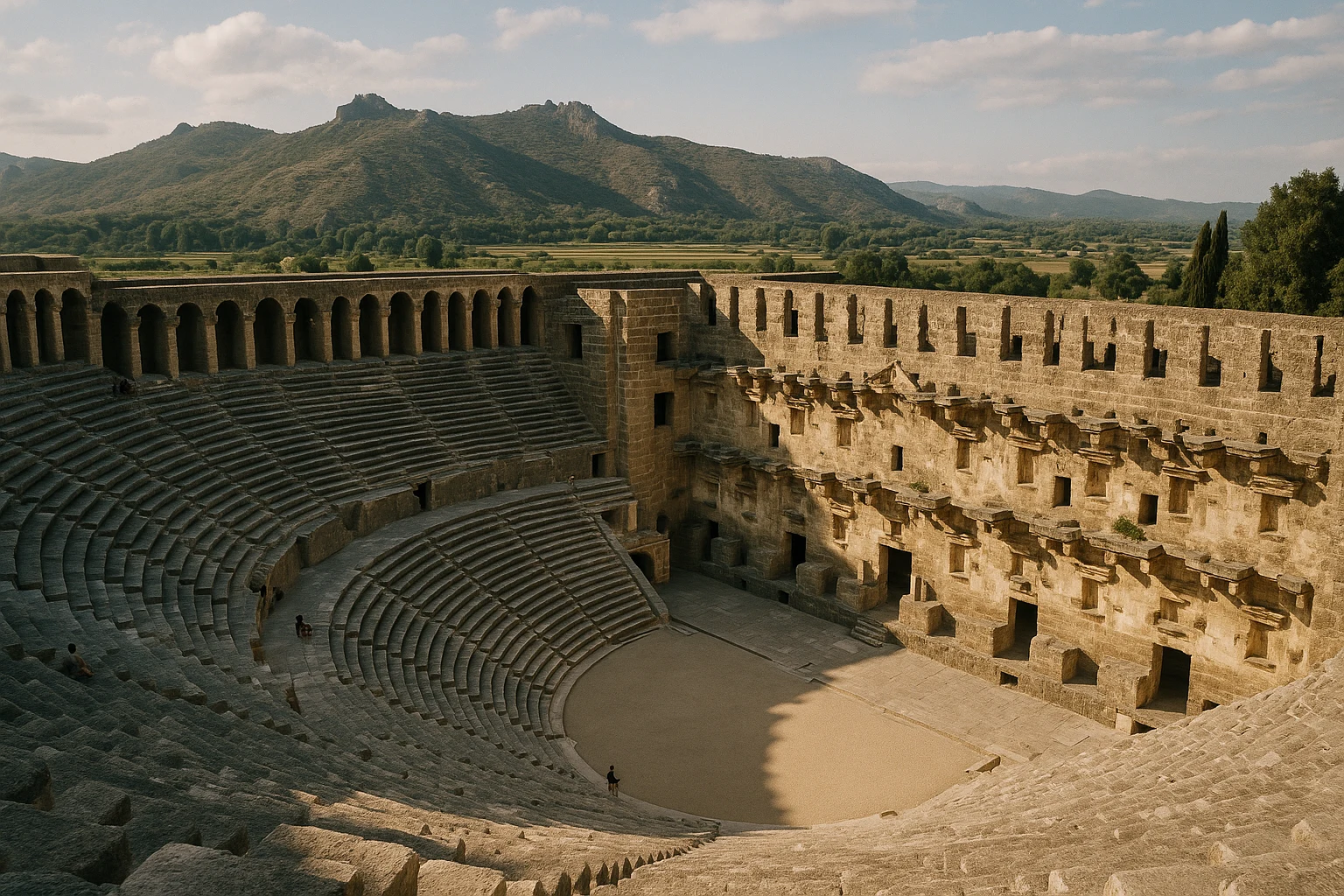
Aspendos Turkey Guide 2026: Roman Theatre & Pamphylian Aqueduct
Pamphylian-Greek-Roman-Byzantine-SeljukPlan your Aspendos visit in Turkey with practical tips on tickets, transport from Antalya, and what ...