Quick Info
Curated Experiences
Tulum Ruins Guided Tour with Early Entry
Tulum and Cenote Day Trip from Cancun
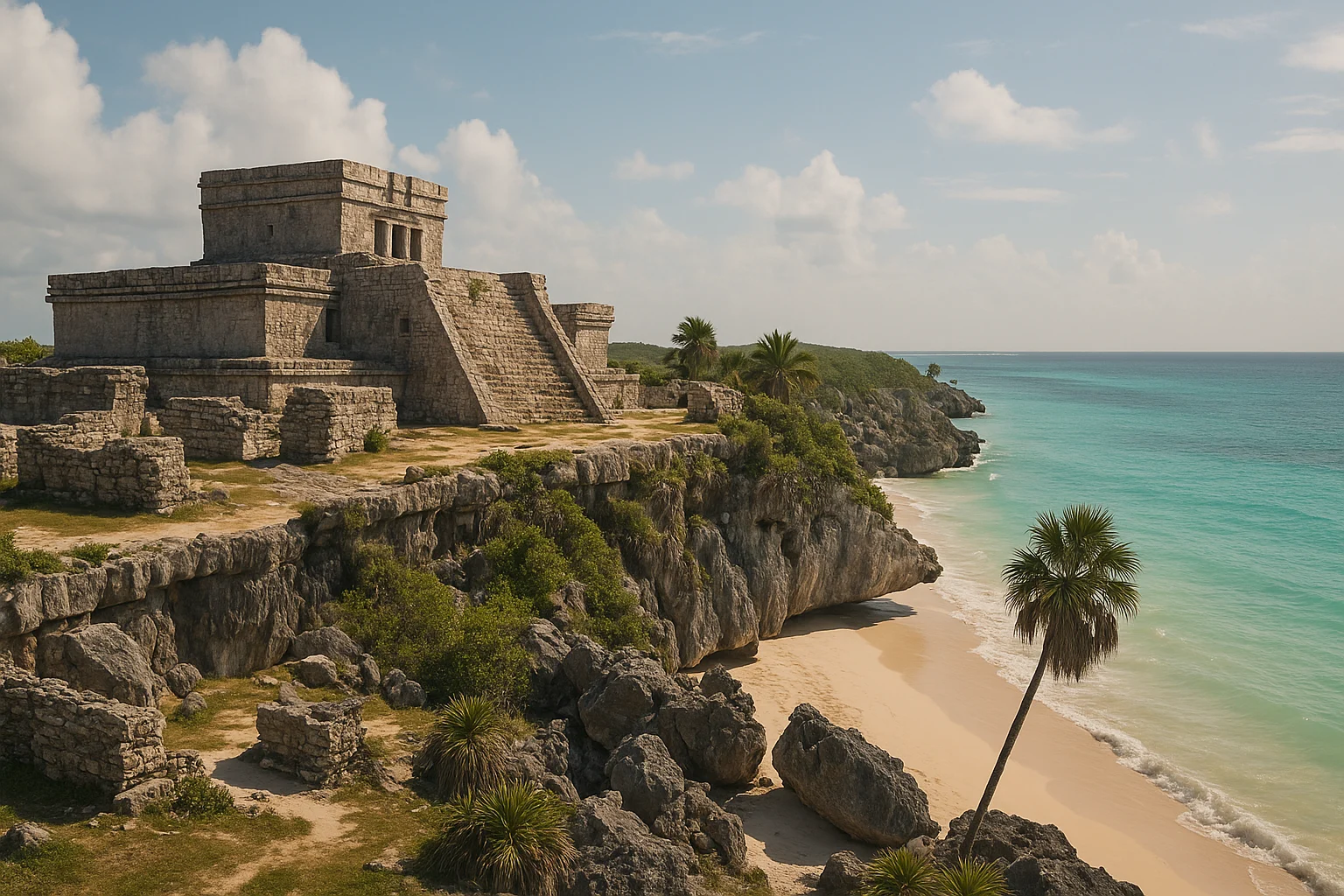
You smell the salt before you see the ruins. The path from the entrance winds through low scrub, and then the Caribbean appears in a color that photographs consistently fail to reproduce — a transparent turquoise stretching to the horizon. Perched on the limestone cliffs above it, gray and unadorned in the morning light, stand the temples and platforms of Tulum. The combination is striking not because it was designed for tourists but because it was designed for trade: this was a working port city, and the cliffs were its loading dock, its lighthouse, and its first line of defense.
Most visitors arrive expecting a beach stop with some old stones attached. What they find is a compact, walled Maya trading post that still reads clearly as a functional urban space. Defensive walls, ceremonial platforms, merchant quarters, and a cliffside beacon building are all compressed into an area you can walk in under two hours. Tulum is not the most architecturally ambitious Maya site. It is one of the most legible — a place where the logic of Late Postclassic Maya life snaps into focus faster than at any sprawling inland capital.
For anyone visiting their first Maya ruin, or for travelers working Tulum into a broader Riviera Maya itinerary, the site rewards a focused morning more than a lazy afternoon. Get the timing right and you will leave with a sharper understanding of how the Maya world actually functioned at its coastal edges.
Historical Context
Tulum was founded around 1200 CE, roughly seven centuries after the great Classic Maya cities of Tikal and Palenque had already collapsed. That timeline matters. While most Maya ruins visitors encounter belong to a civilization long vanished by the time Europeans arrived, Tulum was still actively occupied when Spanish ships appeared off the Yucatan coast in 1518. Juan de Grijalva’s expedition reported seeing a city “as large as Seville” glowing white in the sun — almost certainly Tulum’s plastered buildings catching the light from the sea.
The city’s ancient name was likely Zama, meaning “dawn,” a reference to its east-facing position on the coast. It served as a node in a maritime trade network that stretched from Honduras to the Gulf of Mexico, moving goods like jade, obsidian, cacao, and cotton along the Caribbean shoreline by canoe. Archaeological evidence shows connections to sites hundreds of kilometers away, confirming Tulum’s role not as an isolated outpost but as a commercial hub integrated into a living economy.
The site’s defensive architecture tells its own story. Three sides of the city are enclosed by a stone wall up to five meters thick, with narrow controlled-access gates. The fourth side is the cliff itself, a sheer drop to the sea. This was not ceremonial decoration. Tulum existed in a period of political fragmentation and competition among small Maya states, and its walls reflect a city that understood the value of what it held and the cost of losing it.
Tulum’s decline came gradually after the Spanish conquest disrupted the trade routes that sustained it. European diseases swept the coast, populations collapsed, and the jungle slowly reclaimed the buildings. When John Lloyd Stephens and Frederick Catherwood visited in 1843, they found a site already half-consumed by vegetation. Systematic excavation in the twentieth century revealed the compact, well-preserved archaeological zone visitors see today.
What to See
El Castillo
The defining structure at Tulum sits on the cliff edge facing the open Caribbean. At roughly 7.5 meters tall, El Castillo is modest by Maya standards, but its position gives it outsized presence. This was both a ceremonial platform and a functional navigational landmark. Archaeologists have noted that two windows in the upper temple, when aligned with a torch at night, would create a visible bearing for canoes approaching through the reef gap offshore — essentially a lighthouse operated by firelight.
The viewpoint from the beach below, looking up at the Castillo framed by turquoise water, produces Tulum’s most recognizable image. But spend time on the upper terrace as well, where the relationship between the building and the coastline becomes clear. The Castillo was not placed here for aesthetics. It was placed here because this cliff controlled the approach to a harbor that made the city rich.
Practical note: You cannot enter the Castillo itself, but the surrounding platform offers unobstructed views in every direction. Morning light hits the facade directly.
Temple of the Frescoes
This is Tulum’s most archaeologically significant building, and most visitors walk past it too quickly. The two-story structure served as an observatory and ceremonial space, and its exterior niches hold stucco figures of the Descending God — a deity depicted diving headfirst that is unique to this stretch of coast and possibly connected to Venus or the setting sun.
Inside the lower level, traces of painted murals survive depicting scenes tied to rain, fertility, and the Maya underworld. The painting style shows connections to the Mixtec codex tradition from Oaxaca, evidence of the long-distance cultural exchange that Tulum’s trade routes facilitated. You cannot enter the building, but the exterior details are visible from the roped perimeter and reward close attention.
Practical note: The frescoes are faded and partially protected behind glass. Binoculars or a zoom lens help enormously for reading the stucco details on the upper facade.
The Perimeter Wall
Three sides of Tulum are enclosed by a stone wall averaging three to five meters in thickness, with five narrow gateways. Walk the wall’s full extent if time allows — the circuit reframes the entire site as a place built around controlled movement and security, not just ceremony.
The wall’s construction speaks to Late Postclassic realities. By the 13th century, the unified political structures of the Classic Maya period had long since fractured, and coastal cities competed directly for trade goods and territory. Tulum’s wall is thick enough to resist assault and narrow enough at its entry points to be defended by small numbers. The fourth side — the cliff — needed no wall at all.
Practical note: The north and south wall sections see far fewer visitors than the central plaza. If you want to photograph the wall’s structure without crowds, head to the perimeter first thing.
The Beach Access
Below the cliffs, a steep wooden staircase descends to a small cove with pale sand and clear water. This is one of the few archaeological sites in the world where you can swim within view of ancient ruins. The beach is genuinely beautiful, though small and crowded by late morning.
Practical note: Beach access conditions vary by weather and season. Check posted signage at the top of the staircase. If swimming is open, bring a towel and water shoes — the rocky entry punishes bare feet. There are no changing facilities.
House of the Columns
Located in the site’s interior, this structure is thought to have served as a market or administrative building, with a covered colonnade that would have provided shade for transactions. It is less photogenic than the coastal buildings but more revealing of Tulum’s commercial identity. The columns support the interpretation of Tulum as a trading hub rather than a purely religious center.
Practical note: Most guided tours skip this building. If you are exploring independently, find it north of El Castillo — it is rarely crowded.
Timing and Seasons
The single most important decision for your Tulum visit is what time you arrive. Get this right and everything else follows.
Best months: November through March. The air is drier, mornings are cooler (24-28°C / 75-82°F), and the rainy season has passed. December and January bring the highest tourist volume, but early arrival still beats the crowds.
Shoulder season: April and May are hotter (32°C+ / 90°F+) but less packed. You will sweat more but share the site with fewer tour groups.
Rainy season: June through October brings afternoon downpours and higher humidity. Mornings are usually dry. The upside is dramatically reduced visitor numbers and lush green vegetation framing the ruins.
Best time of day: Gates open at 8:00 AM. Arrive then. By 10:30 AM, the first wave of tour buses from Cancun and Playa del Carmen fills the site, temperatures climb, and the experience degrades noticeably. The 8:00-10:00 AM window gives you cool air, manageable crowds, and low-angle light that brings out detail in the stone.
Worst time of day: 11:00 AM to 2:00 PM. Tour bus peak, maximum heat, minimal shade. If this is your only option, bring twice the water you think you need and expect company at every viewpoint.
Tickets, Logistics and Getting There
Admission: 95 pesos (approximately $5 USD) for non-Mexican adults. Mexican nationals enter free on Sundays. Cash only — bring pesos in small bills. An additional 78 pesos national park fee may apply.
Hours: Open daily 8:00 AM to 5:00 PM, with last entry at 4:00 PM. Arrive at 7:45 AM to be near the front of the opening line.
From Cancun: The drive is roughly 130 km (1.5-2 hours depending on traffic). Organized day trips ($50-80) include hotel pickup and a guide. ADO buses run from Cancun’s bus terminal to Tulum town for approximately 200-300 pesos ($10-15 USD), taking about 2 hours.
From Playa del Carmen: A 65 km drive (45 minutes to 1 hour). Colectivos (shared vans) depart frequently from Calle 2 near the main ADO terminal, costing about 50 pesos ($2.50 USD). This is the cheapest independent option.
From Tulum town: The ruins are 2 km from the center of Tulum pueblo. Taxis charge 100-150 pesos ($5-8 USD). Bike rentals from town are another option — the ride is flat and takes about 10 minutes.
Parking: The site has a large parking lot (100 pesos for cars). From the lot to the entrance gate, expect a 10-15 minute walk along a paved path lined with vendor stalls. Budget this time into your plan.
Practical Tips
- Bring at least one liter of water per person. Shade inside the site is scarce, and the humidity is punishing even on overcast days.
- Wear closed-toe shoes with grip. The stone paths get slick after rain, and the beach staircase is steep and uneven.
- Sunscreen, a hat, and sunglasses are not optional. There is almost no shade once you pass through the entrance.
- Insect repellent helps in the early morning, especially during rainy season.
- Leave the selfie stick in the car — they are technically prohibited, and the site staff enforce it inconsistently.
- The walk from the parking area to the ticket booth takes longer than most guides suggest. Factor in 10-15 minutes each way, more if you stop at vendors.
- Food and drink inside the site are unavailable. Vendors outside the entrance sell water, fruit, and snacks at inflated prices. Bring your own.
- If you plan to swim at the beach, wear your swimsuit under your clothes. There are no changing rooms inside the site.
- Photography tip: the best light on El Castillo occurs between 8:00 and 9:00 AM when the sun is low and hits the facade directly from the east.
Suggested Itinerary
7:45 AM — Arrive at the parking area. Walk to the entrance and join the opening line.
8:00 AM — Enter at the gates. Head straight to El Castillo and the cliff viewpoints while the site is still quiet. Spend 20-30 minutes here with the Caribbean light at its best.
8:30 AM — Walk to the Temple of the Frescoes. Study the Descending God stucco figures and exterior detail. Allow 15-20 minutes.
8:50 AM — Explore the perimeter wall, starting at the north gate and working south. This section is usually empty in the first hour. Allow 20 minutes.
9:10 AM — Visit the House of the Columns and the interior structures. Another 15 minutes.
9:25 AM — If beach access is open, descend the staircase for a swim or to photograph the Castillo from below. Allow 30-45 minutes.
10:15 AM — Exit the site before the late-morning crush. Total time inside: approximately 2 to 2.5 hours.
10:30 AM onward — Pair with a cenote visit. Gran Cenote (4 km from the ruins) or Cenote Dos Ojos (20 minutes north) are the best options within easy driving distance.
Nearby Sites
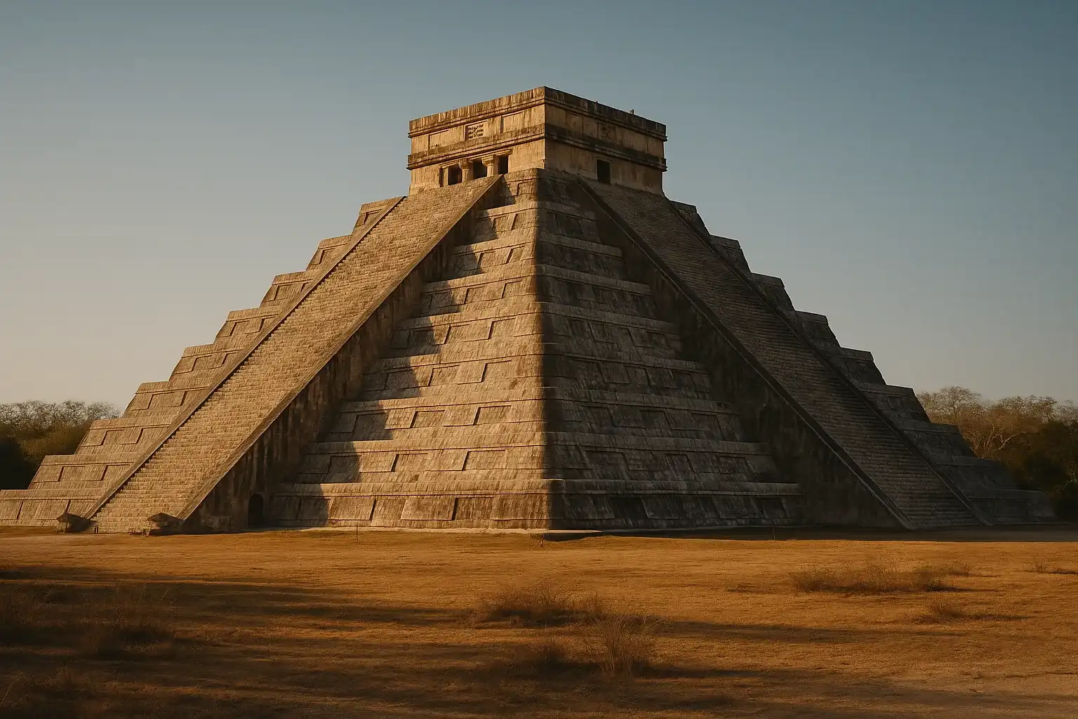
Chichen Itza — The monumental Maya-Toltec capital is roughly 2.5 hours west of Tulum by car. Most travelers visit on a separate day as a standalone trip from Cancun or Valladolid. The contrast between Tulum’s compact commercial port and Chichen Itza’s massive political-ceremonial complex is striking and worth experiencing.
Coba — Only 45 minutes inland from Tulum, Coba offers a jungle-set Maya site with raised causeways and the tallest pyramid in the northern Yucatan. The combination of Tulum in the morning and Coba in the afternoon makes for a full but rewarding day.
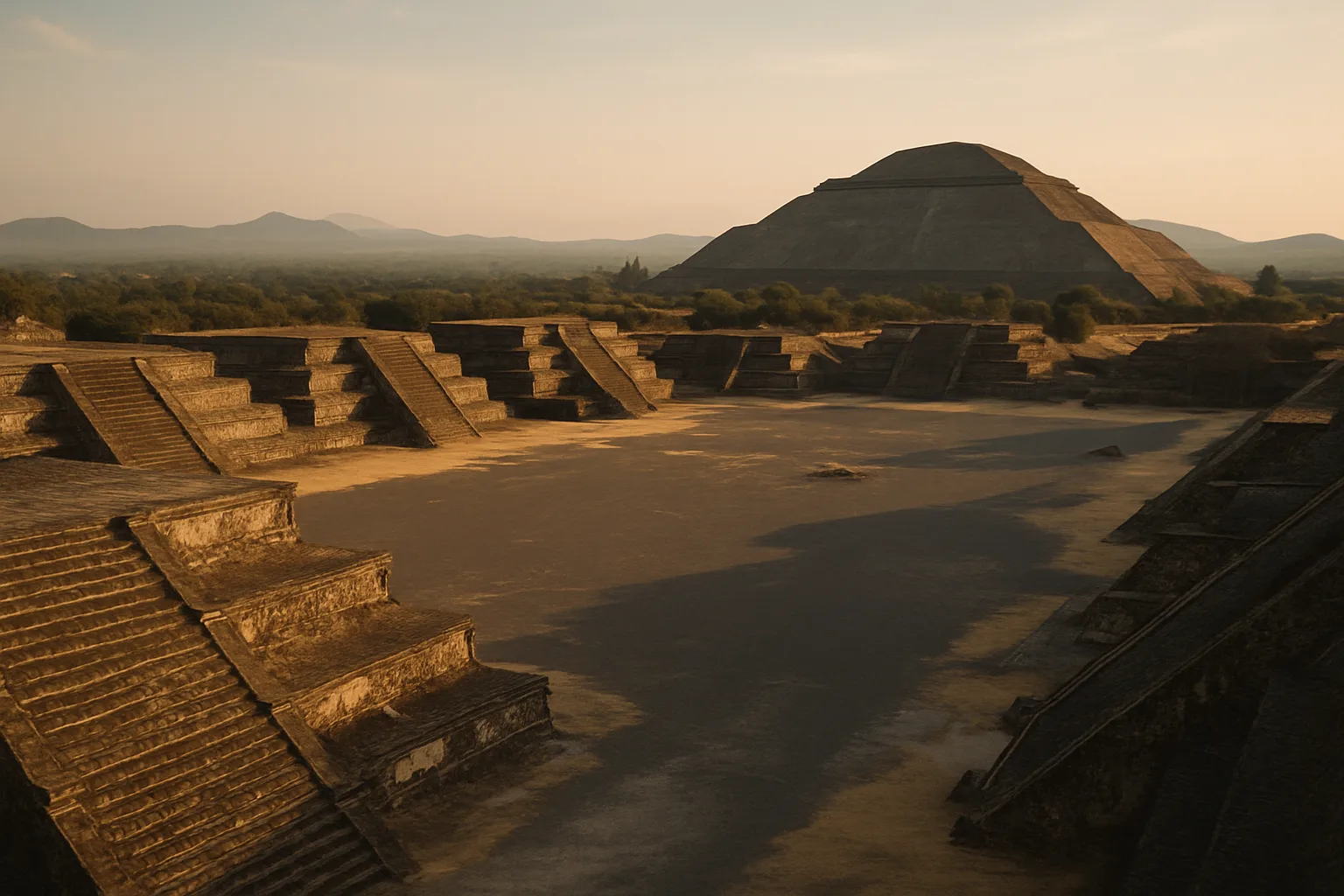
Teotihuacan — Mexico City’s colossal pre-Aztec ruins are a domestic flight away but belong on any broader Mexico archaeology itinerary. Teotihuacan predates Tulum by more than a thousand years and operates at an entirely different scale.
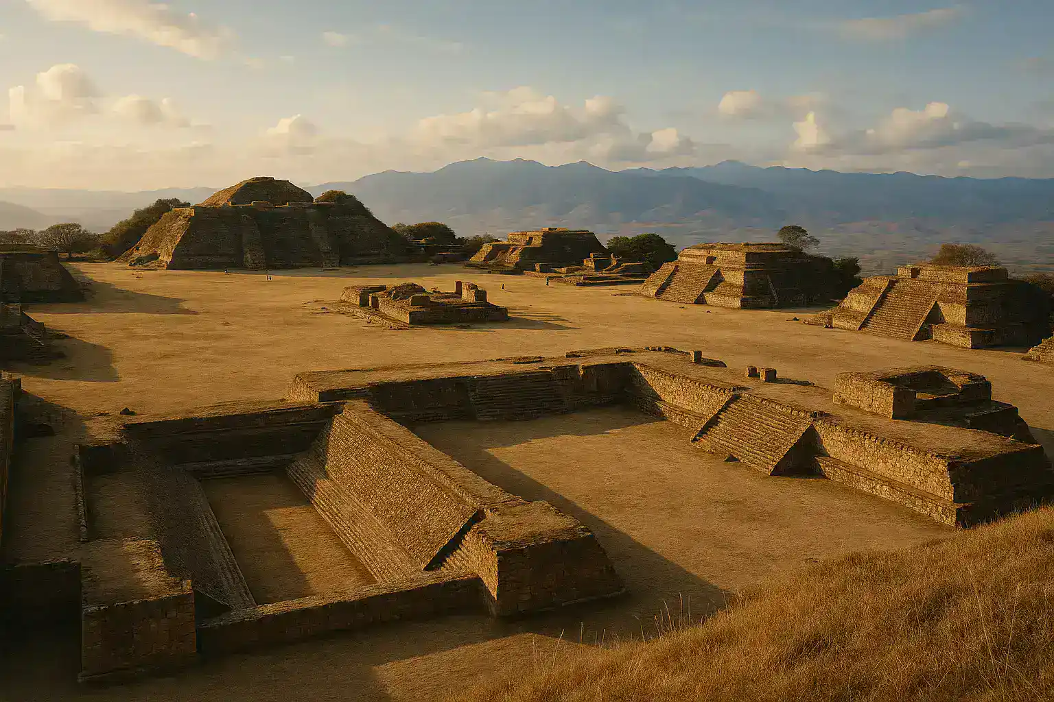
Monte Alban — The Zapotec hilltop capital in Oaxaca is another strong pairing for travelers exploring Mexico’s full archaeological depth. A flight from Cancun to Oaxaca connects two radically different Mesoamerican traditions.
Final Take
Tulum rewards visitors who arrive early, move deliberately, and treat the site as archaeology rather than scenery. The cliffs and the Caribbean are part of the story, but so is the wall, the trade logic, and the late-period resilience of a city that outlasted most of its contemporaries by centuries. This was not a dying culture’s last gasp. It was a functioning economy, a defended port, and a religious center that operated under its own terms until contact with Europe made continuity impossible.
Give Tulum a focused morning. Walk the wall, read the frescoes, stand on the cliff where Maya merchants once watched for canoes on the horizon. Then go swim in a cenote and let the rest of the Riviera Maya earn your afternoon.
Discover More Ancient Wonders
- Chichen Itza — The iconic Maya-Toltec pyramid and ballcourt on the Yucatan plains
- Uxmal — Puuc-style stone mosaics and the elliptical Pyramid of the Magician near Merida
- Palenque — Jungle temples, Pakal’s tomb, and the most refined Classic Maya architecture in Chiapas
- Coba — Jungle pyramids and ancient Maya causeways, 45 minutes from Tulum
- Explore our complete Mexico Ancient Sites Guide for full itinerary planning
Quick Facts
| Attribute | Details |
|---|---|
| Location | Tulum, Quintana Roo, Mexico |
| Country | Mexico |
| Region | Quintana Roo |
| Civilization | Maya |
| Historical Period | 13th-16th century CE |
| Established | c. 1200 CE |
| UNESCO Status | Not inscribed (part of Sian Ka’an Biosphere buffer zone) |
| Entry Fee | 95 pesos (~$5 USD); cash only |
| Hours | 8:00 AM - 5:00 PM daily |
| Best Time | November-March; arrive at 8:00 AM opening |
| Coordinates | 20.2150, -87.4297 |
Frequently Asked Questions
How long do you need at Tulum ruins?
Most travelers spend 1.5 to 2.5 hours at the archaeological zone, then add extra time for the beach access point or nearby cenotes.
What time should I arrive at Tulum ruins?
Arriving at opening is best for cooler temperatures and thinner crowds, especially in high season.
Can you swim at Tulum ruins?
Beach access conditions vary by weather and local controls. Check same-day signage at the site entrance before planning swim time.
Nearby Ancient Sites
Teotihuacan Mexico Travel Guide 2026: Pyramids, Mysteries & Day Trips
TeotihuacanoTeotihuacan, the 'birthplace of the gods,' remains Mesoamerica's most influential ancient city. This...
Chichen Itza Travel Guide 2026: Maya Secrets, Sacred Cenote, and Smart Timing
MayaChichen Itza stands as the most visited ancient site in Mexico, showcasing the architectural genius ...
Monte Albán Mexico Travel Guide 2026: Zapotec Capital Above Oaxaca
ZapotecExplore Monte Albán, the ancient Zapotec capital perched above Oaxaca. Discover the Grand Plaza, bal...