Quick Info
Curated Experiences
Umm Qais and Jerash Day Trip from Amman
Northern Jordan Private Tour: Umm Qais, Jerash and Ajloun
Jordan Pass: 40+ Attractions including Umm Qais
Where Three Countries Meet
On a windswept hilltop in northern Jordan, where the land drops away in every direction toward borders that carry the weight of ancient and modern conflict alike, the black basalt ruins of Gadara offer one of the most arresting panoramas in the entire Middle East. From this single vantage point—a hillside terrace above an Ottoman-era café—you can trace the shimmering surface of the Sea of Galilee lying 210 meters below sea level, follow the dark plateau of the Syrian Golan Heights rising beyond it, watch the Jordan River Valley unspool southward toward the Dead Sea, and on the clearest winter mornings catch the snow-capped silhouette of Mount Hermon hovering at the horizon. In exceptional conditions, the distant glimmer of the Mediterranean appears 80 kilometers to the southwest. This is Umm Qais, ancient Gadara—a Decapolis city that chose its promontory not merely for defense, but seemingly to stand at the crossroads of worlds. The ruins here are not the most extensive in Jordan, nor the best preserved, but the experience of wandering volcanic black stone among colonnaded streets while three countries lay spread below is unlike anything else in the region.
Gadara: City on the Edge of Empires
Gadara’s origins reach back to the Ptolemaic period of the 3rd century BCE, when Hellenistic rulers recognized the strategic value of this commanding ridge above the Jordan Rift Valley. The natural geography placed the city at the convergence of trade routes connecting Damascus, the Mediterranean coast, and the commercial centers of the Jordan Valley—a position that guaranteed both prosperity and political significance for centuries to come.
When Pompey’s legions reorganized the Levant in 63 BCE, Gadara was incorporated into the Roman world as one of the ten cities of the Decapolis—a loose league of Hellenistic urban centers granted special administrative status under Roman oversight. Unlike purely military outposts, these cities were genuine urban communities with theaters, baths, temples, and agoras that sustained Greek language and culture deep into a Semitic landscape. The Decapolis cities formed a cultural corridor through which Greco-Roman civilization spread eastward, and Gadara was among the most distinguished members of that network. Ancient sources credit the city with producing philosophers, poets, and rhetoricians—a reminder that this hilltop, remote as it feels today, was once a place where intellectuals debated and competed.
The Roman era brought Gadara its greatest building programs. The theater, colonnaded streets, and bath complexes that visitors explore today were all products of imperial investment during the 1st and 2nd centuries CE, funded partly by taxes on the lucrative trade passing through the valley below. The city’s builders made a decisive choice that gives Umm Qais its visual identity: rather than importing limestone from distant quarries, they quarried the dense black basalt that underlies the volcanic plateau here, creating a city that looks like no other in the Decapolis—dark, brooding, and utterly distinctive against the bright landscape.
Byzantine Christianity arrived in the 4th and 5th centuries and layered new meanings onto the existing urban fabric. Churches rose on the foundations of pagan temples; inscriptions shifted from Greek to a mix of Greek and Aramaic; the old cult spaces found new purposes. Arab armies arrived in the 7th century CE, and Gadara’s long decline began—not through violence, but through the gradual shift of trade routes and political gravity that left the ridge city progressively isolated. By the medieval period, the population had retreated to smaller settlements, and the great buildings fell silent.
The Biblical Connection: Demons, Swine, and Contested Ground
Gadara carries a resonance for Christian visitors that exceeds its archaeological standing. The Gospel of Matthew (8:28–34) places the story of the Gadarene swine here: Jesus arriving by boat on the eastern shore of the Sea of Galilee, encountering two men possessed by demons, casting the spirits into a herd of swine that then rushed into the lake and drowned. The geography fits—the hills above the Galilee’s eastern shore are steep enough that such a headlong rush is entirely plausible, and the view from Umm Qais makes the lake’s nearness viscerally apparent.
Whether the miracle occurred at Gadara specifically or at the nearby site of Kursi (identified by other Gospel accounts as the country of the Gerasenes) remains a subject of scholarly debate. But the association gave Gadara a place in Christian consciousness, and the city’s later Byzantine churches reflect a community that fully inhabited that identity. For visitors today, the biblical connection adds a layer of meaning to the view: the shining surface of the Galilee below was not merely a scenic backdrop but the site of events that shaped two thousand years of religious history.
The View That Defines Umm Qais
No description of Umm Qais is complete without returning, repeatedly, to the view—because it is the view that justifies the journey in a way that the ruins alone, impressive as they are, could not. Standing on the museum terrace or anywhere along the site’s western edge, you look down across a geography that contains more historical weight per square kilometer than almost any comparable area on earth.
To the northwest, the Sea of Galilee—Lake Tiberias—fills a deep depression in the Jordan Rift Valley, its blue surface bracketed by hills that have been continuously farmed and fought over since the Bronze Age. The water gleams with a particular intensity that comes from lying below sea level, concentrated by the surrounding hills into something almost theatrical. Beyond the lake, the Golan Heights rise as a dark volcanic shelf—Syrian territory occupied by Israel since 1967—and the whole contested plateau stretches north toward the snowfields of Mount Hermon straddling the Syrian-Lebanese border. In the valley below, the Jordan River traces its ancient course southward between Israel and Jordan, passing through a landscape of citrus groves and banana plantations before disappearing toward the Dead Sea.
This is why visitors who have seen Jerash and Petra and the great monuments of Jordan still find themselves recommending Umm Qais with particular insistence. The ruins here are a frame for the world, not merely objects to photograph and catalog.
The West Theater: Black Stone, Ancient Voices
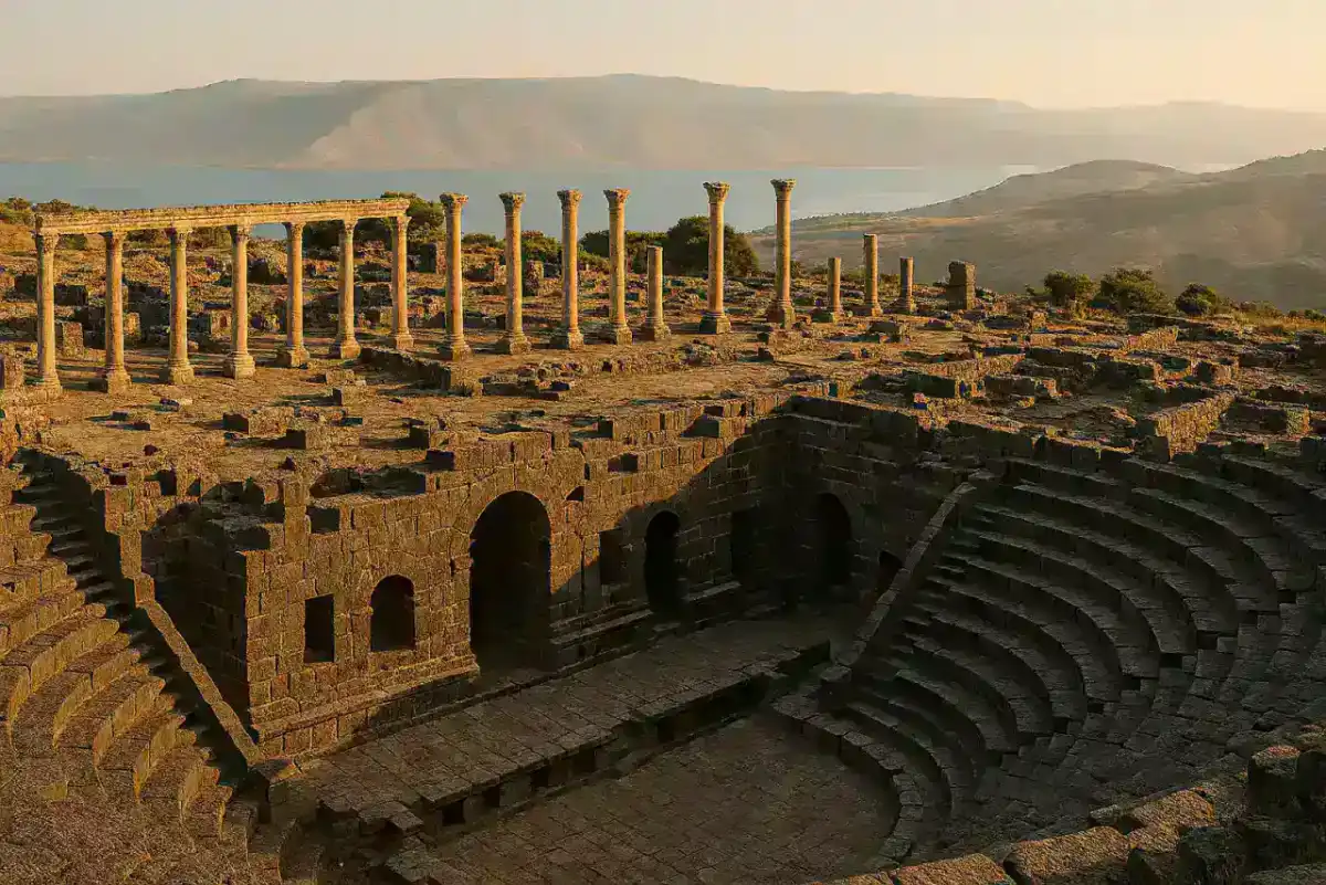
The most structurally impressive ruin at Umm Qais is the West Theater, a performance space carved from the hillside and built largely in the black basalt that defines the site’s character. The theater seated approximately 3,000 spectators in tiers of dark stone that face outward toward the valley—a design that would have placed the distant Galilee squarely in the sightlines of audiences watching performances below. Whether ancient architects intended this visual connection deliberately or simply followed the terrain is unknown, but the effect today remains extraordinary: sit in the upper tiers and you hold both an ancient stage and a vast contemporary landscape in your field of view simultaneously.
The basalt’s density has contributed to the theater’s survival. Unlike the softer limestone of Jerash, which has been worn smooth and gaps readily when disturbed, the volcanic stone resists erosion with stubborn solidity. You can trace individual seating rows, examine the curved orchestra floor where musicians and speakers once performed, and imagine the acoustics that would have carried voices across those dark stone tiers. The theater is partially preserved rather than restored—you are encountering genuine antiquity rather than 20th-century reconstruction—and the atmosphere is correspondingly less polished and more evocative.
Colonnaded Streets and Ottoman Stones
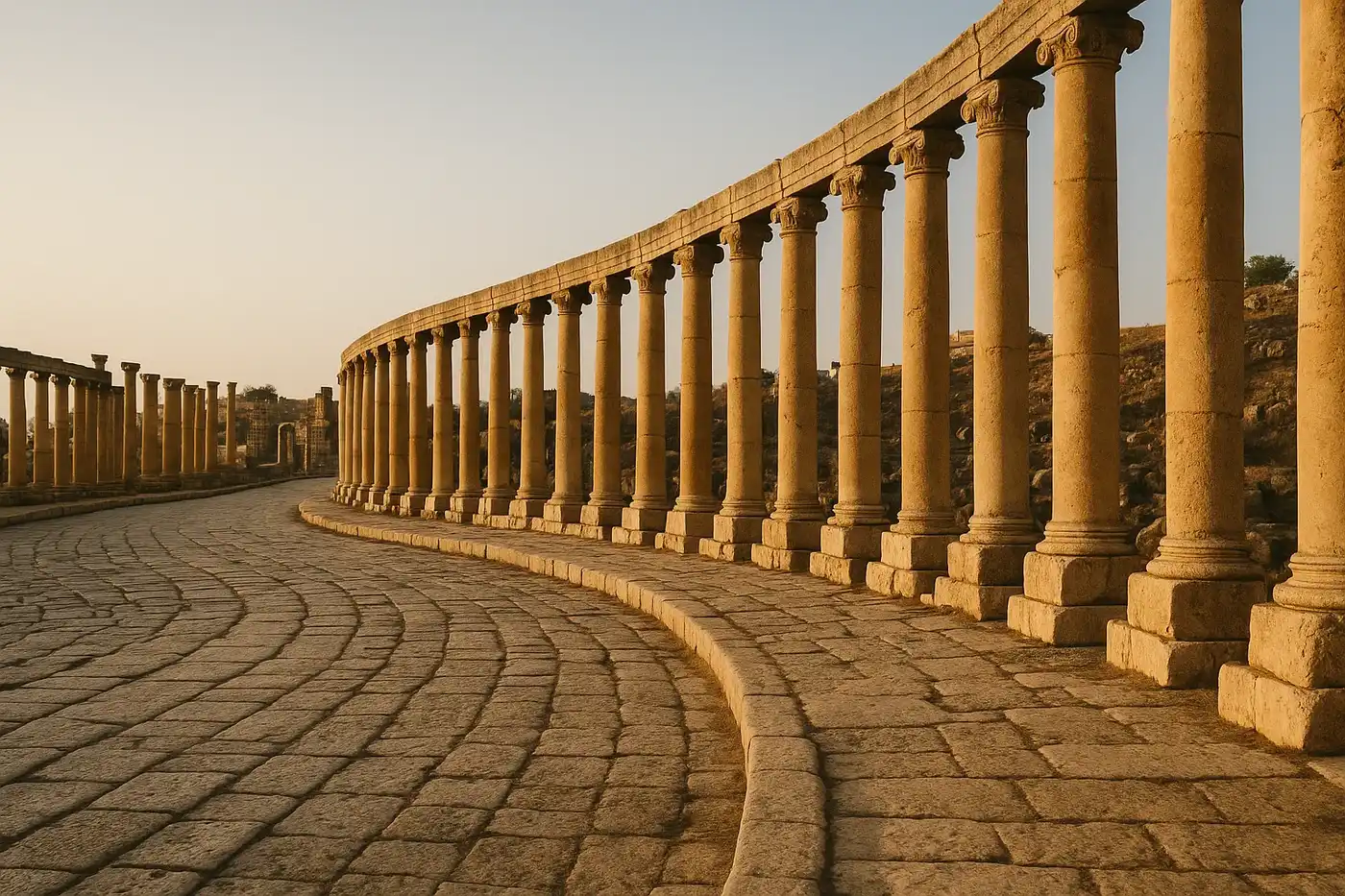
A colonnaded street runs through the main body of the site, lined with the footprints of shops, civic buildings, and public spaces that once constituted urban daily life in Gadara. It lacks the monumental completeness of Jerash’s famous cardo—fewer columns stand, the pavement is more broken—but the fragments speak to the full Roman urban package this city once possessed: regular streets, shaded walkways, commercial frontages, and the ordered spatial logic that distinguished Decapolis cities from purely utilitarian settlements.
The baths preserve evidence of the hypocaust system that circulated warm air beneath mosaic floors, a reminder that Gadara’s inhabitants expected the full range of amenities that Roman civilization provided. Marble fittings and imported decorative materials confirm access to empire-wide trade networks, even here at the eastern edge of the Roman world. Rock-cut tombs on the site’s periphery display elaborately carved facades that track the evolution of burial customs from Hellenistic through Byzantine periods, while foundation walls of Byzantine churches mark the overlay of Christian Gadara atop its pagan predecessor.
The Ottoman Village: A Living Palimpsest
What distinguishes Umm Qais from most ancient sites is the presence of a 19th-century Ottoman settlement built directly within and upon the Roman ruins. The villagers who established themselves here found the most practical building material imaginable in the ancient stones around them: columns became wall courses, carved capitals served as threshold blocks, architectural fragments were incorporated wherever they fit. The resulting architecture creates a visual record of human pragmatism across centuries—Roman stonework pressed into Ottoman service, creating hybrid walls where you can trace the building careers of stones that have been shaped and reshaped by hands spanning two thousand years.
This Ottoman village has been partially restored and now houses the site’s visitor center, a small museum, and the restaurant terrace that has become Umm Qais’s most beloved gathering point. The museum displays sculptural fragments, Greek and Latin inscriptions, pottery, and coins that span the full arc of occupation from Hellenistic foundation through Byzantine decline, providing context that the open-air ruins alone cannot convey. Allow twenty or thirty minutes here before exploring the site, and the experience of walking among the ruins becomes considerably richer.
Practical Guide: Tickets, Getting There & Timing
Essential Planning FAQs
How do I get to Umm Qais from Amman?
By car is by far the most practical approach. Drive north on the Desert Highway toward Irbid—110 km, approximately two hours—then follow the well-signposted road west from Irbid for the final 25 km. The mountain road approaching the site winds through terraced hillsides with increasingly dramatic views; a standard sedan handles it without difficulty. Organized tours ($110–140) typically combine Umm Qais with Jerash in a single full-day excursion, eliminating navigation concerns and providing historical context. Taxis from Irbid cost 15–20 JOD each way (30 minutes); negotiate a return pickup or have the driver wait. Public buses from Amman reach Irbid regularly (1.5 hours), but onward service to Umm Qais is limited and time-consuming.
How much does entry cost, and what are the hours?
Admission is 5 JOD (approximately $7 USD). The site is covered by the Jordan Pass, which bundles Umm Qais with Jerash, Petra, the Amman Citadel, and over 40 other attractions—excellent value for anyone visiting multiple sites. Hours are 8 AM–6 PM in summer and 8 AM–4 PM in winter. The site is open daily.
When is the best time to visit?
Spring (March–May) delivers the ideal combination: temperatures of 20–28°C, wildflowers blooming across the hillsides, and reliably clear skies that reveal the full panorama including Mount Hermon and sometimes the distant Mediterranean. Autumn (September–November) offers similar advantages with thinner crowds. Summer is hot (30–38°C) and haze typically reduces visibility across the valley—if visiting in summer, arrive by 8–9 AM before heat shimmer builds. Winter brings cool temperatures and the chance of snow on the Golan Heights, creating dramatic compositions, but clouds frequently obscure the distant views that define the Umm Qais experience.
How much time do I need?
Plan 2–3 hours for the ruins, museum, and viewpoint. Combine with Jerash (75 km, 1.5 hours by road) for a natural full-day northern Jordan itinerary: Jerash in the morning, Umm Qais in the afternoon for golden-hour light on the ruins and views over the Galilee. An extended northern Jordan circuit adds Ajloun Castle and the Decapolis site of Pella in the Jordan Valley for a two-day exploration of the region.
What should I bring?
Water is essential—at least a liter per person, as the exposed hilltop site has no water sources along the ruins. Sun protection (hat, sunscreen, sunglasses) is equally critical; the promontory receives full sun with minimal shade. Binoculars significantly enhance the experience of identifying landmarks across the Sea of Galilee and Golan Heights. The hilltop wind can be brisk even in summer, so a light layer is worth packing.
Quick Facts
| Attribute | Details |
|---|---|
| Location | Irbid, Irbid, Jordan |
| Country | Jordan |
| Region | Irbid |
| Civilization | Greco-Roman (Decapolis) |
| Historical Period | c. 3rd century BCE–8th century CE |
| Established | c. 3rd century BCE |
| Coordinates | 32.6534, 35.6841 |
Explore More Ancient Jordan
- Jerash: The best-preserved Roman city in the Middle East
- Amman Citadel: Temple of Hercules overlooking Jordan’s capital
- Qasr Amra: Umayyad desert castle with extraordinary frescoes
|-----------|---------| | Location | Northern Jordan, Irbid Governorate | | Ancient Name | Gadara | | UNESCO Status | Not individually listed (Jordan tentative list) | | Peak Period | 1st–3rd centuries CE (Roman imperial period) | | Distance from Amman | 110 km (68 miles); approx. 2 hours | | Distance from Jerash | 75 km (47 miles); approx. 1.5 hours | | Elevation | Approx. 378 meters (1,240 feet) above sea level | | Best Time | March–May, September–November | | Entry Fee | 5 JOD (~$7 USD); included with Jordan Pass | | Hours | 8 AM–6 PM (summer); 8 AM–4 PM (winter) | | Suggested Stay | 2–3 hours; half day with Jerash combination |
Frequently Asked Questions
How do I get to Umm Qais from Amman?
Drive north from Amman on the Desert Highway, then west toward Irbid (110 km, 2 hours). The site is well-signposted from Irbid. Public transport is limited; rental car or organized tour ($110) is recommended. The winding road to the site offers spectacular views.
What makes Umm Qais unique compared to Jerash?
While Jerash offers better-preserved Roman architecture, Umm Qais provides unique advantages: dramatic hilltop views over three countries (Jordan, Israel, Syria), distinctive black basalt construction, smaller crowds, and a more atmospheric, less reconstructed feel. The views alone justify the trip.
What will I see at Umm Qais?
The site includes a West Theater built of black basalt, colonnaded streets, a basilica, baths, and tombs. The Ottoman village reused ancient stones in its construction. Most impressive are the panoramic views: Sea of Galilee, Golan Heights, Jordan River valley, and on clear days, Mount Hermon and the Mediterranean.
How much time do I need at Umm Qais?
Plan 2-3 hours to explore the ruins and enjoy the views. Combine with Jerash (1.5 hours away) for a full-day northern Jordan itinerary. The site's small size makes it manageable, but you'll want time to absorb the spectacular panoramas.
Is Umm Qais safe given its proximity to borders?
Yes, the site is safe for tourists. While Umm Qais overlooks the Israeli-occupied Golan Heights and West Bank, the area itself is secure and actively patrolled. The viewpoint is a popular tourist destination. Standard travel precautions apply.
When is the best time to visit Umm Qais?
Spring (March-May) and autumn (September-November) offer clear skies and pleasant temperatures (20-28°C). Summer haze can obscure distant views; winter brings rain and clouds. Morning visits typically offer the clearest visibility for viewing the Sea of Galilee and beyond.
Nearby Ancient Sites
Jerash: The Pompeii of the East and Jordan's Best-Preserved
Roman / NabataeanDiscover Jerash, Jordan's remarkable Roman ruins. Walk the colonnaded streets of ancient Gerasa, exp...
Amman Citadel Jordan Guide 2026: Temple of Hercules & Ancient Rabbah
Ammonite-Roman-UmayyadExplore Jordan's ancient citadel overlooking modern Amman. Discover the Temple of Hercules, Umayyad ...
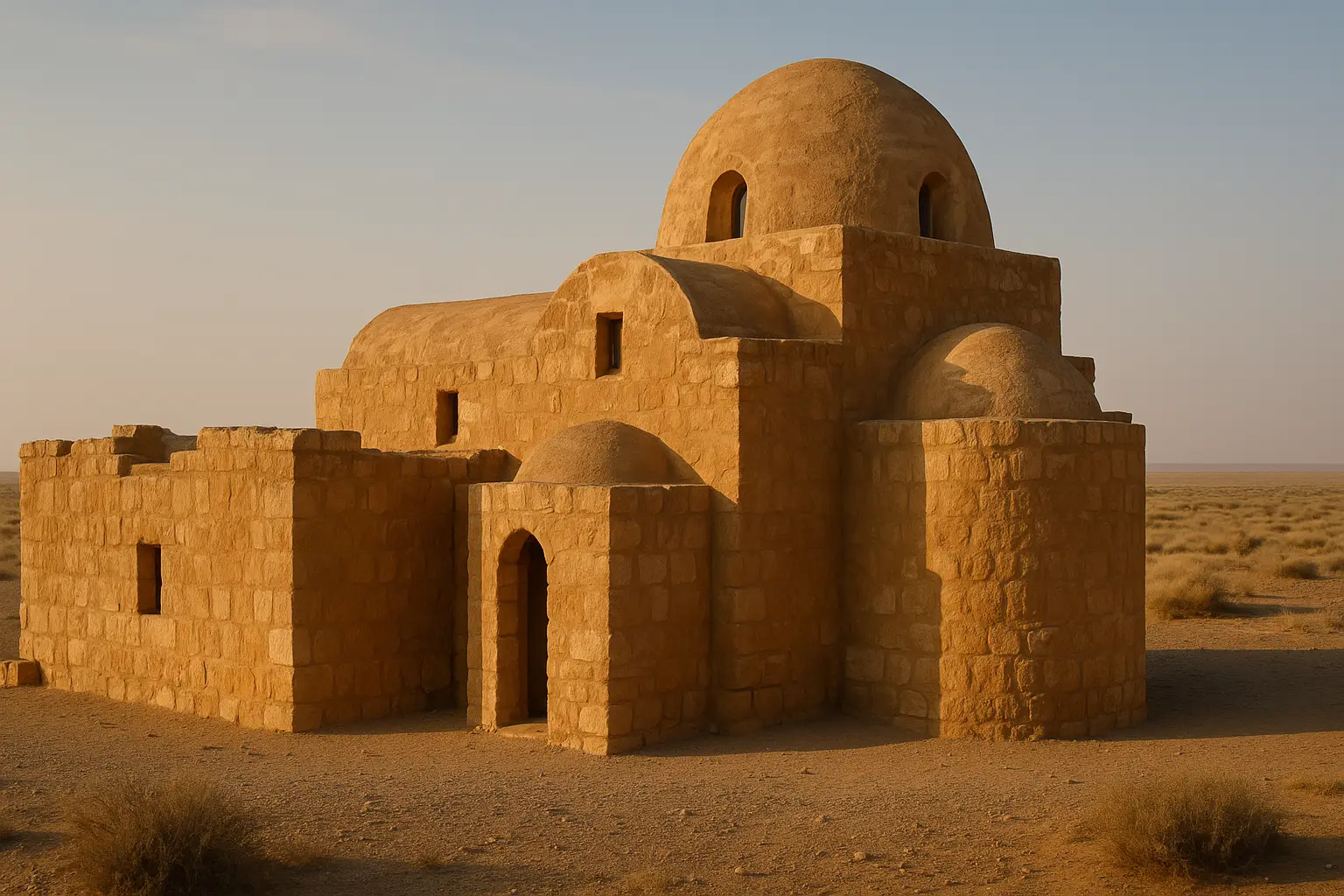
Qasr Amra Jordan Travel Guide 2026: Desert Castle Frescoes
UmayyadDiscover Qasr Amra's extraordinary 8th-century frescoes in Jordan's eastern desert. Our guide covers...