Quick Info
At a glance
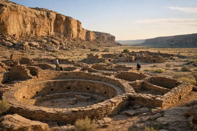
In northwestern New Mexico, United States, Chaco Canyon unfolds across a broad, sunlit basin where sandstone cliffs, desert grasses, and monumental ruins create one of North America’s most memorable archaeological landscapes. Even before you reach the main concentration of sites, the setting feels deliberate: a long canyon floor, distant mesas, huge skies, and silence broken mostly by wind. This was not a casual settlement on the margins of the ancient Southwest. For several centuries, Chaco Canyon served as a center of ceremony, administration, exchange, and architectural innovation for the Ancestral Puebloan world.
What makes Chaco remarkable is not simply age, though the core construction here dates largely from the 9th to 12th centuries. It is the scale of planning. Multi-storied stone complexes rose from the canyon floor with hundreds of rooms. Great kivas marked spaces for communal ritual. Roads spread outward for astonishing distances, linking Chaco to outlying communities across the Four Corners region. Builders aligned walls, doors, and windows with striking precision, and many scholars have explored the relationship between architecture, landscape, and celestial observation. Today, visitors encounter both grandeur and restraint: carefully preserved masonry, vast open distances, and an atmosphere that encourages slow looking. Chaco Canyon is not a crowded urban ruin but a place where architecture, astronomy, ritual, and geography seem woven together. To visit is to see how sophisticated and connected the ancient Southwest truly was.
History
Early settlement before Chaco’s rise
People lived in the broader San Juan Basin long before Chaco Canyon became a major center. Early hunter-gatherer communities moved through the region for millennia, gradually adapting to its dry climate and seasonal resources. By the first millennium CE, farming populations cultivating maize, beans, and squash had established more permanent settlements in parts of the northern Southwest. These communities developed pit houses, storage features, and growing traditions of pottery production and local exchange.
In Chaco Canyon itself, earlier occupation laid the groundwork for later expansion. Small settlements and agricultural activity suggest that the canyon’s resources, though limited, were useful when carefully managed. Seasonal runoff, check dams, and floodwater farming likely helped people make productive use of the arid landscape. Over time, what had been a sparsely inhabited canyon became a focal point for larger ambitions.
The florescence of Chaco, c. 850-1150 CE
Chaco’s great building era began around the mid-9th century and accelerated after about 850 CE. This was the period when the canyon’s best-known monumental structures, often called great houses, were planned and built. Pueblo Bonito, Chetro Ketl, Una Vida, Hungo Pavi, Pueblo del Arroyo, and other major buildings transformed the canyon floor. These were not simple villages. Their formal layouts, engineered masonry, large room blocks, and monumental kivas indicate organized labor and a regional significance that reached well beyond local daily life.
By the 10th and 11th centuries, Chaco had become the hub of an extensive cultural system. Roads radiated from the canyon in remarkably straight segments, crossing difficult terrain and linking outlying great houses and communities. Exotic materials found in Chaco, including macaws from Mesoamerica, marine shell, copper bells, and cacao residue in some vessels, indicate long-distance exchange networks and broad social connections. Timber for roofs and upper stories was brought from mountain ranges many miles away, demonstrating both logistical capacity and social coordination.
Architecture from this period also reveals sophisticated design. Builders used core-and-veneer masonry, with carefully shaped sandstone blocks producing walls of striking visual regularity. Great kivas and plazas suggest large gatherings, and some structures appear to incorporate solar and lunar alignments. Chaco was likely not only a place of residence but also a ceremonial, political, and symbolic center.
Transformation and decline after the 12th century
Chaco’s prominence did not last indefinitely. By the 12th century, environmental and social pressures began to alter life in the canyon. Tree-ring studies and other evidence point to periods of prolonged drought, which would have put severe stress on agriculture in an already marginal environment. At the same time, the very complexity of Chaco’s network may have become difficult to sustain. Maintaining roads, supporting large construction projects, and coordinating distant communities required stability and resources.
Construction slowed, and some of the great houses show signs of changing use. Regional populations increasingly shifted toward other centers, including areas to the north and west. By the late 12th and early 13th centuries, Chaco Canyon was no longer the dominant node it had been during its peak. That does not mean it was forgotten. For descendant Pueblo peoples, Chaco remained part of an enduring cultural landscape and historical memory.
Rediscovery, archaeology, and protection
Euro-American awareness of Chaco’s monumental ruins increased in the 19th century, though local Indigenous knowledge of the place never disappeared. Early surveys and expeditions drew attention to the scale of the ruins, but they also brought looting and poorly controlled excavations. In 1907, the area received federal protection as Chaco Canyon National Monument, reflecting growing recognition of its importance. Later archaeological work, though sometimes shaped by the assumptions of its time, greatly expanded understanding of Chaco’s chronology, architecture, trade, and landscape.
In 1980 the protected area became Chaco Culture National Historical Park, emphasizing a broader regional story rather than only a single canyon. In 1987 UNESCO designated it a World Heritage Site. Today, research continues, often with stronger collaboration with descendant communities and greater sensitivity to sacred significance. Chaco Canyon is now understood not merely as a cluster of ruins, but as one of the most important cultural landscapes in the ancient Americas.
Key Features
The emotional center of most visits is Pueblo Bonito, the largest and most famous great house in Chaco Canyon. Standing before its sweeping D-shaped form, visitors can grasp the ambition of Chacoan architecture in a way photographs rarely capture. The structure once rose several stories high in places and contained hundreds of rooms arranged around plazas and ceremonial spaces. Even in ruin, the surviving walls display extraordinary stonework, with courses of thin sandstone blocks fitted into elegant patterns. Walking through Pueblo Bonito reveals a place that was both practical and symbolic: storerooms, living spaces, kivas, and controlled entrances all suggest a carefully organized environment.
Nearby Chetro Ketl offers a different impression. Broad and expansive, it includes one of the canyon’s largest great kivas and a large plaza that hints at public ceremony on a grand scale. The spacing of rooms and open areas suggests that movement through the site mattered. These were places built for gathering, processions, observation, and social performance as much as for ordinary residence. Pueblo del Arroyo and Casa Rinconada further enrich that picture. Casa Rinconada, in particular, is one of the largest great kivas in the Southwest, and its circular form creates a striking contrast with the angular geometry of the great houses around it.
Another defining feature of Chaco Canyon is the relationship between architecture and landscape. Many ruins are positioned so that cliffs and mesas become part of the visual composition. Fajada Butte, perhaps the most iconic natural landmark in the canyon, rises dramatically from the floor and anchors the horizon. It is associated with one of Chaco’s most discussed archaeoastronomical sites, though direct public access is restricted to protect its fragile remains. Even without climbing it, visitors can feel how geological features helped shape the spiritual and visual world of Chacoan builders.
The canyon’s engineered road system is less immediately visible than the great houses, but it is among Chaco’s most remarkable achievements. Some roads run with startling straightness across broken terrain, implying ceremonial or symbolic purposes in addition to practical movement. Together with stairways cut into cliff faces and formal alignments between structures, the roads point to a landscape understood at a regional scale. Chaco was not isolated architecture; it was the heart of a connected network.
For many travelers, the petroglyph trails are equally memorable. Along routes such as the Pueblo Alto Trail or the short walk near several canyon-floor sites, visitors can see rock art pecked into cliff faces. Spirals, animal forms, human figures, and abstract motifs add another layer to the story, reminding us that Chaco was not only built in stone rooms but also inscribed onto the canyon walls themselves. The elevated trails also provide an essential sense of perspective. From above, the arrangement of great houses and open spaces becomes easier to understand, and the enormous thought invested in placement and orientation comes into focus.
Finally, Chaco’s dark skies are a feature in their own right. The park is famous for exceptionally clear night viewing, and the lack of nearby urban light gives stars a brightness that is rare in much of the modern United States. Because astronomy and celestial cycles may have informed parts of Chacoan design, the night sky here feels less like a bonus attraction than a continuation of the site’s ancient logic. Sunset and evening often reveal dimensions of the canyon that daytime heat and bright light can obscure.
Getting There
Chaco Canyon is remote, and reaching it requires planning. The nearest practical gateway for most travelers is Albuquerque, about 150 to 170 miles away depending on the route. Rental cars from Albuquerque International Sunport often start around $50-90 per day before taxes and insurance, and driving is by far the most flexible option. Farmington is another useful base, roughly 75 miles away, with a shorter approach time and easier access to supplies.
The main challenge is the final stretch. Several approach roads include long unpaved segments, and conditions can deteriorate quickly after rain or snow. High-clearance vehicles are strongly recommended, and some standard rental contracts may restrict driving on rough dirt roads, so check terms carefully. Fuel stations and food services are not available at the park, so visitors should fill up in towns such as Cuba, Bloomfield, or Farmington and carry ample water and snacks.
There is generally no regular public bus or rail service directly to Chaco Canyon. Travelers without a car usually need to join a specialized tour, arrange a private transfer, or hire a guide from Albuquerque, Santa Fe, or Farmington. Guided day trips, where available, often cost roughly $180-350 per person depending on group size and inclusions. Park entry fees are separate unless included in the tour. Once inside the park, the main archaeological sites are connected by a paved loop road, and short walks link parking areas to major ruins. Wear sturdy shoes and expect limited shade.
When to Visit
Spring and autumn are usually the best times to visit Chaco Canyon. From March to May and from late September to early November, daytime temperatures are often more comfortable for walking among the ruins and climbing the canyon trails. These seasons also tend to offer clearer visibility, gentler light for photography, and fewer weather extremes than midsummer or winter. Nights can still be cold, especially in spring and fall, so layers are essential.
Summer brings long daylight hours and vivid evening skies, but it also means strong sun, high temperatures, and the possibility of monsoon storms. Afternoon thunderstorms can make dirt roads muddy or temporarily hazardous, and flash-flood risks should never be ignored in desert environments. If visiting in June through August, start early, carry more water than you think you need, and watch forecasts closely.
Winter can be beautiful and very quiet. Snow on the canyon floor and surrounding mesas gives the ruins a stark, dramatic atmosphere, and the low sun can cast especially sharp shadows across the masonry. However, freezing nights, occasional snow, and difficult road conditions may complicate travel. Some visitors find winter ideal for solitude and photography, but only if they are prepared for cold weather and potential access disruptions.
Whenever you go, try to stay until late afternoon or overnight if possible. Chaco changes character as the sun lowers, and the evening sky is one of the park’s greatest rewards. If stargazing matters to you, schedule your visit around a new moon for the darkest conditions.
| Quick Facts | Details |
|---|---|
| Location | Northwestern New Mexico, United States |
| Best Known For | Ancestral Puebloan great houses, roads, kivas, and astronomical alignments |
| Peak Period | c. 850-1150 CE |
| Cultural Affiliation | Ancestral Puebloan / Chacoan culture |
| UNESCO Status | World Heritage Site since 1987 |
| Nearest City for Services | Farmington |
| Time Needed | 1 full day minimum; 2 days ideal |
| Access | Primarily by private vehicle via remote paved and unpaved roads |
| Best Seasons | Spring and autumn |
| Special Tip | Bring extra water, fuel, and check road conditions before departure |
Chaco Canyon rewards visitors who arrive prepared and willing to slow down. It is not the kind of destination that reveals itself through a quick stop and a few photographs. Its significance emerges through repetition and distance: one great house after another, one carefully laid wall after another, one view from the canyon floor followed by another from the rim. The more time you give it, the more coherent it becomes. What first appears as a scatter of ruins resolves into a planned ceremonial landscape tied to regional networks, seasonal cycles, and enduring cultural traditions.
For travelers interested in ancient history in the United States, few places compare. Chaco Canyon combines architectural sophistication, archaeological importance, and an extraordinary desert setting with a sense of stillness that remains rare. It is both a major historical site and a place of contemplation. Long after the road out of the canyon has disappeared behind you, the scale of what was built here—and the mystery of how it functioned—continues to stay in the mind.
Guided tours: worth it?
A guide can be genuinely useful at Chaco Canyon, especially if you want help with transport, timing, tickets, or understanding a large site without losing half the day to logistics.
Best for
- Travelers who want transport, timing, or entry logistics handled
- Short visits where a planned route saves time
When to go self-guided
Go independently if you already have transport and tickets sorted, enjoy moving at your own pace, and are comfortable checking the latest official rules before you arrive.
What I’d avoid
Skip paid tours that bundle unrelated stops you do not actually want. The best option should either save meaningful planning time or add historical context you would miss on your own.
Chaco Canyon tours and day trips
Useful when: transport or pickup logistics matter
New Mexico archaeology tours
Useful when: you want to compare guided formats before deciding
Albuquerque to Chaco Canyon experiences
Useful when: you want to compare guided formats before deciding
Some tour links are affiliate links, which may earn Ancient Travel a small commission at no extra cost to you. I try to surface options that make practical sense for the site—not just anything bookable.
Frequently Asked Questions
What is Chaco Canyon best known for?
Chaco Canyon is best known for its massive stone great houses, ceremonial kivas, engineered roads, and its role as a major Ancestral Puebloan ceremonial and trade center between the 9th and 12th centuries.
Do I need a reservation to visit Chaco Canyon?
A general timed reservation is not typically required for standard park entry, but camping, ranger programs, and special events may need advance booking. Check the National Park Service website before traveling.
How difficult is the drive to Chaco Canyon?
The final approach includes rough unpaved roads that can become difficult or impassable after rain or snow. High-clearance vehicles are strongly recommended, and drivers should check current road conditions before departure.
How much time should I spend at Chaco Canyon?
Most visitors need at least a full day to see Pueblo Bonito, Chetro Ketl, Casa Rinconada, and one or two trails. An overnight stay allows time for sunset, stargazing, and a more relaxed visit.
Is Chaco Canyon good for stargazing?
Yes. Chaco Culture National Historical Park is internationally recognized for dark skies, and its remote location makes it one of the best places in the United States for stargazing.
What should I bring when visiting Chaco Canyon?
Bring plenty of water, food, sun protection, sturdy walking shoes, layers for temperature changes, and a full tank of fuel. Services are limited and cell coverage can be unreliable.
Nearby Ancient Sites
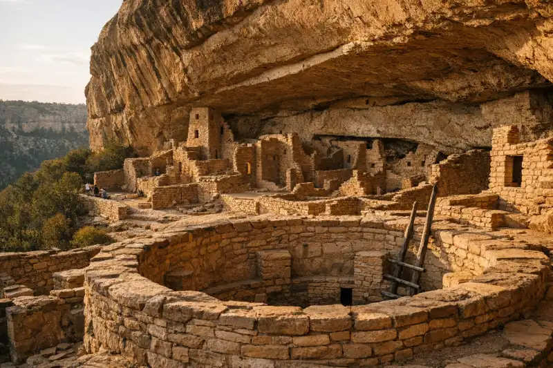
Mesa Verde
Ancestral PuebloExplore Mesa Verde in the United States, home to spectacular Ancestral Pueblo cliff dwellings, mesa-...
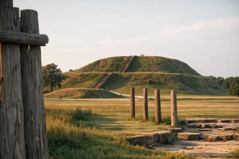
Cahokia Mounds
Cahokia Mounds in the United States preserves the largest pre-Columbian archaeological site north of...
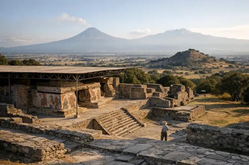
Cacaxtla
Olmeca-Xicalanca and broader Epiclassic Mesoamerican traditionsExplore Cacaxtla in Mexico, a hilltop archaeological site famed for vivid murals and Epiclassic hist...