Quick Info
Curated Experiences
Hadrian's Wall and Roman Britain Day Tour
Private Hadrian's Wall Forts and Landscape Tour
Northumberland Tour Including Hadrian's Wall
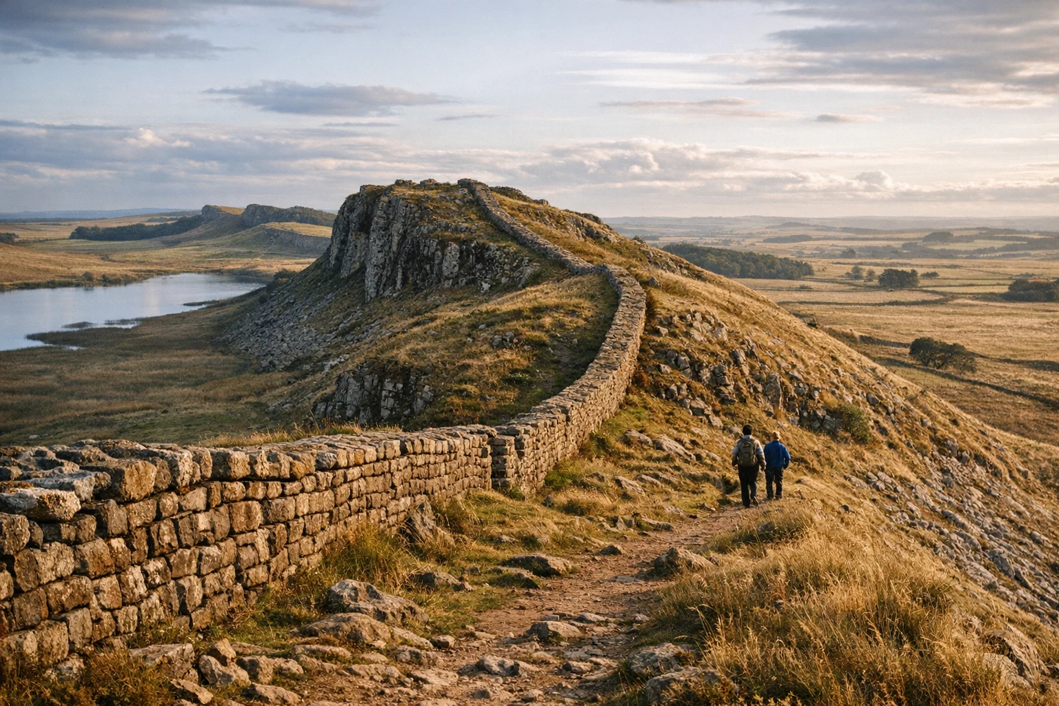
Hadrian’s Wall in the United Kingdom is one of those rare ancient sites that feels bigger than any single ruin. Stretching across northern England from coast to coast, the frontier line runs through cities, farms, open moorland, and some of the most memorable upland scenery in the country. In some places it survives as a rugged ribbon of stone climbing ridges and dipping into saddles; in others it is visible only as earthworks, road lines, ditch systems, or the locations of forts that once anchored the Roman edge of empire. That variation is part of its power. Hadrian’s Wall is not a self-contained monument waiting at the end of a gate and ticket line. It is a landscape of military planning, imperial ambition, and centuries of reuse, spread across real weather, real distance, and real ground.
What makes it unforgettable is the way history and terrain work together. The wall is often imagined as a simple barrier, but on the ground it becomes something much more complex: a frontier system of forts, milecastles, turrets, roads, supply lines, gates, and communities, all positioned with extraordinary sensitivity to ridges, visibility, and movement. Here Rome did not just build in Britain; it organized space on a continental scale. And yet the site never feels abstract. You can walk along surviving masonry, stand in fort gateways, look through barrack blocks, and watch clouds move over the same hills that Roman soldiers once scanned. Hadrian’s Wall is one of the best places in Europe to feel how empire operated not only through armies and laws, but through the hard practical business of putting stone, men, roads, and ritual authority into a living landscape.
History
Hadrian and the Imperial Frontier
Construction of Hadrian’s Wall began in 122 CE during the reign of Emperor Hadrian, whose rule was marked by consolidation, inspection, and a preference for securing imperial frontiers rather than endlessly expanding them. In Roman Britain, that meant creating a monumental frontier line across the narrowest practical width of northern England. The project was enormous. It ran roughly from the River Tyne in the east to the Solway Firth in the west, combining stone walling in some sections with turf construction in others, plus a ditch, a large earthwork known as the Vallum, forts, milecastles, and regularly spaced turrets. The result was not merely a wall in the ordinary sense. It was an integrated frontier system.
Why Rome built it has long been debated, but the answer was almost certainly not a single purpose. Defence mattered, of course, but so did control, taxation, surveillance, prestige, and the symbolic expression of Roman order. Hadrian’s Wall defined a line in the landscape where movement could be observed and managed. It communicated power to the peoples beyond it and to the imperial subjects within it. It was both practical and theatrical, a functioning military instrument and a statement that Rome could mark the edge of its world in stone.
Soldiers, Forts, and Life on the Edge
Once completed and adjusted over time, the wall became home to a complex military world. Garrisons stationed along the frontier were not exclusively Italian Romans but auxiliary troops recruited from across the empire, including men from places like Batavia, Gaul, Syria, and elsewhere. This cosmopolitan character is one of the most fascinating aspects of Hadrian’s Wall. Roman Britain was not culturally isolated. It was connected to a huge imperial network, and the people who lived and served here brought languages, beliefs, and habits from far beyond the island.
The forts were the real engines of frontier life. Sites such as Housesteads, Chesters, Birdoswald, and others functioned as bases for troops, storage, command, and administration. Around them grew civilian settlements, often called vici, where traders, families, craftspeople, and unofficial communities developed. The frontier was therefore not an empty military strip. It was a social landscape. Religion flourished too, with altars, shrines, and inscriptions showing devotion to Roman gods, local deities, and imported cults. Hadrian’s Wall was an imperial edge, but not a dead one. It was active, populated, and surprisingly diverse.
Change, Reorganization, and Decline
The frontier did not remain static. Later emperors modified the system, and the northern strategy of Roman Britain shifted more than once. Antoninus Pius briefly pushed the official frontier farther north with the construction of the Antonine Wall in Scotland, but Hadrian’s Wall eventually resumed its role as the primary northern boundary. Over the 3rd and 4th centuries, forts were rebuilt, garrisons adjusted, and the wall continued to function within a changing imperial world shaped by military pressure, internal instability, and administrative reform.
By the late Roman period, frontier life was evolving under growing strain. Yet the wall was not simply abandoned overnight. Military presence lingered, structures were adapted, and some communities continued after formal imperial systems weakened. The end of Roman rule in Britain in the early 5th century did not erase the frontier from the landscape. It remained physically present, even as its political framework dissolved.
After Rome: Reuse, Loss, and Rediscovery
In the centuries after Rome, Hadrian’s Wall entered a long and varied afterlife. Stone was quarried from it for churches, castles, farm buildings, and roads. Earthworks softened, and many sections vanished into the working countryside. Medieval and early modern people often knew the wall was ancient, but their uses for it were practical rather than archaeological. This reuse explains why some stretches survive dramatically while others exist only as lines, mounds, or ghosted traces.
Modern interest in Roman Britain gradually changed that. Antiquarians, archaeologists, landowners, and preservationists began documenting and protecting surviving sections, especially from the 18th century onward. In the 19th century, figures like John Clayton played a major role in conserving parts of the central wall. Archaeological excavation then transformed understanding of the frontier from a romantic ruin into a highly structured military landscape. Today Hadrian’s Wall is recognized as part of the Frontiers of the Roman Empire World Heritage framework, a reminder that this British landscape belonged to a continental imperial system of extraordinary scale.
Key Features
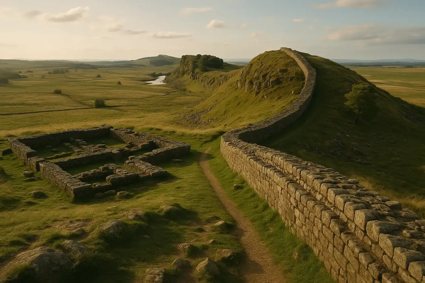
The most famous feature of Hadrian’s Wall is the surviving central stone section that rides the Whin Sill escarpment through dramatic country around Housesteads, Steel Rigg, and the high crags of Northumberland. This is the postcard wall: a jagged line of Roman masonry following the contours of the hills with such precision that it seems almost grown from the rock. Walking this stretch gives visitors the clearest visual sense of the wall as both engineering and topographical intelligence. The builders chose commanding ground not only for defence but for psychological effect. The frontier here feels monumental because landscape and structure reinforce one another.
The forts are equally essential. Housesteads is among the best known because of its striking position and relatively clear internal plan, including barracks, granaries, and the communal latrine system that makes Roman daily life suddenly concrete. Chesters is different, famous for its bathhouse and cavalry associations, while Birdoswald helps explain the broader line of the frontier and later reuse. No single fort tells the whole story, which is why Hadrian’s Wall works best when experienced as a network. Each site reveals a different aspect of military life, logistics, and adaptation.
Another defining feature is the milecastle-and-turret system. These smaller installations, placed at regular intervals, show that the wall was designed for controlled movement rather than simple exclusion. Gates allowed passage under supervision, and watch points maintained surveillance along the frontier. This turns the monument from a simplistic barrier into a managed border regime. It was not built to stop all movement. It was built to regulate it.
The Vallum is often overlooked but deeply important. Running south of the wall in much of the central sector, this great earthwork with banks and ditch seems to have marked and controlled the military zone behind the frontier. Its exact purpose is still discussed, but on the ground it reveals that the wall was part of a much broader spatial system. You are not looking at one line. You are looking at a corridor of authority.
Vindolanda, though technically just south of the wall and not part of the wall structure itself, is one of the richest companion sites for any serious visit. Its excavations have produced writing tablets, shoes, tools, and astonishing evidence for life on the frontier. Combined with the wall itself, it gives the whole landscape emotional texture. Suddenly the frontier is not just strategic. It is personal, filled with letters, supply lists, requests for socks, and glimpses of ordinary human life at the edge of empire.
Getting There
Hadrian’s Wall stretches across a large area, so the best access depends on which section you want to see. Most visitors base themselves in Newcastle upon Tyne, Carlisle, Hexham, or nearby Northumberland towns and then travel by car, guided tour, or a mix of train and local bus. A car gives the most flexibility, especially if you want to combine forts, museums, and scenic walking sections in one day. Driving from Newcastle to central wall sites like Housesteads or Steel Rigg typically takes around 1 to 1.5 hours depending on the exact destination.
Public transport is possible and can work well with planning. Trains connect major towns such as Newcastle, Hexham, and Carlisle, and seasonal or regional bus services help connect some wall attractions. The AD122 bus route is especially useful in the main visitor season because it links several key sites along the central section. Tickets and fares vary, but this is one of the best non-car ways to explore the frontier. Guided day tours from Newcastle and other northern cities are also widely available and often make sense for first-time visitors.
Because the site is dispersed, it helps to choose a focus rather than trying to see everything at once. Comfortable walking shoes, waterproof layers, and a realistic sense of distance matter more here than at many single-site heritage stops. Hadrian’s Wall is as much a walking landscape as a monument destination.
When to Visit
The best time to visit Hadrian’s Wall is usually from late spring through early autumn, when daylight is long, transport links are more convenient, and walking conditions are generally better. May, June, September, and early October are especially good because the weather can be milder than peak summer while the hills remain green and the views wide. These months also make it easier to combine archaeological visits with longer trail walks.
Summer is popular for obvious reasons: longer days, more open facilities, and the fullest bus and visitor-service schedules. But it can also bring more walkers and more competition for parking at central sites. Even in summer, the weather can change rapidly. Wind, mist, rain, and sudden sun are all normal parts of the wall experience. That unpredictability is not a flaw. It is part of what makes the frontier feel real.
Winter visits can be hauntingly beautiful, especially if you want mood and emptier landscapes, but conditions are tougher. Mud, shorter days, cold wind, and occasional snow or ice can make ridge walks more demanding. If you visit then, plan carefully and prioritize selected forts or easier sections. Whatever the season, early morning or later afternoon often brings the best atmosphere, when the wall’s stone and earthworks sit more quietly in the landscape and the modern world falls back a little.
| Quick Facts | Details |
|---|---|
| Location | Northern England, United Kingdom |
| Best Known For | Rome’s great northern frontier in Britain |
| Main Period | Begun in 122 CE under Emperor Hadrian |
| Original Length | About 117 kilometers or 73 modern miles |
| UNESCO Status | Part of the Frontiers of the Roman Empire World Heritage Site |
| Signature Sites | Housesteads, Chesters, Birdoswald, Vindolanda, Steel Rigg |
| Recommended Visit Length | 1 full day minimum, multiple days ideal for walkers |
| Best Season | Late spring to early autumn |
| Best Way to Explore | By car, guided tour, or a mix of trail walking and the AD122 bus |
| Practical Tip | Pick one section or cluster of forts instead of trying to “do the whole wall” in a single rushed outing |
Frequently Asked Questions
What is Hadrian's Wall best known for?
Hadrian's Wall is best known as Rome’s great northern frontier in Britain, with forts, milecastles, barracks, roads, and dramatic stretches of surviving wall across northern England.
How long is Hadrian's Wall?
The wall originally ran for about 73 Roman miles, roughly 117 kilometers or 73 modern miles, from the River Tyne to the Solway Firth.
Can you walk Hadrian's Wall?
Yes. Many travelers walk short scenic sections, while others tackle the full Hadrian’s Wall Path National Trail over several days.
Which part of Hadrian's Wall is best to visit?
The central section around Housesteads, Steel Rigg, and Sycamore Gap country has some of the most dramatic scenery, while sites like Chesters and Vindolanda add richer archaeological context.
How much time should you spend at Hadrian's Wall?
Most visitors should allow at least a full day for one or two forts and a scenic walk, while history lovers may want two or more days to explore the frontier properly.
When is the best time to visit Hadrian's Wall?
Late spring to early autumn is usually best for walking and visibility, though the wall can be rewarding year-round if you are prepared for fast-changing weather.
Nearby Ancient Sites
Hadrian's Wall Travel Guide 2026: Best Sections, Roman History, and Practical Planning
Roman BritainPlan a UK frontier-heritage day at Hadrian's Wall with clear section priorities, practical one-day r...
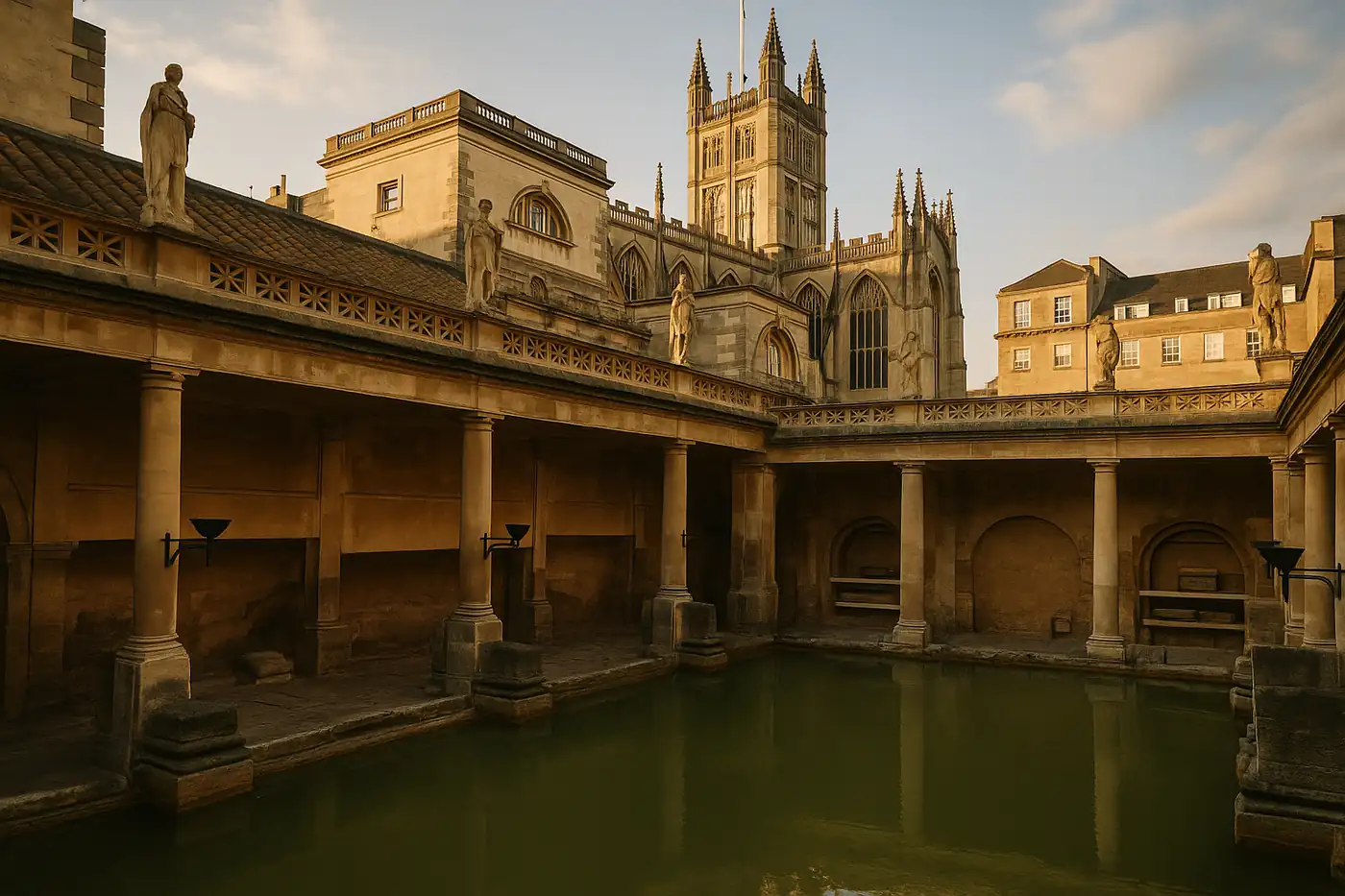
Roman Baths Bath Travel Guide 2026: Tickets, History, and Smart Visit Tips
Roman BritainPlan a better visit to the Roman Baths in Bath with clear ticket strategy, historical context, and p...
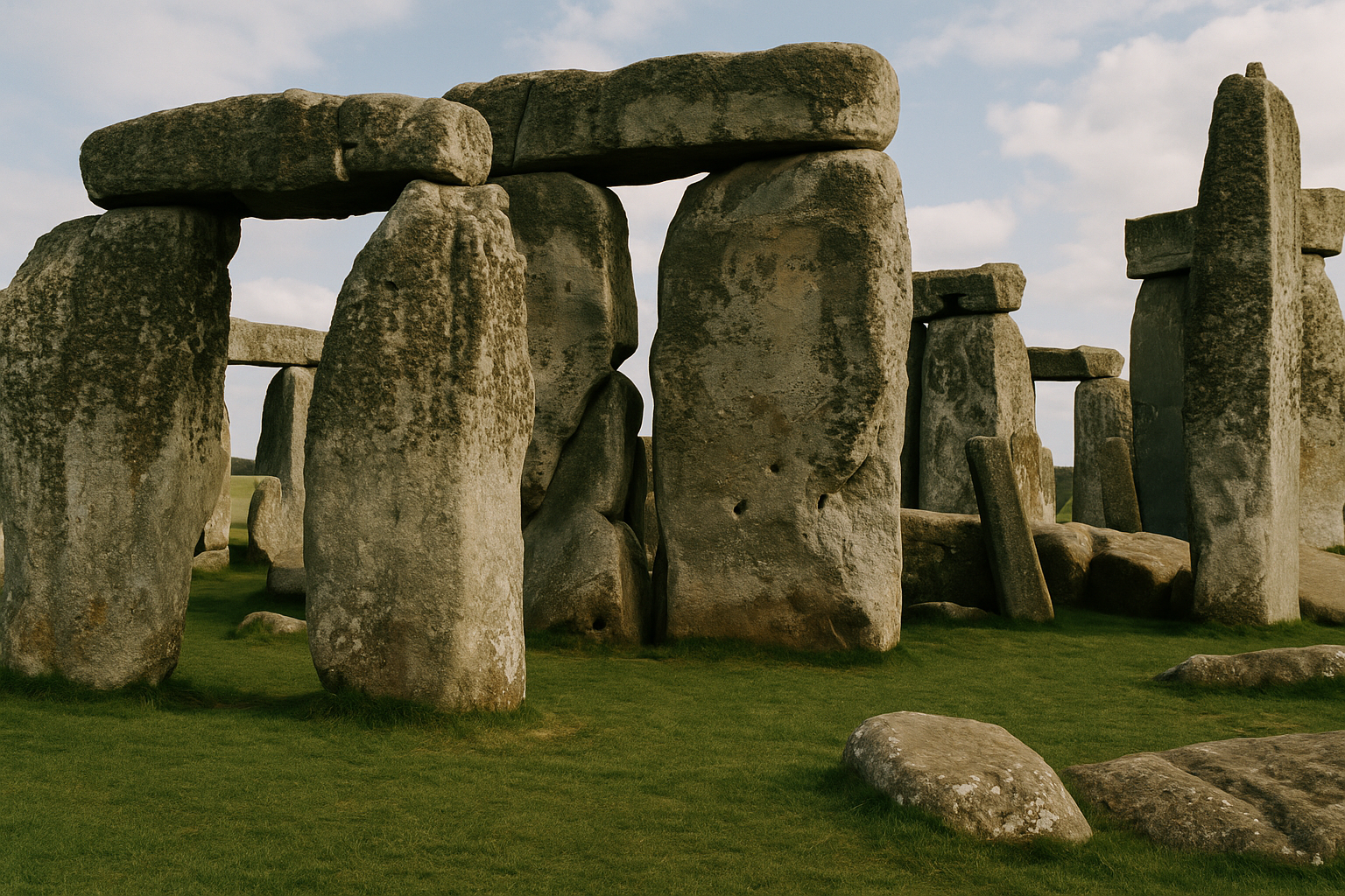
Stonehenge Travel Guide 2026: Solstice History, Tickets, and Day-Trip Planning
Neolithic and Bronze Age BritainPlan a smooth visit to Stonehenge with practical ticket timing, transport options from London and Ba...
Sutton Hoo Travel Guide 2026: Anglo-Saxon Burial Site, Museum Highlights, and Suffolk Planning Tips
Anglo-Saxon Kingdom of East AngliaPlan your Sutton Hoo visit with practical museum advice, burial mound context, and itinerary tips fo...