Quick Info
Curated Experiences
Huanuco Highlands Archaeology Day: Huanuco Pampa and Inca Road
Private Huanuco Viejo Cultural Circuit
Andean Imperial Routes: Huanuco Pampa and Kotosh
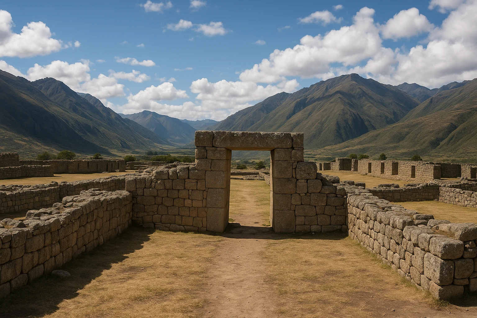
At Huanuco Pampa in Peru, the first thing that unsettles you is scale. The wind crosses a plaza so large it feels less like a ruin and more like a political statement in stone and sky. There is no jungle spectacle or single postcard wall. Instead, you stand inside an imperial design: movement, storage, ceremony, and control laid out across a high Andean plateau around 3,600 meters. This was one of the major provincial centers of the Inca state, positioned on the Qhapaq Nan to project authority far from Cusco.
Ancient Travels recommends Huanuco Pampa because it reveals how the Inca governed, not just how they built beauty. You see a geometric plaza for mass assembly, an ushnu for official ritual, long halls for state functions, and sectors that supported logistics at scale. This guide covers the site’s history, key monuments, transport from Huanuco, seasonal timing, and realistic itinerary planning.
History: The Inca State on the High Plateau
Before the Inca: regional highland societies (before c. 1450 CE)
Long before imperial planners arrived, the Huanuco highlands were part of a culturally active Andean world shaped by local communities, inter-valley exchange, and older regional traditions often associated with groups such as the Yarowilca. These societies managed elevation, water, and seasonal movement through local political systems that were already sophisticated in their own right. The plateau where Huanuco Pampa later emerged was not empty land awaiting history; it was a strategic landscape with routes, memory, and labor potential. That context matters because Inca expansion succeeded not by inventing administration from nothing, but by absorbing and restructuring existing social terrains.
Imperial foundation under late Inca expansion (c. 1470-1490 CE)
Huanuco Pampa appears to have been founded during the later 15th century, likely under rulers in the line of Tupac Inca Yupanqui, when the empire was consolidating and extending control across large portions of the central Andes. Its location on a major branch of the Qhapaq Nan was intentional. From here, the state could stage military movement, collect and redistribute resources, host ritual gatherings, and project authority into neighboring regions. Unlike ceremonial-only centers, Huanuco Pampa was planned as a multifunctional node: bureaucratic, logistical, and symbolic. The enormous central plaza was not wasted space; it was the theater where imperial order became visible to subject populations and local elites.
Huanuco Pampa at its peak: administration, ritual, and storage (late 15th-early 16th century)
At full operation, Huanuco Pampa likely coordinated labor levies, storage systems, elite receptions, and state festivals linked to the Inca calendar and political cycle. The site’s architecture reflects this layered purpose. The ushnu platform anchored formal ceremony and state ritual, while kallanka halls and adjacent compounds supported gatherings, officials, and traveling contingents. Inca governance depended on movement and provisioning as much as monumental symbolism, and centers like this made that possible between Cusco and more distant zones.
Archaeological evidence suggests dense planning rather than ad hoc growth, with sectors arranged around circulation logic and social hierarchy. That built order was political language. People arriving here would immediately read imperial power in geometry, scale, and controlled access.
Colonial rupture and changing landscape use (16th-19th centuries)
The Spanish invasion and colonial restructuring fractured the state systems Huanuco Pampa had served. As Inca administrative networks dissolved, many provincial centers were abandoned, partially reused, or reduced to local memory landscapes. Huanuco Pampa did not vanish overnight, but its role as an active imperial node ended quickly once tribute routes, labor obligations, and official rituals were redirected under colonial authority. Stone and infrastructure from former state centers were sometimes repurposed in nearby settlements, and over centuries weather, grazing, and erosion reworked what remained visible. By the republican period, the site endured more as a vast archaeological footprint than a continuously inhabited urban core.
Modern archaeology and conservation (20th century-present)
Systematic study in the twentieth century identified Huanuco Pampa as one of the most important surviving examples of Inca provincial planning. Mapping, excavation, and comparative analysis have clarified the function of its plaza, ushnu, halls, and peripheral sectors, while research on the Qhapaq Nan has reframed the site as part of a continental infrastructure system rather than an isolated ruin. Conservation remains an ongoing challenge because of altitude, climate exposure, and the sheer scale of the complex. Today, Huanuco Pampa is invaluable for travelers and researchers alike: it lets you see the administrative DNA of the Inca world in a form that is still legible on the ground.
The Key Monuments: What to See at Huanuco Pampa
The great imperial plaza
The defining feature of Huanuco Pampa is its enormous central plaza, one of the largest open civic-ceremonial spaces associated with Inca provincial architecture. Standing here resets your sense of proportion. This was not designed for intimate ritual; it was designed for assembly, visibility, and governance at scale. Officials could receive delegations, stage announcements, and anchor political choreography in a setting that made hierarchy physically obvious. The plaza’s dimensions and openness also suggest practical flexibility for moving people, goods, and ceremonial processions.
What survives today is less about vertical grandeur than horizontal command. The emptiness is the message. By refusing architectural clutter at the center, planners preserved long sight lines and directional authority toward the ushnu and surrounding compounds. For photography, shoot from slightly elevated edges in early or late light to capture the plaza’s geometry against distant ridges.
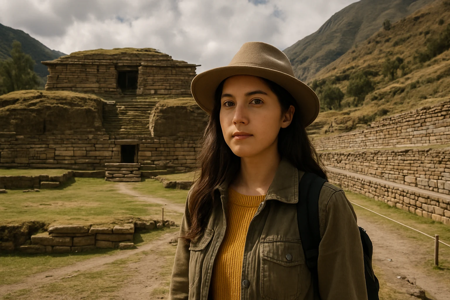
The ushnu ceremonial platform
Near the heart of the site, the ushnu functioned as a raised ceremonial and political platform associated with official rites, offerings, and staged expressions of authority. In many Inca centers, ushnus linked local territory to imperial cosmology: ceremony performed on a raised, formalized point that materialized the state’s claim over landscape and people. At Huanuco Pampa, the relationship between ushnu and plaza makes this especially clear. The platform did not stand alone as a shrine; it worked within a larger civic script.
Archaeologists have interpreted such structures as venues for ritualized governance, where officials, emissaries, and local leaders participated in events that were both sacred and administrative. When you stand at or near the platform, imagine audiences across the plaza and processions moving toward this focal point. The site reads best when you think in terms of performance and protocol, not only architecture.
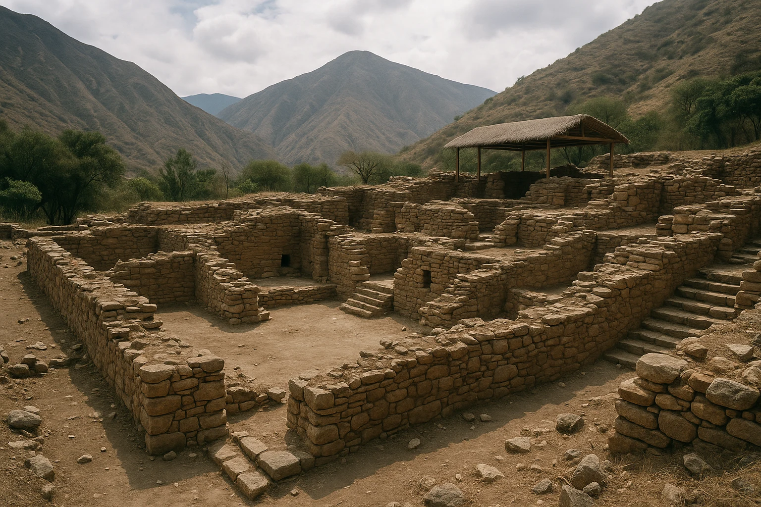
Kallanka halls and formal gathering architecture
Huanuco Pampa includes substantial kallanka-type halls, long rectangular buildings commonly associated with state hospitality, military lodging, labor organization, and ceremonial events. These structures illustrate how Inca power depended on infrastructure that could host people in motion: officials, craft specialists, porters, and regional delegates traveling the high roads. Their scale and placement around major circulation zones suggest planned flows rather than spontaneous occupation.
Even in ruined condition, you can trace walls, alignments, and thresholds that reveal controlled entry and multipurpose use. Kallankas were architectural workhorses of empire, less glamorous than temples but absolutely central to how the state functioned. Spend time here after the plaza and ushnu to understand Huanuco Pampa as a complete system. A useful photo angle is along wall lines at oblique perspective, where length and orientation become obvious.
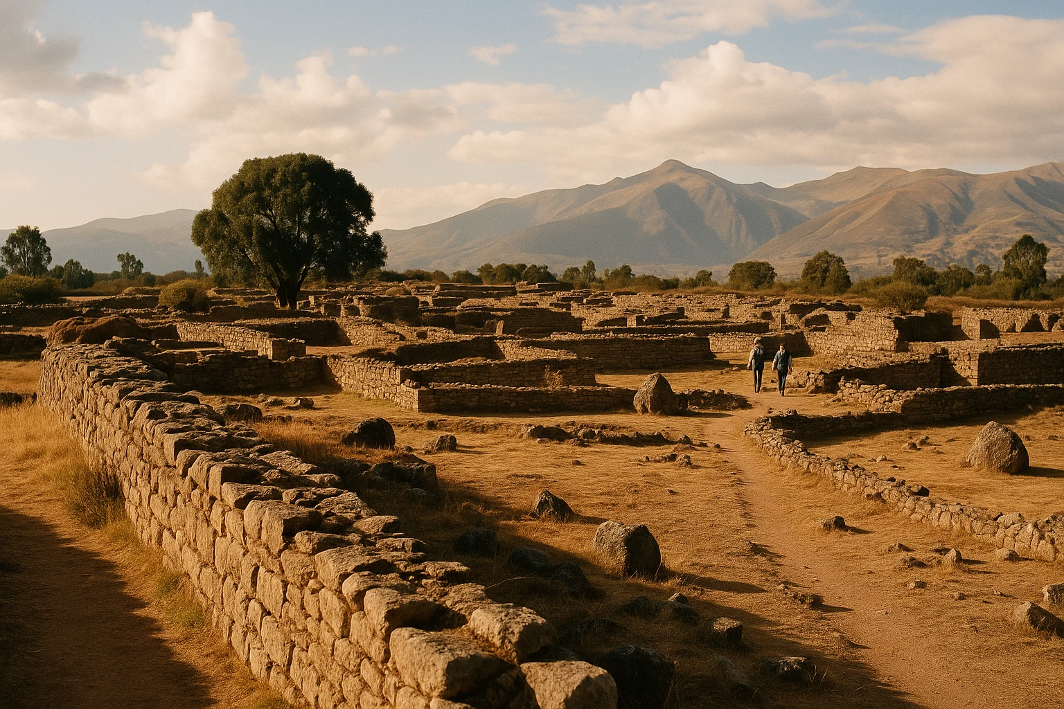
Residential-administrative compounds
Around the core monumental space, groups of smaller compounds likely supported administrative staff, specialized labor, and state-linked residential functions. These zones are crucial because they show that Huanuco Pampa was not merely a ceremonial stop. It had a working social ecosystem: storage management, accounting practices tied to labor and goods, and daily routines that made periodic grand events possible.
The masonry here can look modest compared with better-known Inca royal sites, but the planning logic is unmistakable. You see repeated modules, bounded spaces, and relationships to circulation routes that imply governance by design. For travelers, these sectors are where the city becomes human scale. Walk slowly and notice how quickly movement channels between open and controlled spaces.
Storage sectors and logistical landscape
A less visible but critical dimension of Huanuco Pampa is its role in Inca storage and redistribution systems often associated with qullqa networks. Not every storehouse is clearly preserved at the core, but the site’s size and location on major routes make logistical purpose unmistakable. The empire needed stockpiles of food, textiles, and tools to manage seasonal risk, labor movement, and state ceremony.
Huanuco Pampa is best read as a high-altitude operations hub where roads, labor, storage, and ritual authority converged.
The wider Qhapaq Nan context
The final “monument” is the network itself. Huanuco Pampa makes the most sense when viewed as part of the Qhapaq Nan, the vast Andean road system that stitched together territories from Ecuador to Chile and Argentina. Roads were state power in motion: they carried officials, armies, messages, tax labor, and ceremony. A center this large on a major route was never accidental. It was a node in a continental strategy.
Before leaving, take a few minutes to look outward from the site edges rather than inward at walls. The surrounding plateau and route corridors are part of the archaeology. Huanuco Pampa is architecture plus movement landscape, and you need both to understand it.
Getting There: Transportation and Access
Huanuco Pampa is remote but entirely reachable with planning, usually as a full-day highland journey from Huanuco city.
From Huanuco city
Most travelers depart early, often around 5:30 to 7:00 AM, because drive times are long and weather can shift in late afternoon.
- Private driver/taxi for the day: Typically S/450-S/900 ($120-$240 USD) depending on vehicle, route, wait time, and season.
- Organized archaeology tour: Commonly S/260-S/520 ($70-$140 USD) per person with transport and guiding.
- Segmented public transport: Usually cheaper, often S/40-S/90 ($11-$24 USD) total, but slower and less predictable for same-day return.
- Rental car: Often $45-$90 USD per day plus fuel; practical only if you are comfortable with highland roads and navigation.
From Lima or Huaraz
If you are coming from outside Huanuco, overnight in Huanuco first; same-day long transfer plus site visit is usually exhausting.
- Lima to Huanuco, then day trip: Long-distance bus options often around S/80-S/180 ($21-$48 USD), then continue by private driver or tour.
- Huaraz to Huanuco region route: Feasible but long and variable by road condition; best as a multi-day overland plan, not a rushed out-and-back.
- Custom private transfer chain: Convenient but expensive, often justified only for small groups splitting costs.
Admission and hours
Entry policies can vary by local administration and event calendars, but visitors should generally expect a modest fee in the range of S/5-S/15 ($1.50-$4 USD), with occasional free-access days or reduced categories. Daytime visiting hours are typically in broad windows around 8:00 AM to 5:00 PM, though staffing and weather can affect on-site services. Carry cash in soles, snacks, and extra water because facilities are limited. Arriving before late morning gives you better light, steadier pacing at altitude, and a larger safety buffer for return travel.
Practical Information
Huanuco Pampa is exposed and high, so preparation matters. Bring 1.5 to 2 liters of water, sun protection, a warm layer, and a light rain shell. Wind and weather shifts are common even in dry months.
Wear shoes with grip for dust, uneven stones, and occasional muddy patches. Services are limited, so pack snacks. Mobile signal can be inconsistent, so confirm return transport and pickup time in advance.
Altitude is the main challenge: walk slowly on arrival, hydrate, and avoid intense effort for the first 20 to 30 minutes. Accessibility is limited by uneven ground and long distances, though private transport plus a shortened route can help.
When to Visit: Seasonal Considerations
Spring (September-November)
Spring often brings good shoulder-season conditions, with daytime ranges around 10-20°C (50-68°F). Grass can be greener after seasonal transitions, and crowd levels are usually moderate. Morning skies are often clearer than afternoon, which helps both photography and navigation. Bring a shell for occasional rain bursts.
Summer (December-March)
Summer is generally wetter in much of the central highlands, with typical temperatures around 11-21°C (52-70°F). Rain can soften roads and reduce visibility later in the day, making early departures essential. Crowds are variable but can increase around holiday periods. Waterproof layers and extra transit buffer are non-negotiable in this season.
Autumn (April-May)
Autumn is one of the strongest windows for Huanuco Pampa, often with stable weather around 9-20°C (48-68°F), improving road reliability, and manageable visitor numbers. Light quality can be excellent across the plaza, especially in late morning. If you want a balance of clarity, comfort, and logistics, autumn is a top choice.
Winter (June-August)
Winter is usually drier and clearer, with daytime temperatures often around 7-19°C (45-66°F) and cold early starts. Visibility is frequently excellent, making it ideal for reading site layout and shooting wide-angle photos. Dress in layers and protect against strong UV at altitude. For many travelers, winter mornings are the most reliable period overall.
Combining Huanuco Pampa with Huanuco Region Heritage
Because drive times are long, Huanuco Pampa works best as a focused full-day loop. Leave Huanuco by 6:00 AM and aim to arrive around 10:00 AM.
Start with the plaza and ushnu, then move through kallanka and administrative sectors by 11:30 AM. A solid circuit with interpretation stops takes about 2.5 to 3.5 hours. Around 1:30 PM, break for a packed lunch and a short perimeter walk.
Most travelers return to Huanuco between 6:00 and 8:00 PM, depending on weather and roads. If you have a second day, pair this with Kotosh separately rather than forcing both sites into one long push.
Why Huanuco Pampa Matters
Huanuco Pampa matters because it shows what empire looks like when you strip away postcard romance and study the machinery underneath. The Inca here are not only master stonemasons or mountain mystics. They are planners, logisticians, and political choreographers working at continental scale. In one highland complex, you can see how roads, ceremony, labor, and architecture fused into a durable governing system.
That perspective changes how you read the rest of Peru. Famous royal and sacred sites become part of a larger map of coordination, not isolated wonders. Huanuco Pampa is the connective tissue: a place where imperial intent was made legible to everyone who arrived, from local communities to state officials moving along the Qhapaq Nan. Stand in the middle of that great wind-cut plaza, and the silence is not empty at all. It is administrative, ceremonial, and deeply human time, still holding its line in the high Andes.
Quick Facts
| Attribute | Details |
|---|---|
| Location | Dos de Mayo Province, Huanuco Region, Peru |
| Ancient Name | Huanuco Pampa (also called Huanuco Viejo) |
| UNESCO Status | Part of the wider Qhapaq Nan cultural network context (site-level management varies) |
| Established | c. 1470 CE Inca administrative center |
| Distance from nearest hub | About 150-170 km from Huanuco (roughly 3.5-5 hours by road) |
| Entry Fee | Typically around S/5-S/15 ($1.50-$4 USD) |
| Hours | Usually daytime access, commonly around 8:00 AM-5:00 PM |
| Best Time | April-September, especially clear morning windows |
| Suggested Stay | 2.5-4 hours on site; full day from Huanuco with transit |
| Signature Highlight | Vast imperial plaza and ushnu platform on the Qhapaq Nan |
Explore More Peru
- Kotosh: Trace one of Peru’s earliest ceremonial traditions at the Temple of the Crossed Hands near Huanuco.
- Chavin de Huantar: Explore a foundational highland ritual center with galleries, carved iconography, and deep pre-Inca influence.
- Wari: See how a major pre-Inca state organized urban administration and regional power in the central Andes.
- Caral-Supe: Visit the oldest known urban civilization in the Americas and Peru’s deep archaeological beginning.
Plan your broader route with our Peru Ancient Sites Guide and prep highland logistics with our Peru altitude and overland planning guide.
Frequently Asked Questions
How much time should I plan at Huanuco Pampa?
Plan 2.5 to 4 hours on site for the main plaza, ushnu, kallanka zones, and a slower perimeter walk. If you like architecture and spatial planning, you can easily spend longer because the site is broad and exposed. Most visitors experience it as part of a full-day trip from Huanuco due to driving times.
What is the best time of year to visit Huanuco Pampa?
The driest and most reliable period is generally May through September, with clearer skies and easier road conditions. Shoulder months like April and October can also be excellent with fewer visitors. In the wetter season, bring waterproof layers and allow extra transit time.
How high is Huanuco Pampa, and should I worry about altitude?
Huanuco Pampa sits at high elevation, around 3,600 meters (about 11,800 feet), so altitude can affect even fit travelers. Hydrate well, pace your walking, and avoid sprinting across the plaza on arrival. If you are coming directly from lower elevations, consider an acclimatization day in Huanuco first.
How do I get to Huanuco Pampa from Huanuco city?
Most travelers go by private driver, organized tour, or hired taxi via La Union and nearby highland roads. Travel time is typically around 3.5 to 5 hours each way depending on route, weather, and roadworks. Public transport is possible in segments but usually slower and less convenient.
What are the main highlights at Huanuco Pampa?
The key highlights are the enormous imperial plaza, the ushnu ceremonial platform, long kallanka halls, and the broader layout that reveals how the Inca organized administration, ceremony, and storage. The scale of urban planning is the site's signature feature. It is one of the best places in Peru to understand the state logic behind the Qhapaq Nan road network.
Is Huanuco Pampa safe and suitable for independent travelers?
Yes, the site is generally safe, but it is remote and exposed, so logistics matter more than urban safety concerns. Bring food, water, sun protection, and layers because services on site are limited. Independent travelers should confirm return transport in advance and avoid late departures.
Nearby Ancient Sites
Kotosh Peru Guide 2026: Temple of the Crossed Hands & Mito Ritual
Late Preceramic-Kotosh-Mito-Early AndeanPlan your Kotosh, Peru visit to see the Temple of the Crossed Hands near Huanuco, with history, tran...
Chavin de Huantar Peru Guide 2026: Lanzon & Temple Galleries
Chavin-Highland Andean-Inca-Modern PeruvianPlan Chavin de Huantar, Peru: see the Lanzon and sunken plaza, reach the site from Huaraz, and time ...
Wari Peru Guide 2026: Ancient Capital & Museum Highlights
Huarpa-Wari-Inca-Spanish ColonialPlan a visit to Wari in Peru with history, key compounds, tickets, and transport from Ayacucho, plus...
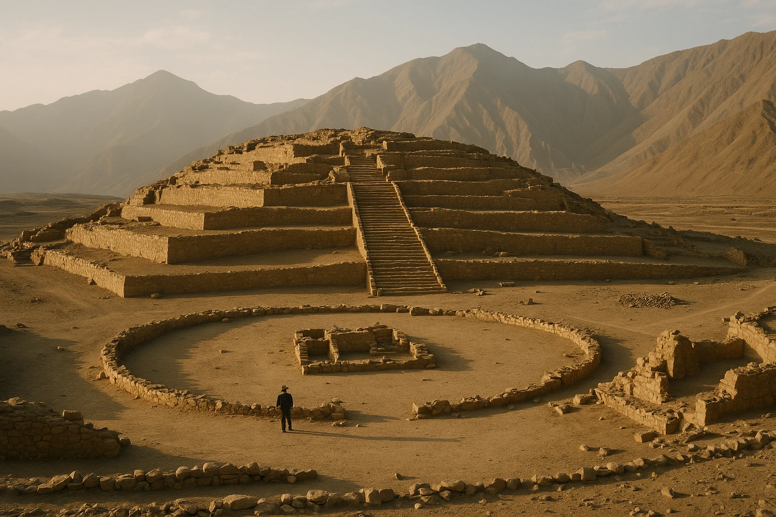
Caral-Supe Peru Guide 2026: Sacred Pyramids & the First Andean City
Norte-Chico-CaralVisit Caral-Supe in Peru, the oldest known city in the Americas, with practical transport from Lima,...