Quick Info
Curated Experiences
Private Full-Day Tour to Huamachuco and Marcahuamachuco from Trujillo
Andean Archaeology Day Trip: Marcahuamachuco and Wiracochapampa
Northern Peru Highlands Heritage Tour from Trujillo
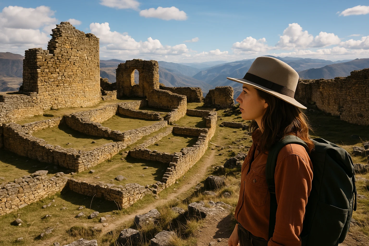
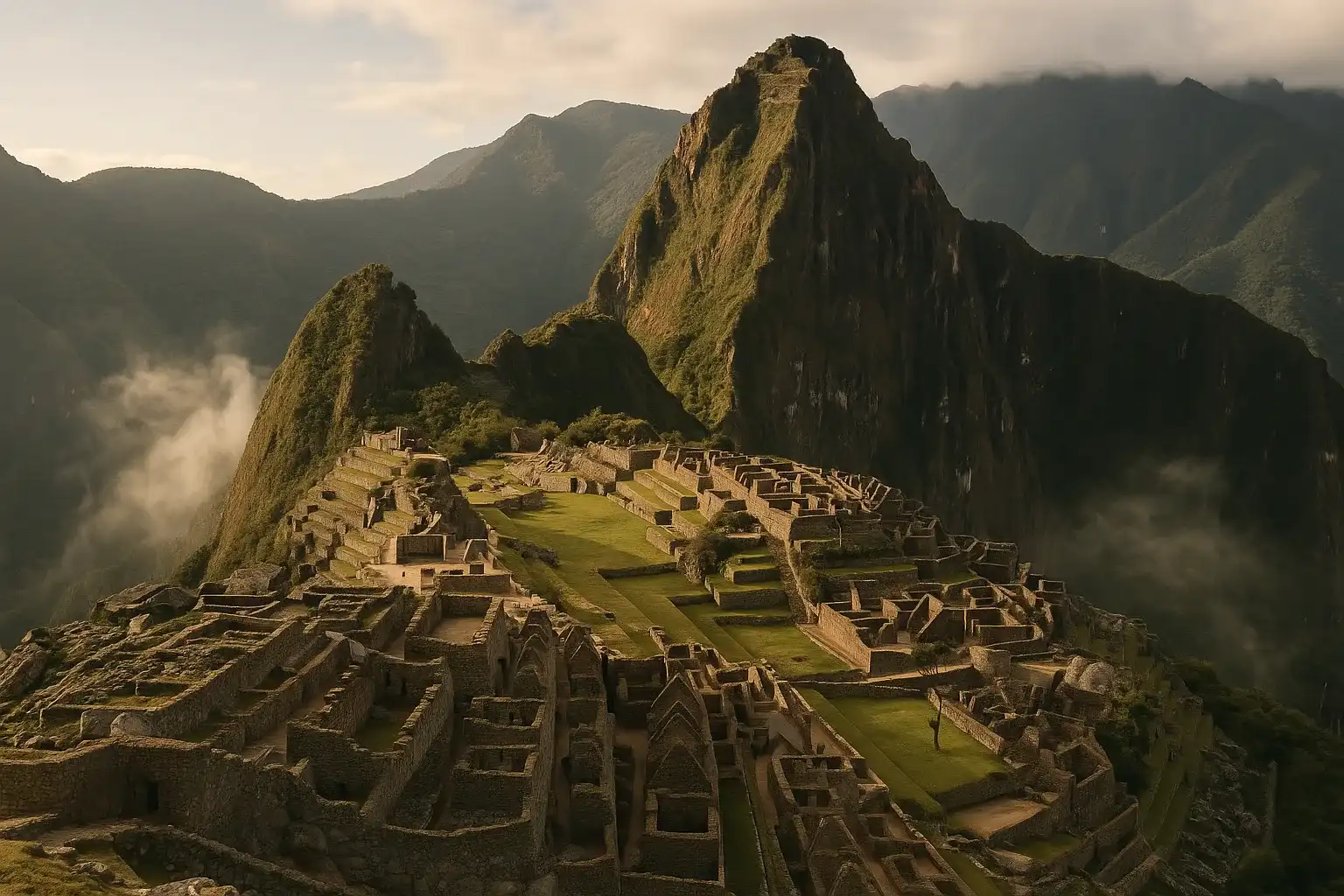
The first thing you notice at Marcahuamachuco, Peru is scale. The second is silence. On a high plateau above Huamachuco, long stone walls run across the grass like the outlines of a lost city drawn against the sky, with ravines dropping away on either side. It does not feel like a polished archaeological park. It feels older, rougher, and somehow closer to the original pulse of Andean life: a place of power, defense, ceremony, and regional identity that mattered for centuries before the Spanish colonial era rewired the northern Peruvian highlands. For travelers who want more than postcard ruins, Marcahuamachuco is one of the most compelling ancient sites in the country.
Ancient Travels recommends Marcahuamachuco as a serious anchor destination for northern Peru, especially if you are interested in the world beyond Inca imperial centers. This guide walks you through the site’s layered history, the major sectors and walls worth prioritizing, transport logistics from Huamachuco and Trujillo, practical entry advice, and seasonal planning. You will also find a realistic way to combine Marcahuamachuco with nearby archaeology in a single day, plus a clear quick-facts summary at the end to help you plan efficiently.
History: A Highland Power Before and Beyond Empire
Early highland foundations (c. 400-800 CE)
Archaeological evidence suggests Marcahuamachuco developed as a major regional center during the Early Intermediate to Middle Horizon transition, when highland societies in northern Peru were consolidating power. Its plateau location was not accidental: commanding views, defensive edges, and enough space for monumental enclosures made it ideal for a polity that needed authority and protection in equal measure. Rather than a single palace-city model, the site appears to have grown as a complex of elite compounds and ceremonial sectors tied to surrounding settlements. Even in this early phase, its builders invested heavily in labor-intensive stone architecture, signaling organized leadership and wide territorial influence.
Regional florescence and ceremonial authority (c. 800-1100 CE)
By the Middle Horizon, Marcahuamachuco likely reached its height as a prestigious highland center linked to trade, ritual, and political negotiation. Scholars connect portions of the site’s trajectory to interactions with broader Andean currents, including the expanding Wari sphere, though local dynamics remained distinct. Massive perimeter walls and enclosed compounds suggest controlled access and socially differentiated space, where public ritual and elite gatherings reinforced hierarchy. This was not simply a fortress on a hill. It functioned as a symbolic landscape where architecture itself projected permanence, legitimacy, and spiritual authority over valleys and routes below.
Late pre-Hispanic transitions (c. 1100-1532 CE)
As regional power structures shifted in the Late Intermediate Period, Marcahuamachuco continued to matter, though possibly with changing intensity and function. Some sectors seem to have been reused, modified, or partially abandoned over time, reflecting a long-lived site adapting to new political realities. By the late pre-Hispanic centuries, influence from expanding states, including the Inca Empire, reached much of the northern highlands. Marcahuamachuco appears to have been incorporated into broader networks rather than erased, with strategic and ceremonial value still recognized in a transformed world. The site’s layered construction and reuse patterns are part of what makes it so archaeologically rich.
Colonial rupture and local memory (16th-19th centuries)
The Spanish conquest and colonial order redirected settlement, labor, and sacred geography across the Andes. Like many major pre-Hispanic centers, Marcahuamachuco lost its former institutional role as population and authority concentrated in colonial towns and church-centered systems. Yet it never disappeared from local awareness. Residents of the Huamachuco region preserved place memory through oral tradition, agricultural routes, and continued familiarity with the plateau. Long before modern heritage branding, these ruins remained part of a lived landscape, known as meaningful terrain rather than forgotten stone.
Modern rediscovery and archaeology (19th century to present)
Systematic description by scholars and travelers accelerated in the 19th and 20th centuries, and subsequent archaeological campaigns began clarifying chronology, architecture, and regional significance. Contemporary research has focused on mapping major sectors, documenting construction techniques, and understanding how Marcahuamachuco fit into wider highland political ecologies. Conservation remains an active challenge: weather exposure, site scale, and limited resources complicate preservation. Even so, growing recognition of the site’s importance is pushing better protection and interpretation. Today, Marcahuamachuco stands as one of northern Peru’s most important pre-Hispanic archaeological landscapes, still revealing new details as fieldwork advances.
The Key Monuments: What to See at Marcahuamachuco
Cerro del Castillo sector
The Cerro del Castillo area is often the emotional center of a first visit because it combines mass, height, and views in one dramatic circuit. Here you will encounter thick stone walls and enclosed spaces that suggest restricted movement and formal activity rather than casual habitation. Construction in this zone demonstrates deliberate engineering: long stretches of masonry adapted to uneven bedrock, with elevated lines that maximize both defense and visibility. As you walk, pay attention to how passage narrows and then opens, creating spatial choreography that likely carried social meaning. Photography tip: arrive early and shoot oblique angles along the wall faces to emphasize scale and stone texture.
Las Monjas enclosures
Among the most discussed sectors are Las Monjas, a set of monumental enclosures whose shape and organization have fueled debate about function. While older interpretations leaned heavily toward a convent-like analogy (hence the colonial-era name), current scholarship favors more context-sensitive readings tied to elite, ceremonial, or administrative uses. The defining experience here is enclosure itself: high walls, compartmentalized interiors, and a feeling that activity was carefully structured and perhaps performed for selected audiences. You can sense a social gradient in the architecture, where not every space was equally accessible. Photography tip: mid-morning light helps reveal wall lines without flattening relief.
El Castillo and defensive edges
The El Castillo zone and adjacent plateau margins show why Marcahuamachuco is often described as both ceremonial and strategic. Natural ravines act as defensive barriers, while built walls reinforce vulnerable approaches. The effect is cumulative: geography and masonry work together to create a protected highland complex that could monitor movement across the surrounding region. Standing near these edges, you understand that this was never merely symbolic architecture. It was practical, territorial, and responsive to risk. Respect marked paths and wind conditions here; drop-offs can be severe. Photography tip: use a wider lens late in the day for dramatic sky-to-wall compositions.
Monumental wall corridors and interior compounds
Some of the most memorable moments at Marcahuamachuco come not from one named monument but from the long wall corridors linking sectors across the plateau. These linear features create perspective lines that pull you forward and reveal how extensive the site really is. Interior compounds vary in size and preservation, hinting at differentiated functions across time: gathering spaces, controlled-access areas, and possible residential or storage zones tied to elite management. Because the site is less crowded than Peru’s headline destinations, you can pause and read masonry details in quiet. Look for subtle shifts in stonework that may reflect phased construction.
Panoramic viewpoints and the wider landscape
Marcahuamachuco’s final monument is the landscape itself. The plateau’s viewpoints frame valleys, ridges, and routes that explain why this center commanded regional attention. Ancient architecture and topography are inseparable here; each wall line seems to answer the land’s contours. For travelers, these viewpoints also provide narrative closure: after walking through enclosed sectors, you step out to horizons that connect ritual space, defensive logic, and long-distance movement in one glance. If weather is clear, stay for shifting afternoon light over the highlands. Photography tip: include a foreground wall segment to anchor scale against the vast terrain.
Getting There: Transportation and Access
Marcahuamachuco is reachable but not casual: the final approach is highland road travel, and your experience improves significantly with realistic timing.
From Huamachuco
Huamachuco is the practical base, and from town the site is usually a short road transfer followed by on-foot exploration across uneven ground.
- Taxi: Typically S/25-45 ($7-12 USD) one way depending on pickup point, wait time, and season; around 20-35 minutes.
- Colectivo/local transport: Limited and schedule-dependent, often S/8-15 ($2-4 USD), but may require extra walking and flexible timing.
- Rental car or hired driver: Best for control if you plan to combine sites; verify road condition locally before departure, especially in wet months.
From Trujillo
From Trujillo, most travelers go by long-distance road to Huamachuco, then continue to Marcahuamachuco by taxi or private transfer.
- Private car/driver: Most efficient same-day option; usually 6-8 hours one way depending on traffic and mountain road conditions.
- Interprovincial bus to Huamachuco + taxi onward: Budget-friendly but time-heavy; combined journey can exceed 8 hours one way.
- Organized tour: Simplifies logistics and interpretation, useful if you want a single-day archaeology-focused outing from Trujillo.
Admission and Hours
Entry policies can change, but most visitors should budget around S/10-15 ($3-4 USD) for admission, paid in cash. Card terminals are not consistently available, so carry small notes. Opening windows are commonly in the daytime range (roughly morning through late afternoon), with local holiday variations. Ask in Huamachuco for current same-day hours before departure. Aim to arrive early: cooler temperatures, steadier weather, and cleaner light make the site safer and more rewarding. If you are sensitive to altitude, walk slower than usual and build short rest breaks into your route.
When to Visit: Seasonal Considerations
Spring (September-November)
Spring is one of the strongest shoulder seasons, with many days in the 10-19°C (50-66°F) range and relatively comfortable hiking conditions. Crowds are usually light to moderate, and visibility can be excellent after clear nights. Wind still matters on exposed edges, so keep a wind layer handy. For most travelers, this is an ideal balance between temperature, access, and photography.
Summer (December-February)
Summer often brings warmer afternoons and greater rain risk in the highlands, commonly around 11-22°C (52-72°F) depending on cloud cover and elevation variation. Visitor numbers remain far below Peru’s marquee sites, but afternoon weather can shift quickly. Start early, carry rain protection, and expect occasional muddy patches on approach roads. Morning visits are strongly recommended.
Autumn (March-May)
Autumn can be excellent after peak rains, with many days around 9-20°C (48-68°F) and greener surrounding slopes. Trails and road shoulders may still show seasonal wear early in the period, so check local conditions in Huamachuco before you depart. Crowd levels are generally low, making this a great season for quiet, unhurried exploration and wide-angle landscape photography.
Winter (June-August)
Winter is often the clearest season, with brisk mornings and daytime temperatures commonly in the 7-18°C (45-64°F) range. Dry air and sharper light can make architectural details pop, and crowds are usually minimal outside school or holiday peaks. Layering is essential: mornings can feel cold, then warm quickly under direct sun. For many travelers focused on comfort and visibility, winter is the ideal season overall.
Combining Marcahuamachuco with Huamachuco and Nearby Archaeology
Marcahuamachuco works best as the centerpiece of a full highland day rather than an isolated stop, and the rhythm of your itinerary matters as much as the map. The most rewarding sequence begins with a departure from Huamachuco by 7:30 AM, reaching the site around 8:00 AM while the plateau is cool and wind is manageable. Spend the first two hours in the major enclosures and wall corridors, then use 10:30 AM to 11:00 AM for panoramic viewpoints before cloud buildup often increases.
By 11:30 AM, return toward Huamachuco for lunch around the central area; simple Andean menus are usually quick and hearty, which helps if you are continuing to a second archaeological stop. If conditions are good, continue by 1:00 PM toward Wiracochapampa, another important highland site associated with Wari-period expansion and administrative planning. This pairing gives you two complementary lenses on regional power: one monumental and topographically dramatic, one more formally planned in layout. You can be back in Huamachuco by late afternoon, usually around 5:00 PM to 6:00 PM, depending on road and weather.
If you are starting from Trujillo, treat this as an overnight highland circuit rather than forcing a rushed same-day sprint. The extra night makes altitude, pacing, and interpretation all better, and it leaves room for meaningful stops instead of windshield archaeology.
Practical Information
What to bring
- Sun and wind protection: UV is strong at altitude even on cool days; bring sunscreen, hat, and a windproof layer.
- Water: Carry at least 1.5 liters per person; on-site services can be limited or unavailable.
- Footwear: Use sturdy shoes with grip for uneven ground, loose stone, and short inclines.
- Camera or phone with backup battery: The site is expansive, and you’ll likely shoot more than expected.
- Cash in soles: Bring small denominations for entry, taxis, and basic purchases.
Dress code and etiquette
Marcahuamachuco is an archaeological landscape rather than an active ceremonial temple, but respectful behavior still matters. Avoid climbing unstable walls, do not remove stones or pottery fragments, and keep to established pathways where possible. If you are with local residents or guides, ask before photographing people, livestock, or private property during transit.
Accessibility
Accessibility is limited for travelers with mobility constraints. Terrain includes uneven surfaces, slopes, and sections without handrails or formal ramps. Some viewpoints and sectors are reachable with moderate effort, but a full circuit can be demanding. Travelers needing assistance should arrange a private vehicle and discuss route limits in advance with a local guide.
Why Marcahuamachuco Matters
Marcahuamachuco matters because it broadens the story most travelers think they know about ancient Peru. Here, history is not presented as a single imperial arc but as a highland continuum of local power, ceremonial authority, adaptation, and persistence. The walls do not just mark boundaries; they record decisions made by communities negotiating survival, belief, and prestige across centuries of change.
Standing on the plateau, you can feel the intelligence of the site plan: enclosures turned into statements, edges turned into defenses, distance turned into visibility. You also see how fragile this inheritance remains when monumental places sit outside the most visited circuits. Visiting Marcahuamachuco is more than checking off a ruin. It is an act of attention to a deeper Andean map, one where lesser-known centers still carry the weight of civilizational memory. Go early, walk slowly, and let the silence do part of the explaining.
Quick Facts
| Attribute | Details |
|---|---|
| Location | Plateau above Huamachuco, La Libertad, Peru |
| Ancient Name | Marcahuamachuco (regional highland center) |
| UNESCO Status | Not inscribed; nationally significant archaeological complex |
| Established | c. 400 CE fortified highland center |
| Distance from nearest hub | ~6 km from Huamachuco center (20-35 min by road) |
| Entry Fee | Typically S/10-15 ($3-4 USD), cash recommended |
| Hours | Daytime access, generally morning to late afternoon |
| Best Time | Dry-season mornings (June-August ideal) |
| Suggested Stay | 2.5-4 hours on site |
| Main Highlights | Las Monjas enclosures, wall corridors, panoramic defensive edges |
Explore More Peru
- Chan Chan: Explore the vast adobe capital of the Chimú Kingdom near Trujillo.
- Kuelap: Visit the fortified cloud-forest citadel of the Chachapoya in northern Peru.
- Caral-Supe: Discover one of the oldest urban civilizations in the Americas on Peru’s central coast.
- Machu Picchu: Experience the iconic Inca sanctuary in the Andes above the Urubamba Valley.
Plan your complete Peru journey with our Peru Ancient Sites Guide. For smarter route planning at altitude, read our Peru Highlands Travel Planning Guide.
Frequently Asked Questions
How much time should I plan at Marcahuamachuco?
Plan at least 2.5 to 3.5 hours on site if you want to walk beyond the main viewpoints and understand the major sectors. Serious history travelers often stay 4 hours to include slower walking at altitude and longer photo stops. If you are combining with Wiracochapampa in one day, start early and keep lunch in Huamachuco short.
What is the best time of day to visit Marcahuamachuco?
The best window is usually early morning through late morning, roughly 8:00 AM to 11:30 AM, when the light is crisp and cloud buildup is lower. Late afternoon can also be beautiful, but weather can shift quickly in the highlands. Bring layers because temperature and wind can change within an hour.
Is there an entry ticket for Marcahuamachuco?
Fees can vary by local administration period, but visitors generally pay a modest local-currency entrance at or near the control point, often around S/10-15 ($3-4 USD). Carry small cash notes since card payment is not reliably available. Confirm current pricing in Huamachuco before departure, especially on holidays.
How do I get to Marcahuamachuco from Trujillo?
Most travelers route through Huamachuco by road, then continue by taxi or local transport to the archaeological plateau. A private car from Trujillo is the fastest and most comfortable same-day option, while public buses are cheaper but much slower. Total one-way travel from Trujillo can run 6 to 8+ hours depending on road conditions.
What will I actually see at Marcahuamachuco?
You will see vast stone enclosures, curved and linear defensive walls, ceremonial sectors, and panoramic plateau edges that explain why this place was strategically important. The site feels less reconstructed than Peru's better-known destinations, which gives it a raw archaeological atmosphere. Interpretive signage is improving, but a guide adds major value.
Is Marcahuamachuco safe and suitable for most travelers?
Yes, it is generally safe for visitors, especially when you go with local transport providers or a guide from Huamachuco. The bigger challenge is altitude, uneven terrain, and sudden weather change rather than security. Wear proper shoes, keep water with you, and avoid cliff-edge selfies in high wind.
Nearby Ancient Sites
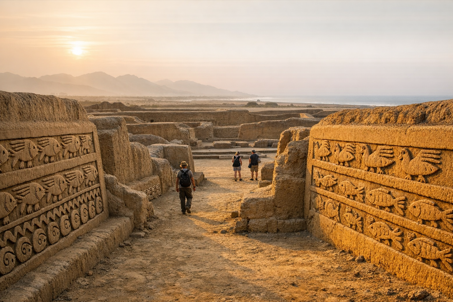
Chan Chan Peru Guide 2026: Chimu Capital & Adobe Citadels
ChimuExplore Chan Chan near Trujillo — the largest pre-Columbian city in the Americas. Discover the Chimu...
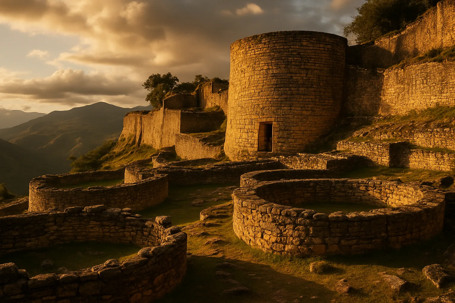
Kuelap Peru Guide 2026: Chachapoyas Cloud Fortress
ChachapoyasExplore Kuelap, the massive Chachapoyas cloud fortress in northern Peru. Reach it by cable car from ...
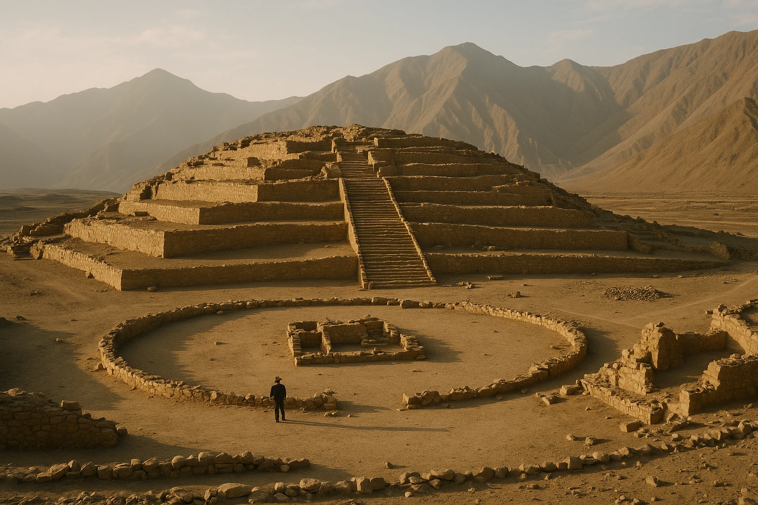
Caral-Supe Peru Guide 2026: Sacred Pyramids & the First Andean City
Norte-Chico-CaralVisit Caral-Supe in Peru, the oldest known city in the Americas, with practical transport from Lima,...
Machu Picchu Peru Travel Guide 2026: Circuits, Tickets & Entry Tips
Inca EmpireNavigate Machu Picchu's 2026 circuit system with our definitive guide. Learn how to choose your rout...