Quick Info
Curated Experiences
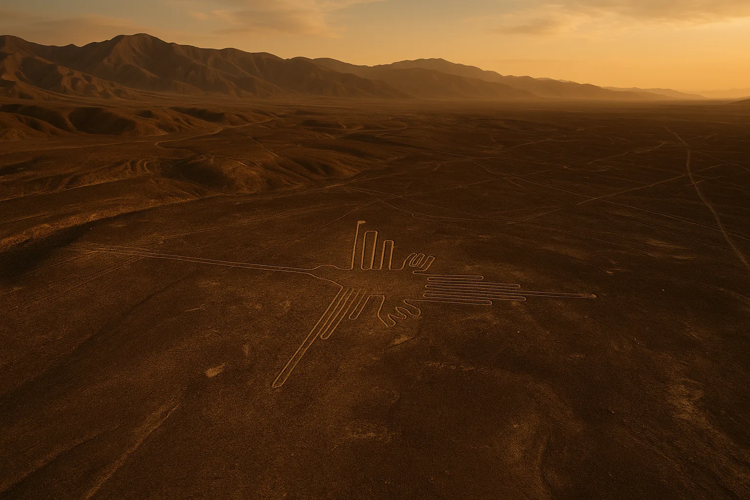
Nasca Lines Land Tour
From the window of a small Cessna banking low over the Peruvian desert, a perfect spider materializes in the ochre earth below — forty-six meters across, its eight legs rendered with a geometric precision that defies both the tools available to the Nazca people and the ground-level vantage point from which they worked. Moments later, a hummingbird appears: ninety-three meters of flowing line, beak to tail, etched into the pampa with a single unbroken stroke. Then the monkey, the condor, the whale — each figure emerging and retreating as the plane turns, visible only from the sky, created by a civilization that had no aircraft and left no written explanation. The Nazca Lines of southern Peru are one of the ancient world’s most baffling and beautiful achievements, a UNESCO World Heritage Site that has defied complete interpretation for nearly a century of modern scholarship.
The lines cover an area of roughly 450 square kilometers across the Pampa de Jumana in the Ica Region, approximately 450 kilometers south of Lima. The Nazca culture created them over seven centuries, from around 100 BCE to 800 CE, by the painstaking removal of reddish-brown surface pebbles to expose the lighter yellowish-white caliche beneath. The desert’s extreme aridity and near-total absence of wind have preserved them with astonishing fidelity. This guide covers the history of the Nazca culture, the major figures and geometric features of the pampa, how to reach Nazca from Lima and beyond, seasonal considerations for overflights, and how to combine the lines with the region’s other archaeological sites.
History: Lines Across the Desert
Nazca Culture Origins (400 BCE–100 CE)
The Nazca culture emerged on Peru’s south coast as the successor to the earlier Paracas civilization, whose extraordinarily fine textiles and trepanned skulls already demonstrated sophisticated technical capacity. By the early centuries BCE, the Nazca had established a network of settlements in the river valleys cutting through the coastal desert, sustaining agriculture in one of the driest environments on earth through an elaborate system of underground aqueducts called puquios. Their ceramic tradition — polychrome painted pottery depicting deities, plants, animals, and decapitated trophy heads — offers the richest visual record of their cosmology and provides the iconographic vocabulary that appears at monumental scale on the pampa above.
Creation of the Geoglyphs (100 BCE–800 CE)
The earliest geoglyphs appear to date from around 100 BCE, with construction continuing across seven centuries. The creation process, while impressive in scale, required no lost technology: workers used wooden stakes, string, and simple surveying to maintain straight lines over kilometers of ground, and cleared surface pebbles into border ridges still visible today. The figures are drawn in a single continuous line wherever possible — a stylistic convention visible in the unbroken stroke of the hummingbird and spider. Scholars now believe different geoglyph types served different functions: straight lines and trapezoids may have been ritual walking paths, while biomorphic figures possibly served as offerings to mountain deities and water spirits whose favor was essential to survival in this harsh landscape.
Collapse and Abandonment (800 CE–1500 CE)
The Nazca culture declined around 800 CE, possibly due to the destruction of coastal ecosystems caused by deforestation of the huarango tree, which destabilized the river systems the settlements depended on. The Wari empire absorbed the region, and later the Inca incorporated Nazca territory into Tawantinsuyu in the 15th century. Neither culture appears to have created new geoglyphs or substantially altered the existing ones. The pampa remained largely undisturbed by subsequent populations, its aridity and remoteness serving as inadvertent preservation.
Modern Rediscovery (1939–Present)
American historian Paul Kosok was the first to study the lines systematically, flying over the pampa in 1939 and noting that certain lines aligned with the winter solstice sunset. He shared his findings with German mathematician and astronomer Maria Reiche, who devoted the rest of her life to documenting and preserving the geoglyphs. Working largely alone and at her own expense from the 1940s until her death in Nazca in 1998, Reiche mapped hundreds of figures, advocated for protective legislation, and lived in a house beside the pampa to guard against vandalism. UNESCO designated the Nazca Lines a World Heritage Site in 1994. Modern research using drones, ground-penetrating radar, and AI image analysis continues to identify new figures — more than 140 new geoglyphs were announced by Yamagata University researchers in 2019–2020 alone.
The Key Monuments: What to See at the Nazca Lines
The Hummingbird
The Hummingbird is the most reproduced of the Nazca biomorphs and for good reason: at 93 meters from beak to tail it is large enough to read clearly from the air yet precise enough to identify the species — a long-billed hummingbird consistent with species native to the Andean foothills. The figure is drawn in a single continuous line, the beak tapering to a fine point and the tail feathers fanning out with a lightness that seems impossible given the tools used. From the aircraft window, it appears briefly and completely before the banking turn carries you past — which is why experienced guides recommend positioning yourself on the correct side of the plane before takeoff. The hummingbird’s iconographic presence on Nazca ceramics suggests it held ritual significance, possibly as a messenger between the human and spirit worlds.
The Monkey
The Monkey is the largest and most complex of the animal figures, stretching 135 meters across the pampa with its distinctive spiral tail curled into a tight geometric form. Spiral motifs appear throughout Nazca art and are associated with water and fertility — themes of paramount importance in a desert culture entirely dependent on seasonal river flows and mountain snowmelt. The monkey’s nine fingers (five on one hand, four on the other) have generated considerable scholarly commentary; no consensus explanation exists, though some researchers note that spider monkeys — native to the Amazon, not the coast — carry symbolic weight as animals from the rain-producing eastern forests. The figure sits near the center of the pampa and is one of the most reliably visible from standard overflight routes. Photograph from altitude before the plane descends for the close pass.
The Spider
At 46 meters, the Spider is smaller than the monkey and hummingbird but arguably the most technically sophisticated. Its eight legs and body are rendered with anatomical accuracy consistent with the genus Ricinulei — a rare spider found only in the Amazon basin and almost never encountered on the coast. The precision implies either direct knowledge from Amazonian trade contacts or an iconographic tradition transmitted through ceramic art. One theory links the spider to a constellation used for seasonal prediction, with specific leg alignments corresponding to stellar positions. The Spider sits close to the Pan-American Highway and is one of the figures visible — if very partially — from the roadside observation tower, though full appreciation requires the aerial view.
The Condor
The Condor spans 135 meters with wings outstretched across the pampa in a posture suggesting soaring flight. The Andean condor held the highest symbolic status in Andean cosmology, associated with the upper world of mountain deities and serving as intermediary between human and divine realms. Its presence at this scale on the pampa reinforces the interpretation that the geoglyphs functioned as ritual offerings visible to mountain spirits and sky deities rather than to human observers on the ground. The condor’s wings align with the afternoon sun during certain periods of the year, suggesting possible astronomical intentionality. On overflight routes, the condor typically appears in the final third of the circuit as the plane sweeps southeast across the pampa.
The Geometric Lines and Trapezoids
Alongside the animal figures, the pampa is covered with hundreds of straight lines extending for kilometers without deviation across uneven terrain, and large trapezoidal cleared areas that early researchers compared to airstrips — a comparison that generated the “ancient astronaut” theories that have never gained scholarly traction. These geometric geoglyphs now receive less tourist attention than the biomorphs but represent the majority of the ground covered. Current research treats the trapezoids as ritual gathering spaces and the straight lines as processional paths connected to water cult ceremonies. Walking these lines — as the Nazca almost certainly did — was itself the ritual act, making the pampa less a canvas for art and more a stage for ceremony visible simultaneously from earth and sky.
Getting There: Transportation and Access
The Nazca Lines sit in one of Peru’s more remote corners, and reaching them requires either a long bus journey south from Lima or a connecting flight to Ica followed by a ground transfer.
From Lima
Lima to Nazca is approximately 450 kilometers along the Panamericana Sur, a well-maintained coastal highway.
- Bus: Cruz del Sur and Oltursa operate comfortable overnight and daytime services from Lima’s Javier Prado terminal (70–120 PEN / $18–32 USD, 7–8 hours). Overnight buses arrive in Nazca at dawn, leaving the full day for activities.
- Rental car: The drive south on the Panamericana is straightforward and scenic. Parking is available at the Nazca airport and observation tower. Allow 5–6 hours depending on stops.
- Fly to Ica: Latam and Sky Airline connect Lima to Ica (1 hour). From Ica, collectivos and taxis run to Nazca (90–120 PEN / $24–32 USD, approximately 2 hours south on the Panamericana).
From Cusco
No direct bus connects Cusco and Nazca conveniently. Most travelers route through Lima or combine Nazca into a coastal circuit traveling south from Lima before turning north to Cusco via Arequipa and Puno.
Admission and Hours
Overflight operators are based at Nazca Airport (NZC) and Pisco Airport in Ica. Licensed operators include Aerodiana, AeroParacas, and several others; prices run from $100–180 USD for the standard 30–45 minute circuit over the main figures. Book in advance during June–August peak season. The roadside observation tower on the Panamericana Sur at km 420 is free to access by highway pullout and charges a nominal entry fee (approximately 3 PEN / $1 USD) collected by local attendants. The Planetarium Maria Reiche in Nazca town offers nightly presentations in Spanish and English for approximately 25 PEN ($7 USD). The pampa itself has no ticket gate; access is controlled through licensed overflight and tour operators.
When to Visit: Seasonal Considerations
Winter (June–August)
June through August is the optimal window for overflights and the peak tourist season. Temperatures on the pampa sit between 18–24°C (64–75°F) during daylight hours, skies are reliably clear, and desert haze is minimal. This is the driest and windiest period inland; the wind actually helps maintain crisp visibility by keeping dust suspended rather than settled on the lines. Book overflights and accommodation several weeks in advance. Morning flights — departing between 7:00 and 9:00 AM — offer the best light and lowest turbulence.
Spring (September–November)
September and October offer the best balance of good conditions and manageable crowds. Temperatures warm toward 25–30°C (77–86°F), visibility remains excellent, and accommodation is easier to book. The surrounding coastal desert blooms briefly after the Andean rains in certain years, adding unexpected color to the approach along the Panamericana. This is the ideal window for independent travelers who want peak conditions without peak-season pressure.
Summer (December–February)
December through February is the Andean rainy season — while Nazca itself receives almost no rainfall, marine cloud layers from the Pacific (garúa) can settle over the coast and ground flights for hours or days. Humidity rises and visibility can be poor. If you must travel in summer, book flexible tickets that allow rescheduling, and plan overflight days with a buffer. Temperatures peak at 30–35°C (86–95°F); sunscreen and full water supply are essential.
Autumn (March–May)
March through May sees improving conditions after the rainy season, with temperatures easing from summer peaks to a comfortable 22–28°C (72–82°F). Cloud cover is less reliable than winter but substantially better than the December–February window. Crowds are light and prices reflect it. May is arguably the most underrated month to visit — conditions approach winter quality at spring-season prices.
Combining the Nazca Lines with the Ica Region
The Nazca Lines anchor one of Peru’s most rewarding archaeological circuits, and a well-planned two-day visit covers several complementary sites without rushing.
Begin day one at Nazca Airport with your overflight, ideally departing by 8:00 AM to catch the low morning light slanting across the pampa. The 30–45 minute circuit covers the Hummingbird, Monkey, Spider, Condor, Astronaut, and several geometric formations. By 10:00 AM, join the Nasca Lines Land Tour for ground-level context at the observation tower, where the Hands, Tree, and Lizard are visible from a 13-meter elevated platform — an experience that clarifies both what you can and cannot see without altitude. Lunch at a restaurant on Bolognesi street in Nazca town follows naturally; local ceviche and seco de cabrito are regional staples worth seeking.
In the afternoon, dedicate 2–3 hours to the Chauchilla Cemetery, 30 kilometers south of Nazca. This extraordinary open-air site preserves pre-Columbian mummies in their original burial chambers, seated upright and wearing the woven textiles that survived 1,000 years in the desert air. It is one of the few places in the world where ancient human remains are displayed in situ with scholarly rigor rather than extracted for museum display.
Day two can extend north to the Ballestas Islands near Paracas (3 hours from Nazca by road) — Peru’s “poor man’s Galapagos,” where sea lions, Humboldt penguins, and vast seabird colonies crowd limestone arches above the Pacific. The nearby Paracas National Reserve adds an afternoon of coastal desert landscape before the overnight bus back to Lima.
Why the Nazca Lines Matter
The Nazca Lines endure as one of archaeology’s most compelling open questions precisely because they resist the easy answers that lesser mysteries invite. They are not a fluke of geology or the product of advanced technology — they were made by human hands, one pebble at a time, across generations, in a landscape that offered no elevation from which to verify the results. Whatever the Nazca people intended when they laid out a 135-meter condor or a perfectly straight 8-kilometer line pointing toward nothing visible, they committed to the work with a seriousness that suggests the making mattered as much as any final audience.
Standing at the base of the observation tower and looking out across the brown pampa, you feel the scale of the undertaking before you understand it. From the air, you feel something rarer: the sudden comprehension that you are looking at a message composed in the only medium capable of conveying it — the earth itself, read from the sky. Whether the intended readers were mountain gods, ancestral spirits, or passing stars, the Nazca people built something that outlasted their civilization by fifteen centuries and continues to ask questions that no generation has yet fully answered. Begin your answer with the morning flight.
Quick Facts
| Attribute | Details |
|---|---|
| Location | Nazca, Ica Region, Peru |
| UNESCO Status | World Heritage Site since 1994 |
| Established | c. 100 BCE geoglyphs |
| Civilization | Nazca culture |
| Historical Period | Early Intermediate Period (100 BCE–800 CE) |
| Distance from Lima | ~450 km south; 7–8 hours by bus |
| Entry Fee | Overflight $100–180 USD; observation tower ~3 PEN ($1 USD) |
| Hours | Flights: dawn to dusk daily (weather permitting) |
| Best Time | June–August (clearest skies); September–October (fewer crowds) |
| Suggested Stay | 1–2 days |
Explore More Peru
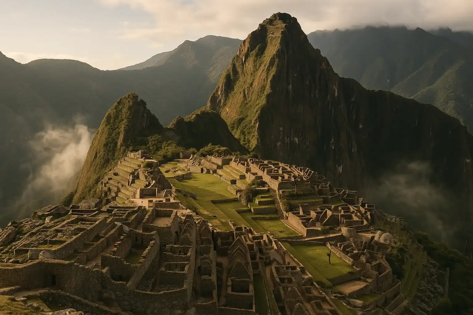
- Machu Picchu: The Inca citadel above the Sacred Valley — Peru’s most iconic ancient site
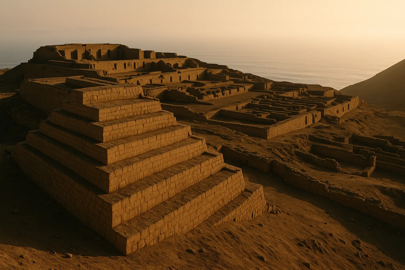
- Pachacamac: The great pre-Inca oracle city on Lima’s coastal cliffs, active for over a millennium
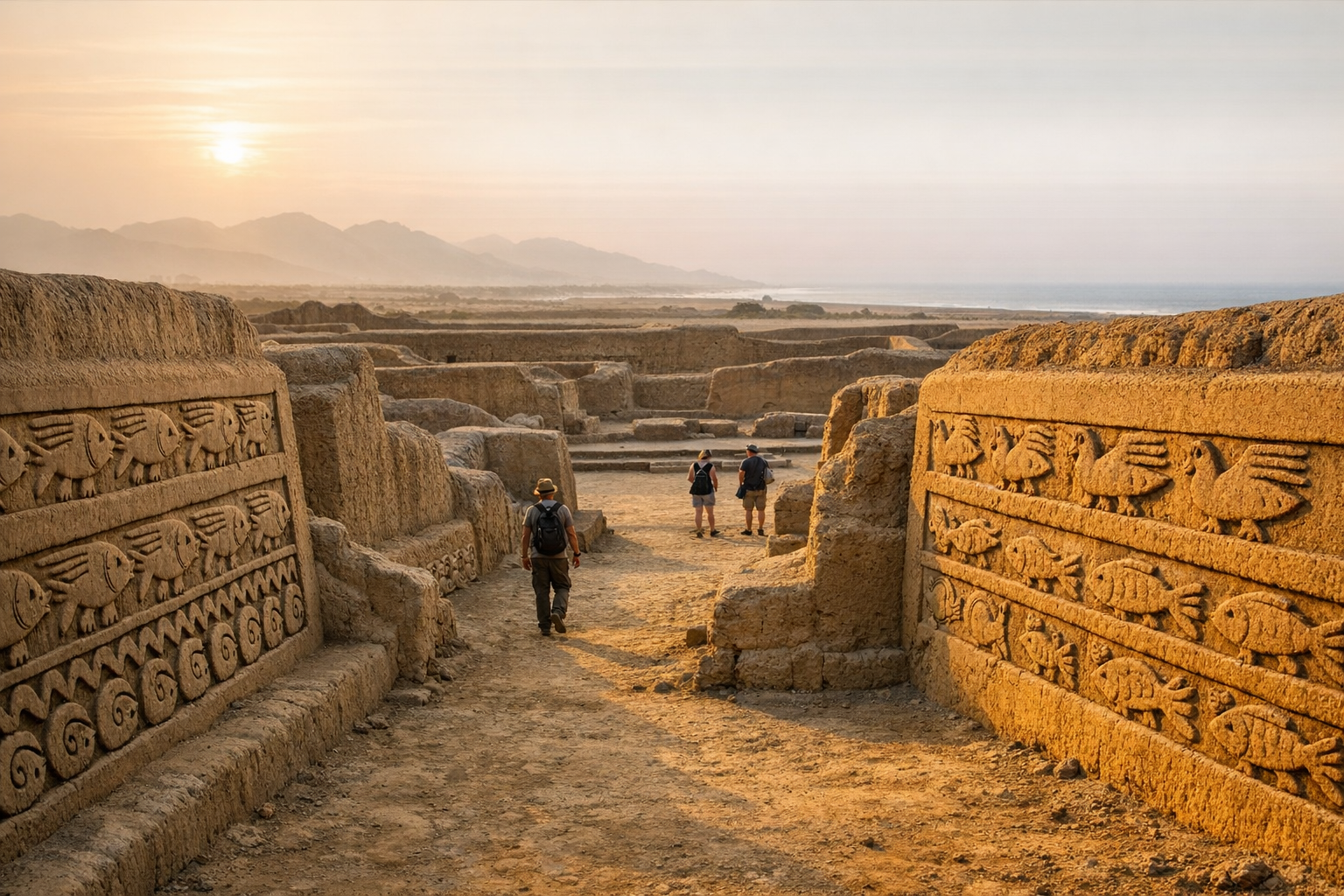
- Chan Chan: The largest adobe city in the pre-Columbian Americas, built by the Chimu empire near Trujillo
Plan your complete Peru archaeological journey with our Peru Ancient Sites Guide. Learn how to combine the Nazca Lines with the Inca Trail and Lima with our Southern Peru Itinerary Guide.
Frequently Asked Questions
How long should I spend at the Nazca Lines?
An overflight lasts 30–45 minutes and covers the major figures. A combined day — morning flight, afternoon land tour to the observation tower and Chauchilla Cemetery — fills 6–7 hours comfortably. If you are short on time, the flight alone is the essential experience.
What is the best time to visit the Nazca Lines?
June through August offers the clearest skies and most reliable visibility for overflights, making it peak season. May and September are nearly as good with slightly fewer crowds. Avoid December through February when coastal cloud layers can ground flights and obscure ground views.
How do I get to the Nazca Lines from Lima?
Cruz del Sur and Oltursa operate overnight buses from Lima to Nazca (7–8 hours, 70–120 PEN/$18–32 USD). Alternatively, fly to Ica (1 hour) and transfer by taxi or collectivo (2 hours south). Most overflight operators pick up at Nazca bus terminal; book your flight in advance.
Do I need a special ticket for the Nazca Lines?
Overflight tickets are purchased directly from licensed aviation operators at Nazca or Ica airport (from $100–180 USD depending on duration and operator). The observation tower on the Panamericana highway charges a small entry fee of around 3 PEN ($1 USD). There is no national park ticket for the pampa itself.
What are the most famous Nazca Lines figures?
The most celebrated biomorphs include the Hummingbird (93 meters long), the Monkey (135 meters), the Spider (46 meters), the Condor (135 meters), and the so-called Astronaut figure (32 meters). The pampa also contains hundreds of straight lines and geometric trapezoids spanning several kilometers.
Is it safe to visit the Nazca Lines?
Yes. Nazca is a safe destination for tourists. Standard Peru travel precautions apply: book overflights with licensed operators at the official airport, avoid unofficial touts offering cheaper flights, and keep valuables secured. Motion sickness is common on small aircraft — take precautions if you are susceptible.
Can I see the Nazca Lines without taking a flight?
Yes. The roadside observation tower on the Panamericana Sur lets you see the Hands, Tree, and Lizard figures from the ground. A newer elevated mirador near km 419 offers broader views. While the land perspective is dramatic in its own way, the full scale and artistry of the figures is only visible from the air.
Nearby Ancient Sites
Machu Picchu Peru Travel Guide 2026: Circuits, Tickets & Entry Tips
Inca EmpireNavigate Machu Picchu's 2026 circuit system with our definitive guide. Learn how to choose your rout...
Pachacamac Peru Guide 2026: Oracle Temple, Pilgrimage Roads & Lima Coast
Lima-Wari-Ychsma-IncaExplore Pachacamac near Lima: ancient oracle temples, multi-civilization coastal history, practical ...
Chan Chan Peru Guide 2026: Chimu Capital & Adobe Citadels
ChimuExplore Chan Chan near Trujillo — the largest pre-Columbian city in the Americas. Discover the Chimu...