Quick Info
At a glance
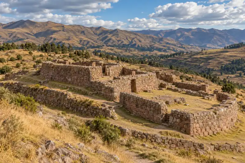
Puka Pukara, commonly translated as Red Fortress, occupies a high position above Cusco on the route through the Sacsayhuamán archaeological park. It is smaller and quieter than the great walls of Sacsayhuamán, but it is not merely a roadside extra. The complex has terraces, stone enclosures, interior spaces, and water-related features set within an open Andean landscape. Peru’s official tourism information connects the name with the reddish tone its stones can take at sunset. That makes for a handsome photograph, sure, but the better reason to stop is to understand how an Inca landscape worked as a network rather than a collection of isolated monuments.
Historical context: function without fake certainty
Puka Pukara dates to the Inca period, when Cusco served as the center of Tawantinsuyu. Its location along the northern approaches to the city and near Tambomachay has led to descriptions of the complex as a fort, checkpoint, lodging place, or administrative station. Some official tourism interpretation also associates it with the Inca’s lodging and court and with water-related practices. These descriptions are useful possibilities, not a license to claim that every room had one conclusively known job.
The site is best understood as multifunctional. Inca architecture often combined movement control, storage, accommodation, agriculture, ritual, and water management in the same landscape. A complex can have a defensible position without being solely military, just as it can include water features without being only a shrine. The surviving layout supports that broader reading: terraces adapt to slope, enclosures organize interior space, and the broader route links Puka Pukara with Tambomachay, Qenqo, and Sacsayhuamán.
Following the Spanish conquest, the Inca imperial system that gave these sites their original political setting collapsed. Modern archaeological documentation and conservation have made the route accessible as heritage, while also simplifying it into a standard tourist circuit. Your job as a visitor is easy: slow the circuit down enough to see what makes each place distinct.
What to see
Stone enclosures and small courts
Walk through the complex with its human scale in mind. Puka Pukara is not built around one enormous ceremonial platform. Instead, its interest lies in the relationship among rooms, narrow entrances, open spaces, and the way masonry responds to the hillside. These details suggest controlled circulation and repeated practical use.
Terraces and the hillside setting
The terraces are part of the architecture, not background scenery. They stabilize the slope and organize movement between levels. From the higher points, look back toward the Cusco basin and along the route toward nearby sites. This is where the strategic logic becomes obvious without requiring a theatrical story.
Water and nearby Tambomachay
Water features at Puka Pukara are best considered in relation to Tambomachay, a nearby Inca complex known for carefully built water channels. Do not claim that the two sites had one simple, proven shared ritual. Instead, notice that water engineering mattered across this highland landscape and that routes, springs, walls, and terrain are closely connected.
Practical planning
Puka Pukara is commonly visited on the circuit north of Cusco. The Dirección Desconcentrada de Cultura de Cusco includes Puka Pukara in the Sacsayhuamán park route and publishes visitor hours and route information. Check that official source before travel for current access, tickets, and any weather or conservation restrictions. Avoid fixed prices, bus times, and pass rules unless you can confirm them for your own date.
The site is high, exposed, and uneven. Start slowly if you have just arrived in Cusco. Bring water, sun protection, a warm layer, and shoes that handle stone and dirt. In wet conditions, take descents carefully. If altitude symptoms become severe or worsen, stop ascending and seek local medical assistance rather than toughing it out for a ruin. Macho nonsense has never improved oxygen saturation.
A taxi, approved guide, or current local transport information can help with the route. If walking between sites, account for elevation, weather, daylight, and your own acclimatization. Do not assume that a map’s short distance means an effortless day.
A sensible Cusco circuit
Pair Puka Pukara with Tambomachay when time is limited, then reserve Sacsayhuamán for the larger architectural and political story. Qenqo adds a different encounter with carved natural limestone. Together, the sites show several modes of Inca building: massive defensive-looking masonry, water engineering, transformed geology, and smaller enclosed complexes.
Avoid trying to cram the northern park, the Sacred Valley, and Cusco’s central museums into one day. Chinchero and Ollantaytambo deserve a separate day with a better transport plan.
Reading the “fortress” label carefully
“Fortress” is memorable, but it can make visitors expect a single-purpose military outpost with a clean historical script. Puka Pukara does not need that oversimplification. Its elevated setting can support surveillance and route control. Its rooms and courts can support accommodation or administration. Its connection with water and nearby sites can support ceremonial practice. Inca landscapes commonly allowed these functions to overlap.
This is why a combined visit helps. At Sacsayhuamán, massive masonry and the setting above Cusco make state power feel unavoidable. At Tambomachay, water engineering comes forward. At Qenqo, modified natural rock becomes the focus. At Puka Pukara, smaller enclosures and the position along the route show the connective tissue between those larger ideas. The circuit has a better narrative when you do not try to make every stop the same kind of “temple.”
Seasons, light, and site care
The stone can look especially warm in low late-day light, a quality reflected in the site’s common name. That is a reason to look, not a reason to wander after safe daylight or ignore official closing arrangements. Weather can change fast in the Cusco hills. Dry-season mornings can be cold before strong sun arrives; wet-season surfaces can be slippery even when rain has stopped.
Use handrails where provided, keep children close near uneven drops, and do not cross masonry to improve a viewpoint. The old walls have made it through conquest, weather, conservation campaigns, and millions of visitors. They should not have to survive your “just one quick climb” phase as well.
Responsible transport planning
Route logistics should be checked close to travel. Transport availability, access roads, and park administration can change. A driver or licensed guide can be practical for a multi-site circuit, but verify what is included and do not assume a tour description guarantees entry, a fixed duration, or a current ticket. Independent visitors should build in return-time and weather margin rather than relying on a last shared ride.
A practical half-day itinerary
For many visitors, the best use of Puka Pukara is a measured northern-Cusco circuit. Start with the site that matters most to your interests, rather than letting a bus itinerary decide the intellectual order. If you care about water engineering, give Tambomachay more time. If you want large-scale masonry, prioritize Sacsayhuamán. If you want to understand route control and smaller built spaces, stay longer at Puka Pukara.
Carry what you need for changing conditions: water, sun protection, a warm layer, rain protection when appropriate, and shoes that can handle uneven ground. Food, toilets, transport, and staff presence should be verified locally for the date you visit. A scattered internet claim about what was available two summers ago is not a contract with the Andes.
Take a moment to look beyond the walls. The surrounding hills, paths, drainage, and views toward Cusco explain the complex more effectively than an isolated close-up of a doorway. Inca building was landscape architecture in the broadest sense. It coordinated terrain and movement, which is why Puka Pukara becomes more legible when seen as one point in a network rather than a tiny fortress left alone on a hill.
What Puka Pukara adds to a Cusco trip
The site makes the broad Inca landscape easier to understand at a manageable scale. You can see how a route might be watched, where people might pass through, and why terracing and water control mattered even outside the monumental core. It is a small complex with a large contextual payoff.
Visit it as part of a connected highland landscape and it stops being a photo break. It becomes evidence for how Cusco’s imperial center was supported by linked places with overlapping roles.
Quick Facts
| Attribute | Details |
|---|---|
| Location | North of Cusco, Peru |
| Name | Puka Pukara, commonly translated as Red Fortress |
| Period | Inca, fifteenth to early sixteenth century CE |
| Main features | Enclosures, small courts, terraces, and water-related features |
| Wider setting | Sacsayhuamán Archaeological Park landscape |
| Suggested visit | 30 to 60 minutes, or part of a longer circuit |
| Current access | Confirm with Cusco’s official cultural authority |
Puka Pukara is a good antidote to the idea that Inca history is only a parade of giant walls. Its smaller spaces show how infrastructure, movement, terrain, and authority could meet in one very deliberate hillside complex.
Frequently Asked Questions
What does Puka Pukara mean?
The name is usually translated as Red Fortress. Peru's official tourism information notes that the stones can take on a red color at sunset.
Was Puka Pukara definitely a military fortress?
Its defensive-looking position and name encourage that reading, but the complex also includes enclosures, terraces, and water features. It is safer to describe several possible administrative, lodging, surveillance, and ceremonial roles than one settled function.
Can Puka Pukara be visited with Tambomachay?
Yes. They are close within the wider archaeological-park landscape north of Cusco and are commonly paired, subject to current access arrangements.
How long should I plan at Puka Pukara?
Allow about 30 to 60 minutes at the site itself. Allow more time for transport, altitude, and a combined circuit with neighboring sites.
Where should I confirm current access details?
Check the Dirección Desconcentrada de Cultura de Cusco, which publishes park-route information and current visitor guidance.
Nearby Ancient Sites

Tambomachay Peru Guide 2026: Inca Water Shrine Above Cusco
IncaExplore Tambomachay near Cusco: precision Inca water channels, ritual architecture, practical access...
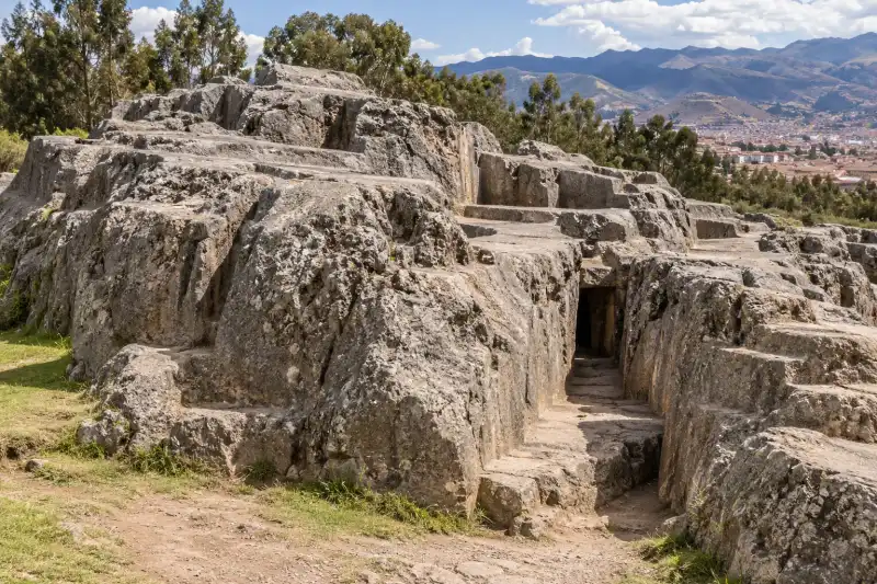
Qenqo Peru Guide 2026: Inca Stonework Above Cusco
IncaVisit Qenqo near Cusco with context on its carved limestone, Inca ceremonial landscape, access throu...
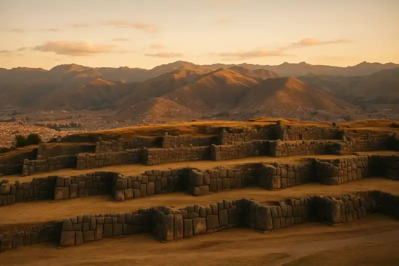
Sacsayhuaman Peru Guide 2026: Cyclopean Walls & Inca Ceremonial Fortress
IncaExplore Sacsayhuaman above Cusco: colossal Inca stonework, battle history, practical ticket logistic...
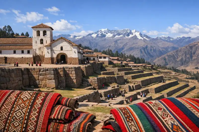
Chinchero Peru Guide 2026: Inca Terraces & Andean Weaving Village
IncaVisit Chinchero on Peru's high plateau above Cusco: Inca royal estate terraces, colonial church buil...
Ollantaytambo Peru Guide 2026: Inca Fortress & Sacred Valley Town
IncaVisit Ollantaytambo in Peru's Sacred Valley: explore the Inca fortress terraces, the Sun Temple, and...