Quick Info
Curated Experiences
Tharros and Sinis Peninsula Archaeology Tour
Cabras to Tharros Half-Day Cultural Excursion
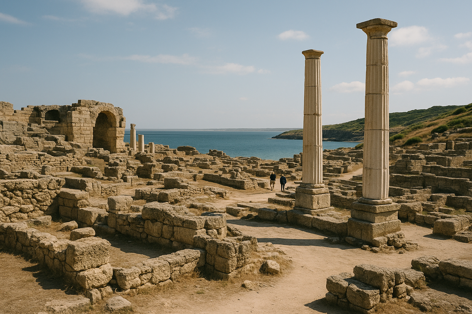
The wind is the first thing you notice at Tharros, and it never stops. It comes off the Gulf of Oristano in steady, salt-edged gusts that flatten the scrub grass and carry the smell of wild rosemary across the ruins. The Sinis Peninsula juts into the sea like a raised fist, and the archaeological site spreads across its spine in a long scatter of basalt columns, sandstone walls, and Roman bath foundations bleached nearly white by twenty-five centuries of Sardinian sun. On a clear morning the view reaches from the Spanish watchtower at the peninsula’s tip to the distant outline of Monte Arci, and the only sounds are wind, surf, and the occasional cry of a peregrine hunting the cliff face.
This is not a manicured archaeological park with velvet ropes and audiovisual stations. Tharros is raw — an open-air ruin field where Phoenician, Carthaginian, and Roman civilizations left overlapping footprints that you read mostly through your feet and your eyes. The interpretive panels are sparse, the paths are unpaved, and the site rewards visitors who arrive with enough context to decode what they are seeing. For anyone interested in how Mediterranean civilizations actually colonized, traded, and defended coastlines, Tharros is one of the most revealing sites in Italy, and one of the least visited.
If your image of Sardinia is beaches and resort towns, Tharros will complicate it in the best way. This island sat at the crossroads of ancient maritime routes, and this peninsula was one of its most strategically valuable pieces of ground for over a thousand years.
Historical Context
Phoenician sailors from the Levant established a settlement at Tharros around the 8th century BCE, drawn by the same geographic logic that would keep the site occupied for the next millennium. The peninsula offered natural harbor protection on two sides, fresh water from inland springs, and a defensible promontory with sightlines across the Gulf of Oristano. The Phoenicians were not colonizing empty territory — indigenous Nuragic communities had inhabited the Sinis coast for centuries, leaving the distinctive stone towers (nuraghi) that still dot the Sardinian landscape — but the new settlement layered commercial infrastructure onto an already occupied terrain.
By the 6th century BCE, Carthaginian influence had extended across Sardinia, and Tharros became a Punic administrative and religious center. The tophet — a sacred precinct associated with ritual offerings — dates to this period and represents some of the most significant Punic religious evidence on the island. Punic Tharros was not a backwater outpost. It was a functioning city with harbors, temples, metalworking quarters, and organized burial zones, integrated into a trade network that connected North Africa, Iberia, and the central Mediterranean.
The Punic city left substantial archaeological traces that distinguish Tharros from the Roman-only sites most travelers encounter in Italy. The tophet stelae, the chamber tombs carved into the peninsula’s rock, and the Punic-era building foundations beneath the Roman street grid all point to a city of considerable size and sophistication. Carthaginian Tharros traded in metals (Sardinia was rich in lead, silver, and copper), agricultural products, and manufactured goods, and its harbor facilities were engineered for regular commercial shipping.
Rome took control of Sardinia in 238 BCE, following the First Punic War, and Tharros entered its third major phase. The Romans did what they typically did with strategically located existing cities: they kept the site, rebuilt the infrastructure, and stamped it with their own architectural vocabulary. Roman baths, paved streets with drainage channels, a water distribution system using lead pipes and basalt-lined channels, and reorganized civic spaces were layered over the Punic urban plan. Some Punic structures were demolished; others were simply absorbed and repurposed.
Tharros remained occupied into the late Roman and early medieval periods, but its decline was driven by a combination of factors. Arab raids along the Sardinian coast in the 9th and 10th centuries CE made the exposed peninsula increasingly dangerous, and the population gradually relocated inland to what would become the town of Cabras. According to local tradition, the inhabitants physically dismantled buildings at Tharros and carried the stones inland to construct their new settlement — a pragmatic act that explains both why Cabras exists where it does and why Tharros is as fragmentary as it is today.
What survives is an archaeological landscape that compresses over 1,500 years of Mediterranean urban history into one walkable coastal strip. The layers are not always easy to separate visually, but that difficulty is itself part of the lesson. Ancient cities were not static. They were constantly rebuilt, repurposed, and cannibalized by the next generation.
What to See
The Roman Baths and Paved Streets
The best-preserved structures at Tharros are Roman-era, and the bath complex near the center of the site is the logical place to start. Enough wall height survives to read room functions: the caldarium with its apsed heating alcove, service corridors, and fragments of the water-supply infrastructure. The surviving hypocaust system — the underfloor heating channels typical of Roman bath construction — is visible in several rooms and helps connect Tharros to the same engineering tradition found at the Baths of Caracalla in Rome, albeit at a fraction of the scale.
Adjacent to the baths, sections of Roman street paving remain in situ, with visible drainage channels cut into basalt blocks. These streets give the site its strongest sense of urban organization and help you mentally reconstruct a functioning city grid rather than seeing isolated ruin fragments. The drainage engineering is particularly worth studying: the Romans designed the street surface to channel rainwater and waste into covered drains that ran beneath the road, a system that kept the city habitable in Sardinia’s rainy winters.
Practical tip: Start at the baths to orient yourself before moving to the less legible Phoenician and Punic zones. The Roman structures provide a readable baseline that makes older remains more interpretable by contrast.
The Tophet (Punic Sacred Precinct)
Located on the southern edge of the site, the tophet is the most archaeologically significant Punic feature at Tharros. Tophets are found at Carthaginian settlements across the western Mediterranean — from Carthage itself to Motya in Sicily and Sulcis in southern Sardinia — and are associated with votive offerings, the exact nature of which remains one of the most debated questions in Punic archaeology. What you see today are foundation traces and the excavated precinct boundary, but the artifacts recovered here (now in the Cabras museum) include carved sandstone stelae, ceramic urns containing cremated remains, and ritual objects that illuminate Punic religious practice with unusual specificity.
The tophet was in use for several centuries, which means the accumulated deposits represent long-duration sacred activity, not a single event. That continuity is itself significant: it suggests the precinct retained its sacred character across generations and possibly across the cultural transition from Punic to Roman administration.
Practical tip: The tophet area is exposed and has minimal signage. Read about it before you arrive, or hire a local guide who can explain the ongoing scholarly discussion around Punic ritual practice. Without context, this section looks like undifferentiated rubble.
The Promontory Viewpoint and Watchtower
Walk to the tip of the peninsula where a Spanish-era watchtower (Torre di San Giovanni) stands on the highest point. The tower itself is a later addition (16th century, built to guard against Ottoman and Barbary raids), but the viewpoint is essential for understanding Tharros’s strategic logic. From here you can see both sides of the peninsula, the reef-protected harbors, the Gulf of Oristano, and the low-lying wetlands that separated the Sinis from the Sardinian interior.
Every civilization that occupied this site chose it for the same reason: it commanded the sea approaches from an easily defended position. The Phoenicians needed harbor access and visual control of approaching ships. The Carthaginians needed a fortified administrative center. The Romans needed a functioning port on their western Mediterranean sea routes. The geography solved all three problems simultaneously.
Practical tip: The climb to the tower takes about 10 minutes from the main ruin field. Go early or late to avoid the midday sun, and bring binoculars — the coastal birdlife is excellent, with flamingos visible in the Cabras lagoon to the east during migration seasons.
The Punic and Roman Necropoleis
Burial zones are scattered along the periphery of the ancient city, with Punic chamber tombs and Roman-era graves representing different funerary traditions across the site’s occupation span. The rock-cut Punic tombs are particularly interesting because they show the scale of the pre-Roman settlement’s population and social organization. The tombs were carved into the soft sandstone of the peninsula’s flanks, creating chambers that were sealed after interment and sometimes reused across multiple generations.
Many have been excavated and their contents moved to museums, but the carved chambers themselves are still visible and worth investigating. The shift from Punic chamber burial to Roman cremation and inhumation practices visible in the later graves illustrates how cultural identity was negotiated across the transition of political power.
Practical tip: The necropolis areas are easy to miss if you stick only to the central ruin path. Ask at the ticket office for a site map that marks the burial zones, and budget an extra 20-30 minutes for exploring them.
The Temple Foundations and Civic Center
Several temple or sacred-building foundations survive in the central zone, though identification of specific dedications is uncertain. The combination of Punic and Roman religious architecture in close proximity is one of Tharros’s distinguishing features — evidence that the site’s sacred geography was maintained across cultural transitions even as the buildings themselves were rebuilt.
Compare the orientation and construction techniques of the different foundation platforms to read the chronological layering. Punic foundations tend to use local sandstone in irregular courses, while Roman rebuilds introduce more regular masonry and sometimes concrete-core construction. The civic center area also includes what appear to be commercial or administrative building foundations, suggesting a mixed-use urban core similar to what has been found at other Phoenician-Punic settlements in the western Mediterranean.
Practical tip: These foundations are low and easy to walk past without recognizing them. A guided tour significantly improves your ability to distinguish temple platforms from domestic or commercial structures.
Timing and Seasons
Best months: April through June and September through mid-October. Temperatures range from 65-80°F (18-27°C), the Mistral wind is less intense than in winter, and the site is quiet enough to explore at your own pace. Late September and early October are particularly good, with warm seas for a post-visit swim at one of the Sinis beaches and softer light for photography.
Summer (July-August): Temperatures reach 90-100°F (32-38°C) and shade on the peninsula is virtually nonexistent. If you must visit in high summer, arrive at opening time and plan to finish by 11:00 AM. Afternoon visits in July or August border on miserable, though the surrounding beaches offer excellent cooling-off options afterward.
Winter (November-March): The Sinis coast takes the full force of winter storms, and while the site is dramatic in rough weather, the wind can make sustained outdoor exploration uncomfortable. Temperatures range from 45-60°F (7-16°C). The upside is near-total solitude — you may be the only visitor on the peninsula.
Best time of day: Morning, always. The site faces east, so early light picks out the stone detail beautifully and the air is coolest. Late afternoon also works well for photography as the sun drops toward the Gulf of Oristano behind you, backlighting the watchtower and the western cliff faces.
Tickets, Logistics and Getting There
Admission: Approximately 5-8 EUR ($5.50-9 USD) for adults. A combined ticket with the Museo Civico Giovanni Marongiu in Cabras (8-12 EUR / $9-13 USD) is available and strongly recommended — the museum transforms your understanding of the site. Children under 6 typically enter free.
Hours: Generally 9:00 AM to 7:00 PM in summer, with reduced hours (9:00 AM to 5:00 PM) in winter. Confirm current hours before visiting, as seasonal adjustments are common and the site may close early in extreme weather.
Getting there by car: Tharros is roughly 20 km west of Oristano and 100 km north of Cagliari. From Oristano, follow signs to Cabras and then to San Giovanni di Sinis. The road ends at a small parking area near the site entrance. This is emphatically a car destination — there is no practical public transit option for most visitors.
From Cagliari: The drive takes approximately 1.5 hours via the SS131. Consider combining Tharros with a night or two in Oristano or Cabras to avoid a rushed day trip. The Oristano area has several agriturismo options with good food and reasonable prices.
From Alghero: About 2 hours by car via the SS131. Feasible as a long day trip but more comfortable as part of a multi-day Sardinia archaeology route that includes Nora to the south and the Nuragic sites inland.
Parking: Free parking is available at the site entrance. In July and August, arrive early because the small lot fills by mid-morning as beach visitors also use the adjacent Sinis coast.
Practical Tips
- Bring at least 1.5 liters of water per person. There is no shade and no water available inside the site.
- Wear a hat, sunscreen, and sunglasses. The reflected light off the limestone and sea can be intense even on overcast days.
- Sturdy closed-toe shoes are essential. The paths are unimproved, with loose gravel, exposed bedrock, and uneven ancient surfaces throughout.
- A wind layer is necessary in spring, autumn, and winter. The Mistral can drop the perceived temperature by 10-15 degrees and make exposed sections of the site genuinely cold.
- Bring binoculars for the watchtower viewpoint and for examining architectural detail on structures you cannot approach closely.
- There are no food vendors inside the site. Pack a snack and eat it at the promontory viewpoint, which is the most sheltered spot on the peninsula.
- The small village of San Giovanni di Sinis, a few hundred meters from the site entrance, has a couple of modest restaurants serving Sardinian seafood. Bottarga (cured mullet roe from the Cabras lagoon) is a local specialty worth trying — it is among the best in Italy.
- A local guide transforms this visit. The interpretive material on-site is thin, and the layered chronology is genuinely difficult to read without expert help. Guide arrangements can often be made through the Cabras museum or the Oristano tourist office.
- If you have time after Tharros, drive to the beach at Is Arutas (20 minutes south), known for its unusual quartz-grain sand that looks like tiny polished rice. It is one of Sardinia’s most distinctive beaches.
Suggested Itinerary
9:00 AM — Arrive at the parking area. Pick up a site map at the ticket office and enter.
9:10 AM — Begin at the Roman baths and paved streets to establish your orientation. Study the hypocaust system, the drainage channels, and the urban layout. Spend 25-30 minutes reading the infrastructure.
9:40 AM — Walk south to the tophet area. Allow 20 minutes to study the sacred precinct boundary and consider the Punic religious context.
10:00 AM — Explore the central temple foundations and civic center zone, comparing Punic and Roman construction techniques. Allow 25-30 minutes.
10:30 AM — Walk to the promontory viewpoint and Spanish watchtower. Take in the full coastal panorama and consider the site’s strategic logic across its different occupation phases. Allow 15-20 minutes.
10:50 AM — Loop back through the necropolis zones on the site’s periphery, examining the rock-cut Punic tombs and the shift in burial practices over time. Allow 20-25 minutes.
11:15 AM — Exit the site. Total on-site time: approximately 2 to 2.5 hours.
11:30 AM — Drive to Cabras (15 minutes) and visit the Museo Civico Giovanni Marongiu. The museum houses the Giants of Mont’e Prama — monumental Nuragic stone statues dating to the 9th-8th century BCE that are among the oldest large-scale stone sculptures in the Mediterranean — along with Phoenician and Punic artifacts from Tharros and essential interpretive context for everything you just saw on the peninsula. Allow 60-90 minutes.
1:00 PM — Lunch in Cabras. Try the bottarga with local flat bread (pane carasau) and the Vernaccia di Oristano wine, a distinctive oxidative white produced from grapes grown in the surrounding wetland-adjacent vineyards.
Nearby Sites
Nora — Sardinia’s other major Phoenician-Roman coastal site, located on the southern coast near Pula, about 2 hours from Tharros by car. Nora offers a useful comparison: same colonial sequence (Phoenician to Punic to Roman), different geography (a smaller peninsula in a more sheltered bay), and different preservation conditions. Visiting both sites gives you the most complete picture of Phoenician colonization in Sardinia available in one trip.
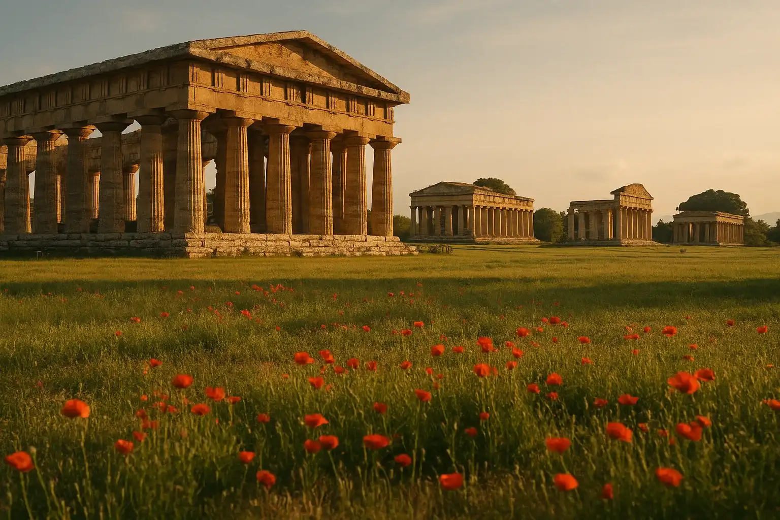
Paestum — The great Greek temple site on the Italian mainland coast south of Naples, accessible by ferry from Sardinia to Naples or Salerno and then a short train ride south. Paestum’s monumental Doric temples provide a dramatic contrast to Tharros’s fragmentary remains and show a different colonization tradition (Greek rather than Phoenician) operating on the same Mediterranean stage during the same centuries.
Ostia Antica — Rome’s ancient port city, reachable from Sardinia by flight to Rome and a 30-minute train ride. If Tharros shows you a small Phoenician-Roman trading port operating at the periphery of Mediterranean networks, Ostia shows you the same concept at imperial scale — the hub that fed a city of a million people.
Hadrian’s Villa — The sprawling imperial retreat at Tivoli, east of Rome. A flight from Sardinia to Rome connects two radically different scales of Roman ambition: the provincial port town and the emperor’s private architectural fantasy.
Final Take
Tharros does not try to impress you. There is no reconstructed temple, no laser light show, no climate-controlled visitor center explaining what you should feel. There is stone, wind, sea, and the accumulated evidence of fifteen centuries of human ambition on an exposed Sardinian headland. Phoenician traders chose this peninsula because it offered two harbors and a defensible hill. Carthaginian administrators built temples here because the site already had sacred weight. Roman engineers repaved the streets because the location was too valuable to abandon. And when the inhabitants finally left, they took the stones with them — the ultimate pragmatic tribute to a city that had already given everything it had.
Visit Tharros in the morning, when the light rakes across the ruins and the sea is still dark enough to distinguish from the sky. Walk the full site slowly. Then drive to Cabras and let the museum fill in what the wind has worn away.
Discover More Ancient Wonders
- Nora — Sardinia’s southern Phoenician-Roman archaeological site near Cagliari
- Paestum — Monumental Greek temples on the Italian mainland coast south of Naples
- Ostia Antica — The remarkably preserved port city of ancient Rome
- Hadrian’s Villa — The sprawling imperial retreat at Tivoli, showcasing Roman architectural ambition
- Explore our full Italy Ancient Sites Guide for complete planning resources
Quick Facts
| Attribute | Details |
|---|---|
| Location | Cabras, Sardinia, Italy |
| Country | Italy |
| Region | Sardinia |
| Civilization | Phoenician, Punic, and Roman |
| Historical Period | 8th century BCE to late Roman era |
| Established | Phoenician foundation around the 8th century BCE |
| Entry Fee | ~5-8 EUR ($5.50-9 USD); combined museum ticket available |
| Hours | 9:00 AM to 5:00-7:00 PM (seasonal) |
| Best Time | April-June and September-October mornings |
| Coordinates | 39.8774, 8.4386 |
Frequently Asked Questions
Is Tharros worth visiting if I'm based in Cagliari or Alghero?
Yes. Tharros is one of Sardinia's strongest archaeology stops and works well as a focused half-day or full-day excursion when paired with Cabras and the Sinis coast.
How much time do you need at Tharros?
Most visitors need 2 to 3 hours on-site for a solid pass of the main ruins. Add time for the museum in Cabras if you want stronger historical context.
Is Tharros mostly Roman or earlier?
You'll see layers from Phoenician and Punic occupation through Roman redevelopment. Roman structural remains are visually prominent, but the site's importance starts earlier.
Can you visit Tharros in hot weather?
Yes, but plan carefully. Shade is limited on the peninsula, so early or late visits, water, and sun protection are essential.
Should I combine Tharros with any museum?
Yes. Pairing the ruins with Museo Civico Giovanni Marongiu in Cabras makes the visit far more meaningful by reconnecting fragments and chronology.
Nearby Ancient Sites
Paestum: Europe's Best-Preserved Greek Temples on Italy's
Ancient Greek / RomanDiscover Paestum's magnificent Greek temples, the Tomb of the Diver, and buffalo mozzarella farms on...
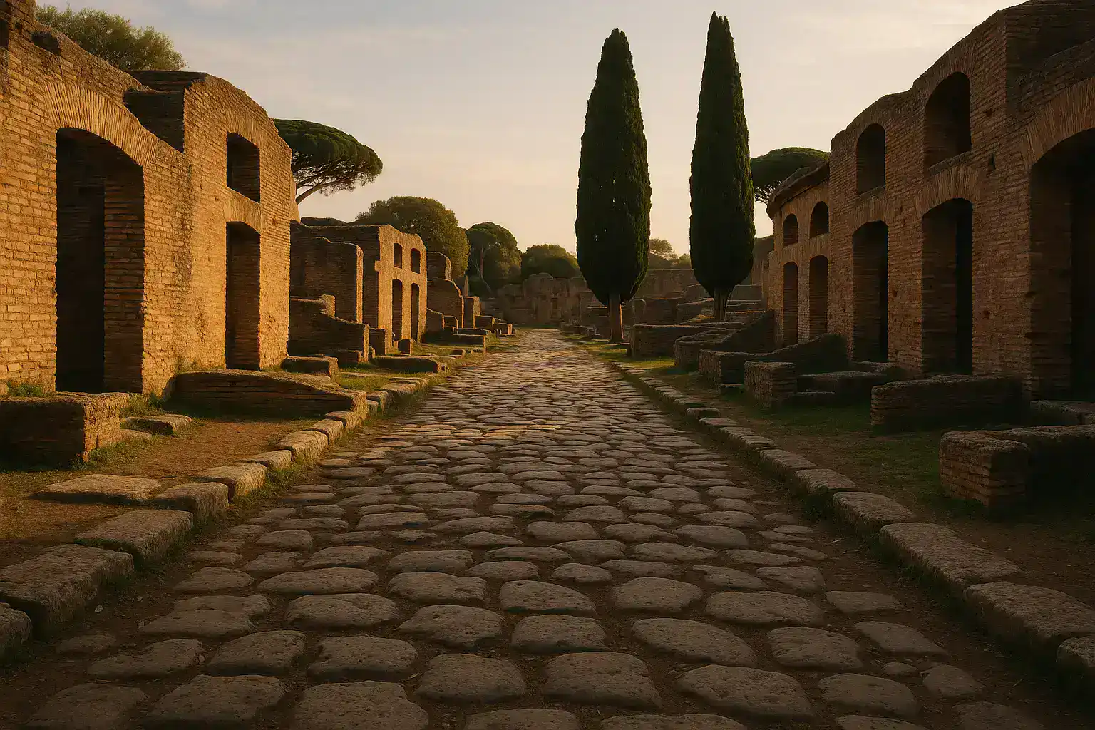
Ostia Antica Italy Travel Guide 2026: Rome's Ancient Port City
Roman EmpireExplore Ostia Antica, the best-preserved ancient Roman city after Pompeii. Walk intact streets, see ...
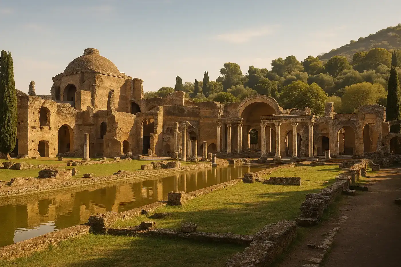
Hadrian’s Villa (Villa Adriana) Guide 2026: Tivoli’s Imperial City-Scale Estate
RomanPlan your visit to Hadrian’s Villa in Tivoli with practical advice on route planning, must-see zones...
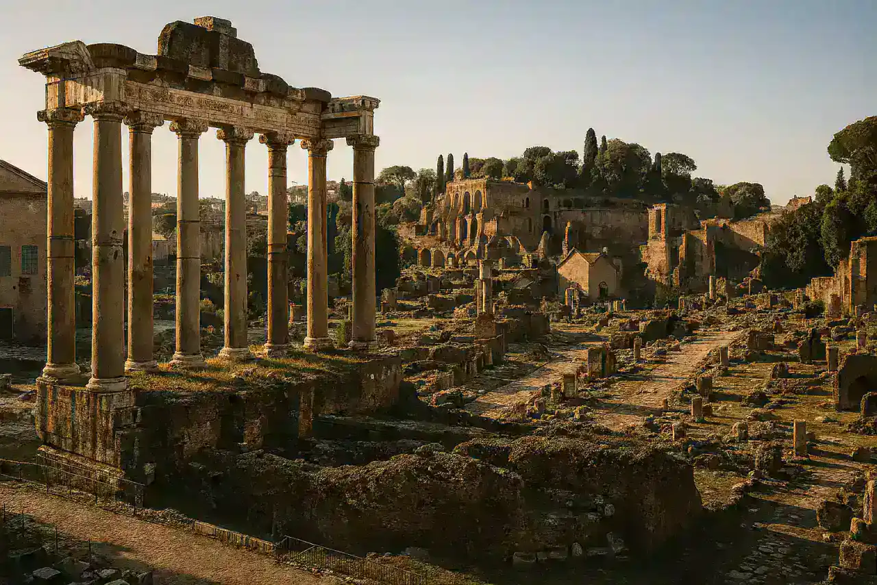
Roman Forum Rome: Heart of Ancient Republic Guide
Roman Republic/EmpireNavigate the Roman Forum's temples, basilicas, triumphal arches. Complete layout, highlights, Palati...
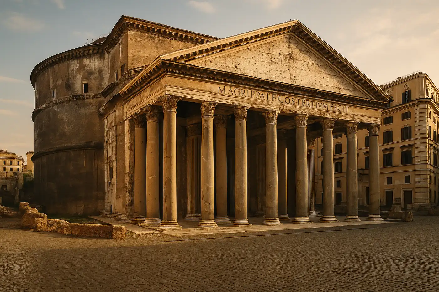
Pantheon Rome: Ultimate Guide to Rome's Best-Preserved Ancient Temple
Roman EmpireMaster your Pantheon visit with history, dome engineering secrets, visiting tips, skip-the-line opti...