Quick Info
Curated Experiences
Cusco South Valley Tour: Tipon, Pikillacta and Andahuaylillas
Private South Valley of Cusco: Tipon and Pikillacta
Cusco Cultural Day Tour with South Valley Sites
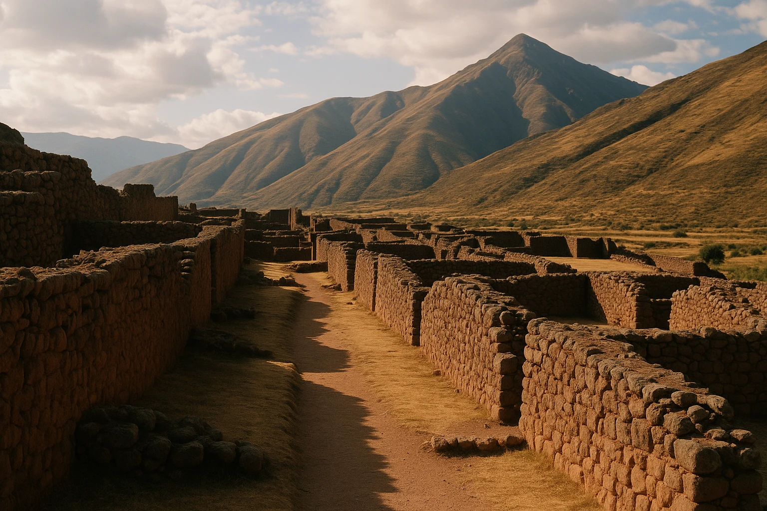
The first thing you notice at Pikillacta, Peru is not a single temple or dramatic carved boulder, but order — astonishing, almost abstract order. Across a broad plateau in Cusco’s South Valley, roofless compounds arrange themselves in lines and right angles so precise they still read like an architect’s drawing from the air. Most visitors arrive expecting another Inca ruin. What they find instead is one of the Andes’ largest surviving cities from the Wari civilization, built centuries before the Inca Empire reached imperial power. Standing among its long corridors and tall perimeter walls, you are looking at an early experiment in urban planning on a continental scale.
Pikillacta matters because it reframes Andean history. It shows that state administration, large-scale planning, and sophisticated social organization were already flourishing in the highlands long before Cusco became the center of Tawantinsuyu. You do not come here for polished ashlar masonry or a postcard icon; you come for the bones of a city and the logic of an empire. Ancient Travels recommends Pikillacta as the anchor of the South Valley route, paired with Tipon and Andahuaylillas in a single day. This guide walks you through the site’s history, key compounds, practical transport from Cusco, ticket strategy, seasonal conditions, and exactly how to combine the visit into a rewarding half-day or full-day itinerary.
History: The Wari Blueprint in the Cusco Valley
Regional roots before imperial planning (before c. 550 CE)
Long before Pikillacta emerged as an organized urban center, the Lucre Basin southeast of modern Cusco supported farming villages linked by exchange routes across the highland valleys. Archaeological survey in the region shows long-term occupation, with communities using terraced agriculture, camelid herding, and seasonal movement patterns adapted to altitude and rainfall cycles. These earlier settlements did not produce a metropolis, but they created the environmental knowledge and transport pathways that later states could absorb. By the early first millennium CE, the valley was already strategically attractive: close enough to highland corridors, yet broad enough to host large planned compounds.
Wari expansion and city construction (c. 550-900 CE)
During the Middle Horizon, the Wari state expanded from its heartland near Ayacucho into multiple Andean regions, and Pikillacta became one of its most significant provincial centers. Built on a rectilinear grid and enclosed by substantial walls, the city may have covered roughly 50 hectares in its core with associated sectors beyond. Some compounds rose two or three stories in adobe and stone, arranged around courtyards and narrow passages likely controlled by administrative function. The consistency of wall alignment suggests centralized planning rather than piecemeal growth. In practical terms, Pikillacta functioned as an operations hub: storing goods, coordinating labor, and projecting Wari authority into a politically important corridor near future Inca territory.
Reorganization, stress, and abandonment (c. 900-1100 CE)
By the late Middle Horizon, the Wari world began fragmenting. Across the central Andes, large Wari centers show signs of disruption, changing exchange networks, and local reconfiguration. Pikillacta appears to have been partially abandoned before complete occupation of all planned sectors, a detail that still shapes the visitor experience today: you can see ambition that outpaced final completion. Some compounds preserve clean geometric shells with little evidence of long domestic continuity, suggesting that administrative and ceremonial priorities may have outweighed residential permanence. Whether climate fluctuations, political decentralization, or shifting regional alliances drove final abandonment remains debated, but by around 1100 CE the city no longer operated as an active imperial node.
Inca reuse of the landscape (c. 1200-1532 CE)
When Inca polities rose to dominance in the Cusco region, Pikillacta’s abandoned compounds still marked the valley as an ancient place of authority. The Inca did not rebuild the entire Wari city, yet they reused parts of its broader landscape, roads, and agricultural settings while establishing their own sacred-administrative geography nearby. This layered reuse is common in Andean history: successor powers rarely erased the past completely; they absorbed and reinterpreted it. Visiting Pikillacta after seeing Inca sites like Sacsayhuaman or Pisac makes this process visible. You begin to read the valley not as a sequence of isolated ruins, but as a long conversation between different state traditions.
Archaeology and modern conservation (20th century to present)
Systematic archaeological work at Pikillacta accelerated in the 20th century, with mapping, excavation, and architectural analysis clarifying the site’s Wari identity and regional significance. Scholars used ceramic typology, construction patterns, and urban layout studies to place Pikillacta firmly within the Middle Horizon administrative network. Ongoing conservation focuses on wall stabilization, erosion control, and visitor circulation, since adobe-and-stone architecture is especially vulnerable to wind and seasonal rain. Today the site is protected as part of Peru’s cultural heritage framework and is increasingly recognized not just as a stop en route to other attractions, but as a major destination for understanding pre-Inca statecraft in the Andes.
The Key Monuments: What to See at Pikillacta
The great perimeter walls
Pikillacta’s outer defensive-administrative walls define the site’s character before you even enter the inner compounds. Built in long, mostly straight runs with alternating stone foundations and adobe superstructures, these walls once reached substantial heights and controlled access through narrow gateways. Their geometry is the point: unlike many organic hill settlements, Pikillacta imposes a deliberate human pattern on the plateau. Walk along the interior face and you can track how sight lines were managed across adjacent sectors, suggesting that movement through the city was regulated and probably hierarchical. For photography, late-afternoon side light is ideal; it sharpens texture in the adobe courses and makes the wall alignments legible in a single frame.
The central orthogonal compounds
Inside the core, rows of rectangular compounds form the urban heart of Pikillacta. Each block is divided into rooms and enclosed patios linked by corridors that create a controlled circulation system. Archaeologists interpret many of these spaces as administrative storage and labor-management units rather than purely domestic houses. The repetition of room modules implies standardized planning, perhaps tied to taxation in goods, temporary lodging for state personnel, or staged redistribution events. You do not need to decode every function to feel the scale of governance embodied here: this was architecture built to organize people and resources. Climb one of the designated elevated points in the core and the grid suddenly resolves into a coherent city plan rather than a maze of ruins.
Ceremonial and elite sectors
Not all of Pikillacta is repetitive. Certain sectors include larger enclosures, broader courtyards, and placement advantages that suggest ceremonial or elite use. These spaces likely hosted gatherings, ritual performances, or negotiations tied to provincial administration. In Wari political culture, ritual and governance were interlocked; architecture that looked bureaucratic could still carry sacred significance through feasting, offerings, and staged processions. Watch for transitional thresholds between narrower passageways and unexpectedly open courts — those shifts in scale are often clues to changing social function. If you are traveling with a guide, this is where context pays off most, since many symbolic readings depend on spatial relationships rather than surviving decoration.
Storage architecture and provisioning logic
One of Pikillacta’s most revealing features is its apparent investment in storage and compartmentalization. Room clusters with restricted access points and repetitive dimensions support the interpretation of planned warehousing for grains, textiles, tools, or tribute goods moving through the valley. In an Andean environment where altitude zones produce different crops and materials, storage was political power: whoever controlled collection and redistribution could reward allies, sustain workers, and absorb short-term shocks. Even in ruin form, these compartments communicate state logic with unusual clarity. Bring a wide-angle lens if possible; photographing multiple aligned rooms in one composition helps communicate how density and repetition served administrative purposes.
The aqueduct-adjacent landscape and valley views
Pikillacta does not stand in isolation; it sits within a broader managed landscape of terraces, water channels, and route connections. From the site’s higher edges, you can look toward the Lucre wetlands and neighboring valleys that fed the settlement’s agricultural and logistical system. The visual relationship between urban core and productive hinterland is a key interpretive lesson here. Wari planners chose this location because it linked movement, water, and farmland in one controllable zone. End your circuit at one of the outer viewpoints and pause before leaving. The panorama explains why multiple later powers stayed invested in this corridor long after the original city was abandoned.
Getting There: Transportation and Access
Reaching Pikillacta from Cusco is straightforward, and the route is one of the easiest archaeological day trips in the region.
From central Cusco
Most travelers start in the historic center and follow the highway southeast toward Urcos. The road is paved and generally reliable, with moderate traffic peaks during morning commute hours.
- Taxi/private driver: Usually 45-60 minutes each way; expect around S/140-220 round trip ($38-60 USD) depending on wait time and season.
- Shared tour transport: South Valley group tours commonly include hotel pickup and run in minibuses; transport is bundled into total tour price.
- Public bus + local transfer: Buses toward Urcos can cost roughly S/6-10 ($1.50-2.70 USD) per person, then a short taxi/walk from the drop point to the entrance.
From Alejandro Velasco Astete Airport area
If you’re departing directly from lodging near the airport districts, travel time can be slightly shorter than from Plaza de Armas when traffic is light.
- Direct taxi: Around 40-55 minutes; fares usually S/120-190 ($33-52 USD) round trip with waiting.
- Prebooked driver: Good option if you want to pair Pikillacta with Tipon and Andahuaylillas on your own schedule.
- Rental car: Viable for confident drivers; parking near major South Valley stops is usually manageable during non-peak hours.
Admission and Hours
Pikillacta is typically accessed with the Boleto Turistico del Cusco, with prices and circuit options updated periodically by local authorities. As a working benchmark, many travelers pay around S/70-130 ($19-35 USD) depending on partial versus broader ticket coverage and eligibility category. Opening hours are commonly around 8:00 AM to 5:00 PM, though holiday schedules can vary. Carry cash in soles as backup even when card payment appears available. For comfort and photography, arrive close to opening or after about 3:00 PM to avoid the hardest midday light.
When to Visit: Seasonal Considerations
Spring (September-November)
Spring in the Cusco region often brings mixed skies, greener valley edges, and moderate daytime conditions around 17-22°C (63-72°F). Crowds are usually lighter than peak dry-season months, and early mornings can be beautifully clear before afternoon cloud build-up. This is a strong season for travelers who prioritize balanced weather and softer visitor density. Bring a light shell for occasional showers.
Summer (December-February)
Summer is the rainy season in much of the southern Andes. Daytime temperatures near Pikillacta commonly sit around 18-23°C (64-73°F), but rainfall can arrive quickly and turn paths slick. Crowd levels are moderate, with fewer large tour clusters than in mid-year peak travel. Visit early, wear grippy footwear, and keep electronics protected. If skies open up, pair the site with indoor cultural stops afterward.
Autumn (March-May)
Autumn is often excellent at Pikillacta: post-rain clarity, greener surroundings, and stable temperatures near 16-22°C (61-72°F). By April and May, precipitation usually decreases and walking conditions improve significantly. Crowd levels range from low to moderate, especially on weekdays. For many travelers, this is the most forgiving season for combining archaeology, road travel, and photography in a single day.
Winter (June-August)
Winter is the dry season and the most consistently sunny period, with daytime highs around 16-21°C (61-70°F) and chilly mornings that can drop close to 1-4°C (34-39°F). This is peak tourism season in Cusco, so expect more organized groups, particularly mid-morning. The upside is reliable weather and crisp visibility across the valley. Start early and layer clothing; winter mornings are cold but ideal for long site circuits.
Combining Pikillacta with Cusco’s South Valley
Pikillacta works best as the structural centerpiece of a South Valley day, whether you self-drive, hire a driver, or join a guided circuit. The most efficient sequence starts with Tipon by 8:30 AM, when the terraces and channels are still quiet and the sun angle makes Inca hydraulic details easy to photograph. Spend about an hour there, then continue southeast toward Pikillacta, arriving around 10:15 AM before larger buses fully cycle in. Give Pikillacta at least 90 minutes to walk the core grid, perimeter walls, and elevated viewpoints without rushing.
By 12:15 PM, continue to Andahuaylillas for the church often called the “Sistine Chapel of the Andes,” where mural and gilded altar programs provide a striking colonial counterpoint to the pre-Hispanic architecture you’ve just seen. Lunch in the village or on the return corridor can be simple and satisfying: trout, soup, and quinoa-focused set menus are common in family-run restaurants. With moderate pacing, the full loop usually takes 6 to 8 hours including transfers.
If you prefer a half-day approach, invert the route and begin at Pikillacta by 2:30 PM for warmer wall tones and softer afternoon shadows. Continue briefly to Andahuaylillas, then return to Cusco for dinner in San Blas or near Plaza de Armas. This shorter plan still gives you the essential historical arc — Wari urbanism to colonial art — without committing to a full-day excursion. Either way, keep water, sun protection, and small cash accessible; service convenience drops outside central Cusco, and being prepared helps the day stay smooth.
Why Pikillacta Matters
Pikillacta matters because it disrupts a familiar travel narrative. In Cusco, the Inca story is rightly dominant, but this city reminds you that Andean statecraft did not begin in the 15th century. The Wari built long-distance systems, planned provincial capitals, and translated political authority into architecture with a discipline that still reads clearly in ruin form. Their city here is not theatrical in the way famous icon sites can be; it is quieter, stricter, and intellectually thrilling.
Walking through Pikillacta, you feel the scale of intention more than the glamour of ornament. You move between walls that once organized labor, goods, and ritual life, and you start to see empire as logistics as much as symbolism. That perspective changes everything once you return to Inca monuments around Cusco: suddenly they sit in a deeper chronology, part of a longer Andean tradition of experimentation and adaptation. Visit Pikillacta with patience, and you leave with something rarer than a postcard view — you leave with a sharper map of how civilizations learn from what came before.
Quick Facts
| Attribute | Details |
|---|---|
| Location | Lucre Basin, South Valley, Cusco Region, Peru |
| Ancient Name | Pikillacta (Wari administrative city; exact original endonym unknown) |
| UNESCO Status | Not individually inscribed; within the broader Cusco cultural landscape |
| Established | c. 550 CE planned Wari administrative city |
| Distance from nearest hub | ~33 km from Cusco (45-60 minutes by road) |
| Entry Fee | Via Boleto Turistico, about S/70-130 ($19-35 USD) depending on circuit |
| Hours | Typically daily around 8:00 AM-5:00 PM |
| Best Time | April-May and September-October; early morning for light and cooler temperatures |
| Suggested Stay | 1.5-2.5 hours on site |
Explore More Peru
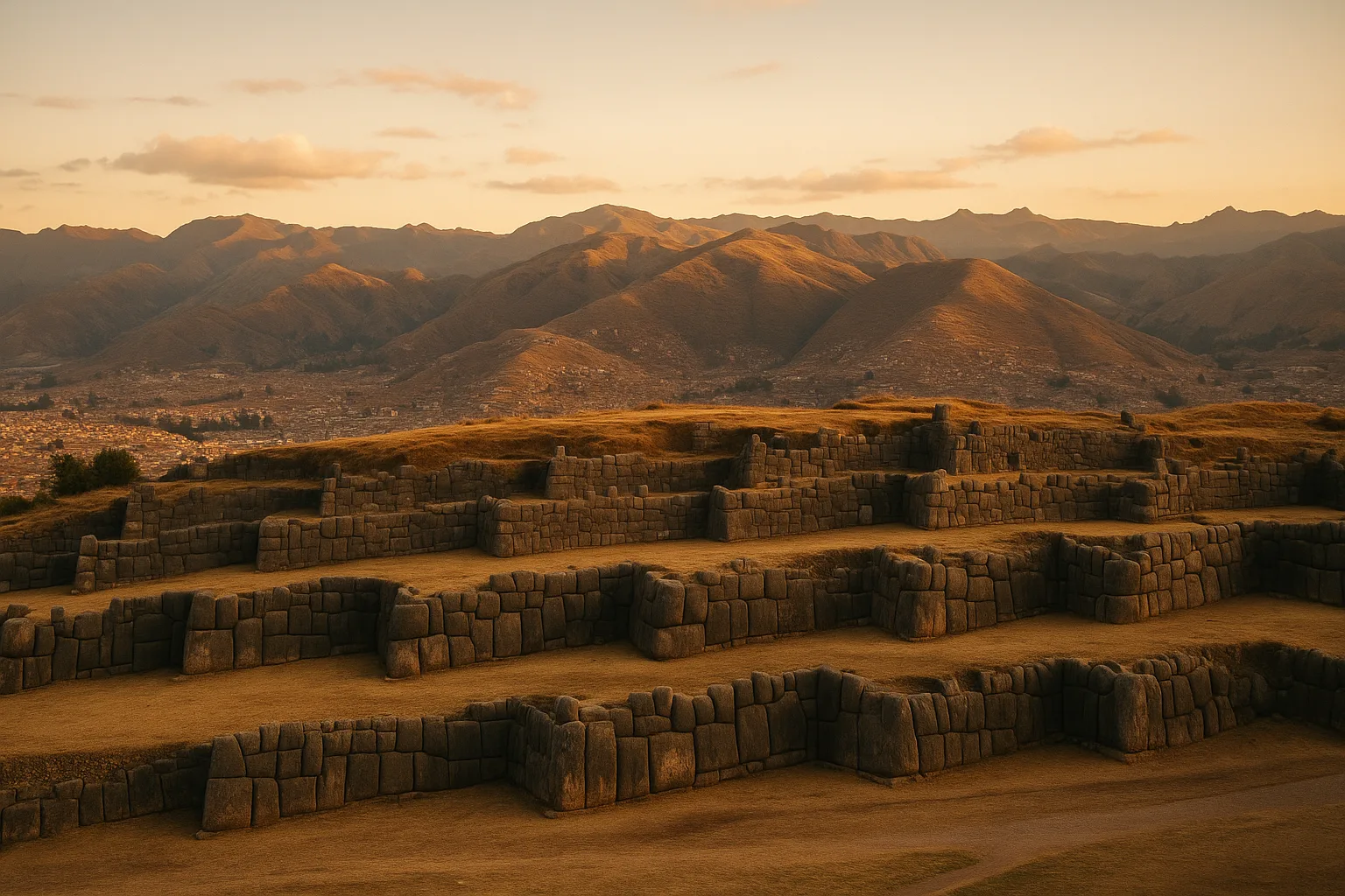
- Sacsayhuaman: Cyclopean Inca walls above Cusco with commanding city views.
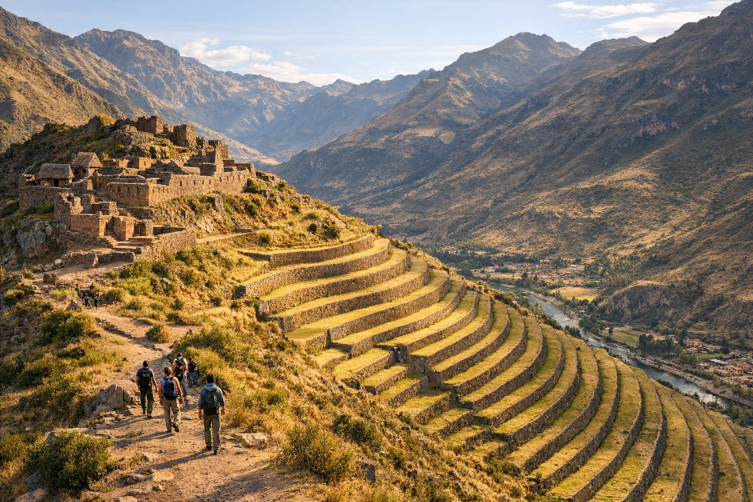
- Pisac: Terraced ridge citadel and one of the Sacred Valley’s most dramatic archaeological settings.
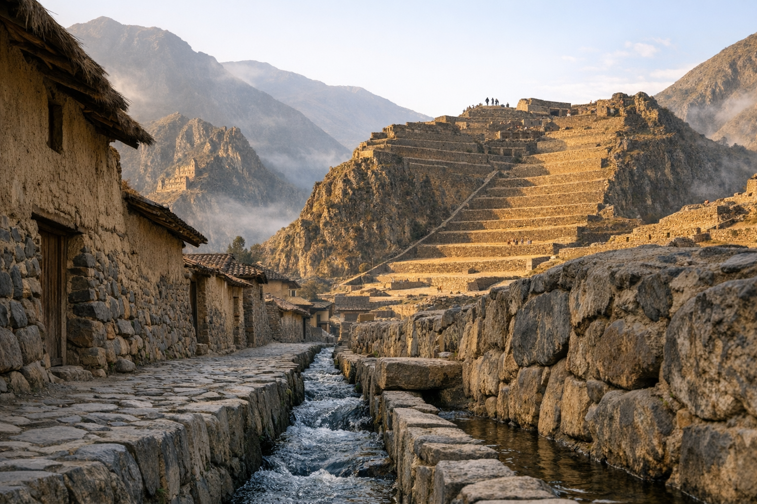
- Ollantaytambo: Monumental Inca fortress-town with intact urban fabric and major temple terraces.
Plan your complete Peru journey with our Peru Ancient Sites Guide. For high-altitude planning, read How to Acclimatize for Andes Archaeology Trips.
Frequently Asked Questions
How much time should I plan at Pikillacta?
Most travelers need 1.5 to 2.5 hours to walk the principal compounds, perimeter walls, and elevated viewpoints. Add another hour if you want slower photography or detailed architectural observation. If you visit as part of a South Valley tour, confirm that your itinerary allows at least 75-90 minutes on site.
Is Pikillacta included in the Cusco tourist ticket?
Yes. Pikillacta is included in the Boleto Turistico del Cusco circuit used for many regional sites. Buying the ticket makes sense if you're also visiting other archaeological stops in and around Cusco, since individual admissions add up quickly.
What is the best time of day to visit Pikillacta?
Early morning to mid-morning is ideal for cooler temperatures, better contrast on the adobe walls, and fewer tour buses. Late afternoon can also be beautiful when side light pulls out the geometry of the compounds. Midday is harsher, with strong sun and limited shade.
How do I get to Pikillacta from Cusco without a tour?
The most straightforward option is a taxi or private driver, usually about 45-60 minutes each way depending on traffic. Budget travelers can take a bus toward Urcos and ask to be dropped at the access road, then continue by short taxi ride or walk. Renting a car is feasible if you are comfortable with Andean two-lane highways.
What makes Pikillacta different from Inca sites near Cusco?
Pikillacta predates the Inca by centuries and reflects **Wari** urban planning rather than Inca stone craftsmanship. You see a strict rectilinear layout, long orthogonal walls, and compartmentalized compounds that read as an administrative city model. Visiting both Wari and Inca sites reveals how power shifted in the Andes over time.
Is Pikillacta safe for visitors and families?
Yes, Pikillacta is generally safe and commonly visited by families and tour groups. The main caution is physical: uneven surfaces, altitude, and strong sun exposure. Wear sturdy shoes, carry water, and move carefully on stairs and eroded paths.
Nearby Ancient Sites
Sacsayhuaman Peru Guide 2026: Cyclopean Walls & Inca Ceremonial Fortress
IncaExplore Sacsayhuaman above Cusco: colossal Inca stonework, battle history, practical ticket logistic...
Pisac Peru Guide 2026: Inca Citadel, Market & Sacred Valley
IncaExplore Pisac in Peru's Sacred Valley: hike the Inca citadel terraces above town, visit the famous a...
Ollantaytambo Peru Guide 2026: Inca Fortress & Sacred Valley Town
IncaVisit Ollantaytambo in Peru's Sacred Valley: explore the Inca fortress terraces, the Sun Temple, and...